
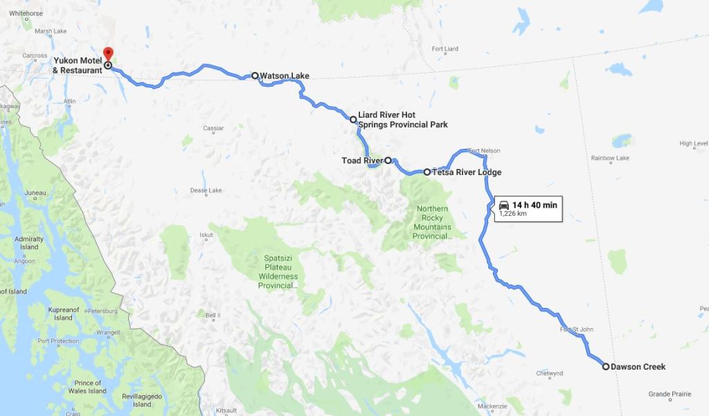
The Alaska Highway (Alcan Highway) is a 1,400-mile stretch of two-lane paved road running from Dawson Creek, British Columbia, to Delta Junction, Alaska. It was constructed during World War II to connect the contiguous United States to Alaska across Canada. Although proposed earlier, it was the attack on Pearl Harbor coupled with Japanese threats to the west coast of North America and the Aleutian Islands that prompted both countries to proceed with this historic road-building project. It is the only road to Alaska, but it is a good one. Some of the world’s wildest and most beautiful scenery is along this route.

We stopped in Dawson Creek, BC, next to the historic grain elevator, now a museum and art gallery. It shared a parking lot with the visitor information center and Milepost 0, the beginning of the Alcan Highway. After the obligatory photo under the sign, we rode north toward Milepost 1,400 with expectations of many adventures in between.
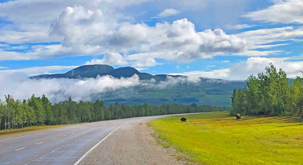
“Two more buffalos on the right,” Don said, as we rounded the bend of the nearly deserted highway. For a while, Don was keeping track of the number of large animal sightings as we traversed through east-central British Columbia. After about a dozen black bears, he gave up the count. Buffalo, bear, moose, and coyotes were spotted that day.

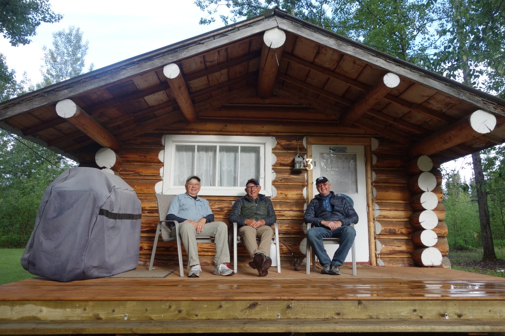
As we approached Fort Nelson we could see dark clouds on our left flank over Northern Rocky Mountains Provincial Park. A sharp left turn at Fort Nelson took us into the mountains and steady rain. The chip-and-seal road repairs that went on for miles were tricky in the rain, but just before the ride became really arduous, we reached Testa River Lodge and Campground, our destination.
“Hey Jim, I’m showing about 10 miles left in my gas tank, how about you? ” Don asked via helmet intercom. Our bikes with 5-gallon tanks had a range of just over 225 miles. There were usually enough opportunities to gas up, but we occasionally skipped a gas station that only pumped 87 Octane and held out for high test which our bikes preferred. We skipped the pump where we camped. Now we were in the middle of nowhere British Columbia hoping that Toad River Lodge up the road had a gas pump—any octane level would do! “I’m about the same,” I replied. “Toad River Lodge is about 15 miles ahead, no worries.”

Toad River Lodge, a restaurant with a couple of cabins behind it is about all that’s left of an outpost established in 1942 for building the Alcan. Back in the day, its name was actually “Towed River” but outsiders kept misspelling it so the locals relented. So far, along the Alcan, it was the most isolated community we encountered. When we arrived, we saw no one except the proprietor and two bicyclists, but we were told that the community (a scattered radius of 50 miles) had about 50 residents and 20 students in a two-room school housing grades 1 through 12.
Oh, yeah! There was a gas pump! 87 Octane and we were happy to have it at any cost (about $6.00/gal US). Most of the time these backwoods pumps had gas with no ethanol so we noticed little or no difference in the performance of our bikes.

That tank of gasoline brought us into Liard River Hot Springs Provincial Park in the early afternoon. The Park is a very popular place along the Alcan. I called ahead for a campsite reservation and was informed that they were booked months ago. However, the Canadian parks keep half their campsites “first come, first serve.” Our early afternoon arrival beat out the competition and put us in a nice spot, and now we lots of time to visit the Springs before dinner.
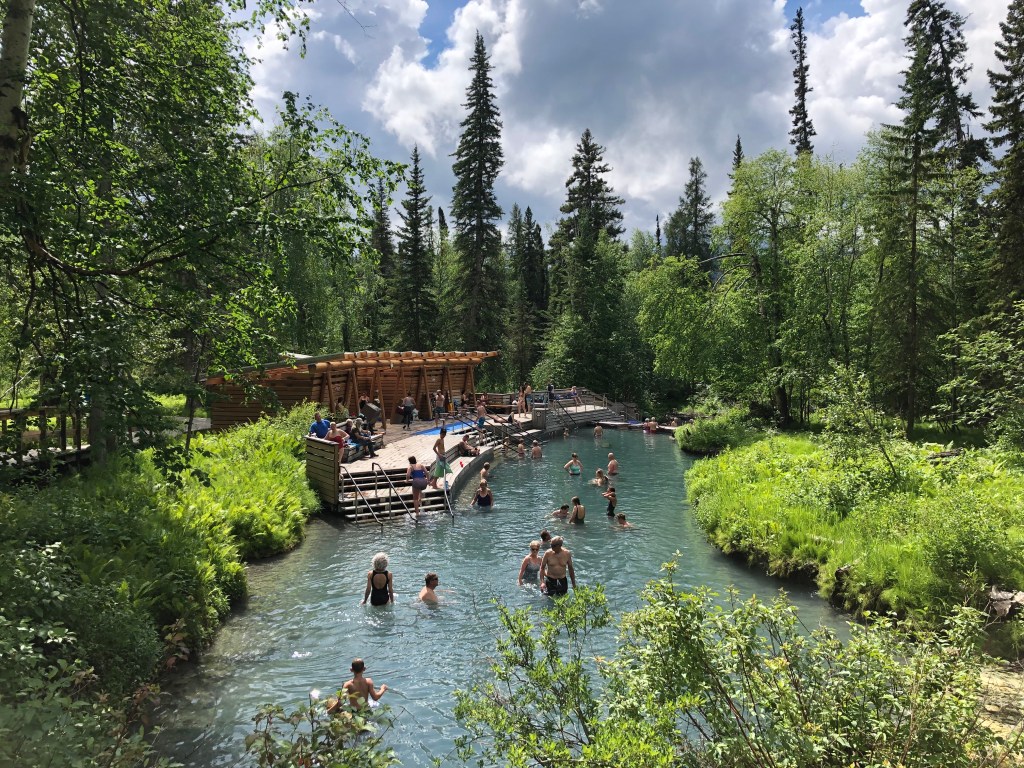
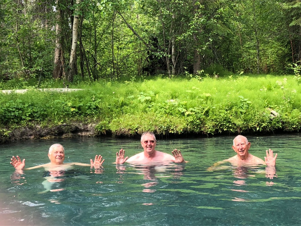
“I don’t have actual bathing pants, but I have something that will work,” Don said as Richard and I were searching for ours among our gear and wondering what Don had in mind. Liard Hot Springs was on our Alcan to-do list and I was happy that the campsite and timing were working out as planned. After a short walk across a wetland boardwalk, we luxuriated in the Springs for a couple of hours on a warm afternoon, beginning at the top end of the spring that was about “one-minute” hot, the middle which was “go-to-sleep” perfect, and lower “regain-your-strength” end that cooled you down so you could stand on your feet as you reluctantly admitted that enough was enough.
Liard Hot Spring Provincial Park was a place that beckoned one to stay a while, so I recommend that you do so when you visit. However, the Gray Grizzlies were on a mission to hang our sign in the Signpost Forest, another iconic stop along the Alcan near Watson Lake, Yukon. It was a 5 AM wake-up and 7:30 departure for the Yukon border and Watson Lake just beyond.
The Yukon’s slogan, at least the one on the sign at the border crossing, is “Larger Than Life”. I never deciphered the meaning of the slogan to my satisfaction. Whose life? Any life? Wildlife? It did have the most visible wildlife, even more than Alaska, and the Alcan through the Yukon seemed the wildest and most isolated, which made one feel humble and small. In that sense, it was “larger than life.” The Yukon was the best part of the Alcan experience.

In 1942, during the construction of the Alcan, the engineers erected mileage posts at their camps that listed places, distances, and directions in the Yukon, other cities, and other parts of the world. One of those posts was erected at the corner of the Alcan and the road to the Watson Lake Airport, where the Sign Post Forest stands today.
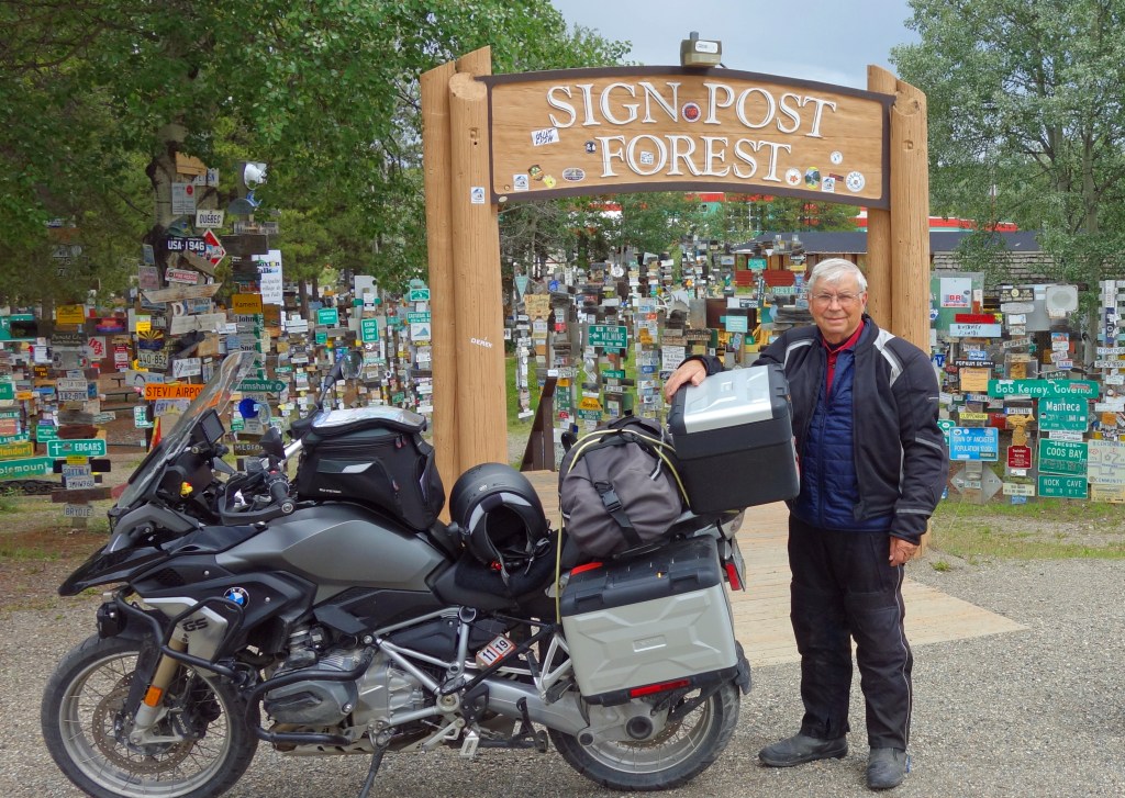
Carl Lindley, a homesick soldier, added his hometown sign to the army signpost and started a time-honored tradition. People from all over the world continue to add their own hometown signs. The Sign Post Forest has been maintained by the Town of Watson Lake and is one of the best-known attractions along the Alcan. At last count (2004), the Forest numbered 55,000 signs. By now, it must be thousands more, plus one more that the Gray Grizzlies nailed to the post!


With “miles to go before I sleep and with promises to keep” (I promised Richard we would be in camp on Teslin Lake by 4 pm) we departed the Signpost Forest and headed west along the 60th Parallel, the border between British Columbia and the Yukon.
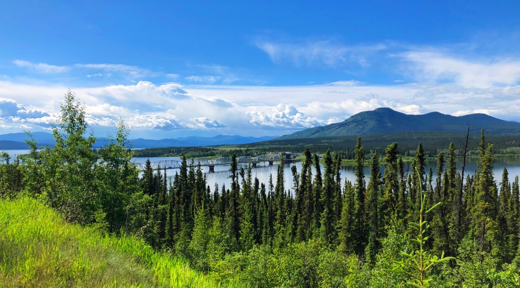
The name Teslin is taken from the native Tlingit word ‘Teslintoo’ meaning “long narrow waters”. The lake is 80 miles long and has the longest bridge on the Alaska Highway, the Nisutlin Bay Bridge. I had read about the lake and bridge, but it wasn’t what I expected. When we crested the shoulder of the plateau overlooking the valley; it was more beautiful than I imagined:
For more motorcycling adventure stories go HERE.

Love hearing about your trip. Thanks for the photos.
LikeLike
Thanks for the travel log!
LikeLike
Awesome Blog! Keep sending!
Sent from my iPhone
>
LikeLike
Sounds like an awesome trip! Thanks for sharing.
LikeLike