
Tags
Yes, I think Texas is an amazing state, not for the usual reasons most Texans brag about (size, lots of oil, cowboy culture, guns per capita, etc.), but for its natural history and geologic and biologic diversity (and I know some lovely people from Texas). Recall that I am riding with my buddies Marc, Don, and Gary (Go HERE for Chapter 1 of my Big Bend trip blog). Our motorcycle ride across Texas began at the Sabine River, the border with Louisiana, and ran for 1000 miles as far as the border town of Presidio on the west side of Big Bend National Park. That meant we would cross several of Texas’ unique landscapes.

At the Texas border, there was a major change in the weather. A cold front pushed the warm, rainy atmosphere east, and it suddenly became sunny, cool, and windy. Even though we had 1,000 miles to go, the fact that we were in Texas made our destination seem a lot closer. The closer we got to Big Bend, the main feature of our trip, the more concerned Marc became that two days were not enough to do Big Bend justice. “I think we need at least three days to traverse the park, do some hiking, and cross the Rio Grande to Boquillas,” Marc argued. Marc’s tight work schedule determined the day-to-day plan. What to do? It was my job to make the schedule work, so I thought about it as we left Louisiana and entered the Piney Woods region of East Texas (#1 yellow area on the map below).

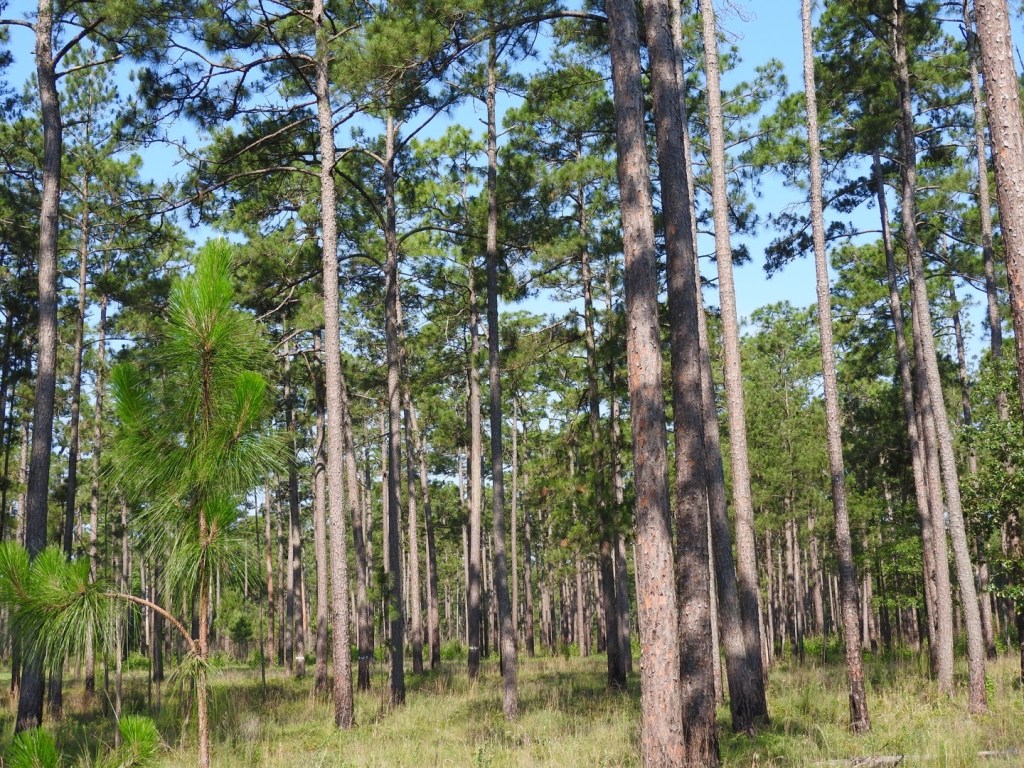
Prior to settlement by Euro-Americans, East Texas was covered by dense forest, but it wasn’t all pine trees. Parts of the southern section were nearly impenetrable hardwoods named the “Big Thicket.” The region was rife with large wildlife including ocelots, jaguars, mountain lions, red wolves, black bears, bison, deer, and elk. Prior to the Civil War, ranchers flocked to the area with their open-range cattle and eliminated the predators and logged out the virgin timber (Sawdust Empire). A great little book describing the natural history of East Texas is Land of Bears and Honey by Truett and Lay (1984).
As we motored toward Lufkin, TX, from the Sabine River along the northern edge of the original range of longleaf pine, I could only imagine what the longleaf forest might have looked like. What I actually saw instead was block after block of loblolly pine plantations of different ages that would, in time, feed the mills at Lufkin. There were a few longleaf pines along the roadside that made me conjure the stately forests Truett and Lay described.
Suddenly, with little transition, we left the pines behind us and entered a landscape of scattered, shrubby post oak and black hickory in and among grazing cattle and along fences of a few cotton fields. This was the Post Oak Savanna Region (#3 on the map above) described by early settlers as “vast, open, forest within the prairie.” Of course, it is different now. Fire suppression, fencing, and the plow are the tools that created the modern landscape we rode through.

At our hotel near Madisonville, TX, that evening, I reviewed our travel plan. “Yeah,” I thought, “I think we can cut a day off our plan for riding the Twisted Sisters (Texas’ answer to Virginia’s Back of the Dragon) and add a day at Big Bend.” The busy tourist season in the Big Bend region actually begins in October. I couldn’t extend our stay in the lodge at Terlingua at the western edge of Big Bend. There was no vacancy in any hotel near the Park.
This is why I usually travel with a tent and sleeping bag, but several of my buddies had a thing about rattlesnakes, tarantulas, and scorpions. Those critters don’t bother me much. What I worried about were bed bugs in the sketchy, cheap motels we stayed (I’ve had a bad experience!). Speaking of sketchy, there was one funky-looking place in Marathon, TX, just north of the Park called La Loma Del Chiva that could only be reached via email. “Could you accommodate four mostly-old motorcycle riders for one night?” I wrote. I wondered what the Spanish name meant in English, but, at this point, we were pretty desperate to find a place.
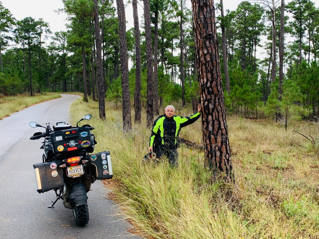
My riding buddies tolerated my interest in the natural history of Texas. Our next stop was Lost Pines at Bastrop State Park southeast of Austin. My GPS suggested a “back gate” entrance from the east but didn’t show the miles of gravel and cattle gates. My buddies seemed to enjoy the ride but had no confidence that I knew where I was going—they had good reason. Lost Pines is an isolated forest of loblolly pines 100 miles removed from the Piney Woods with only Post Oak Savannah in between. This far-western isolated “patch” is likely a refugium that remained after the contiguous forest retreated during the Pleistocene, the last ice age. Their genetic makeup reflects greater drought tolerance but not enough to warrant a separate taxonomic designation.
The crosswinds and traffic were brutal going around the south side of Austin. Ahead on Route 71 were police and EMT vehicles. As we passed we saw only a single crashed vehicle on its side in the median: A large motorcycle with no windshield. We surmised that the wind knocked him down during an unguarded moment.

As we approached the LBJ Ranch west of Johnson City, both the wind and traffic subsided. The home of President Johnson and his wife, Lady Bird, was the focal piece of the Ranch and a center for political activity for several decades. In 1972 the Johnsons donated the house and ranch to the National Park Service. LBJ’s birthplace, the Texas White House, and his gravesite are part of the LBJ National Historical Park. The Park Service maintains more than 1,500 acres as a working ranch, including a herd of cattle descended from Johnson’s original Hereford breed. We toured the ranch on several paved, one-way roads and observed as many white-tailed deer as white-faced cattle.


“You can’t go wrong with either the Sauerbraten or Schweinerippchen,” I said to my buddies, all of whose faces had clear, skeptical expressions. We were at Friedhelms Bavarian Inn in Fredericksburg, TX, a German restaurant in a German community that I had been looking forward to since the beginning of the trip. I had already ordered the Rind Roulade and was second-guessing what these Philly cheesesteak buddies of mine would eat. I had talked them into a German restaurant and wished them a good experience.
Just as we were leaving the restaurant, my phone dinged an email message. It was Ingrid from La Loma del Chiva: “Yes, I can accommodate you. The Goat Shed is available. $100. Let me know as soon as possible.” I replied immediately: “Yes, we would be delighted to stay in the Goat Shed. We’ll see you soon.”
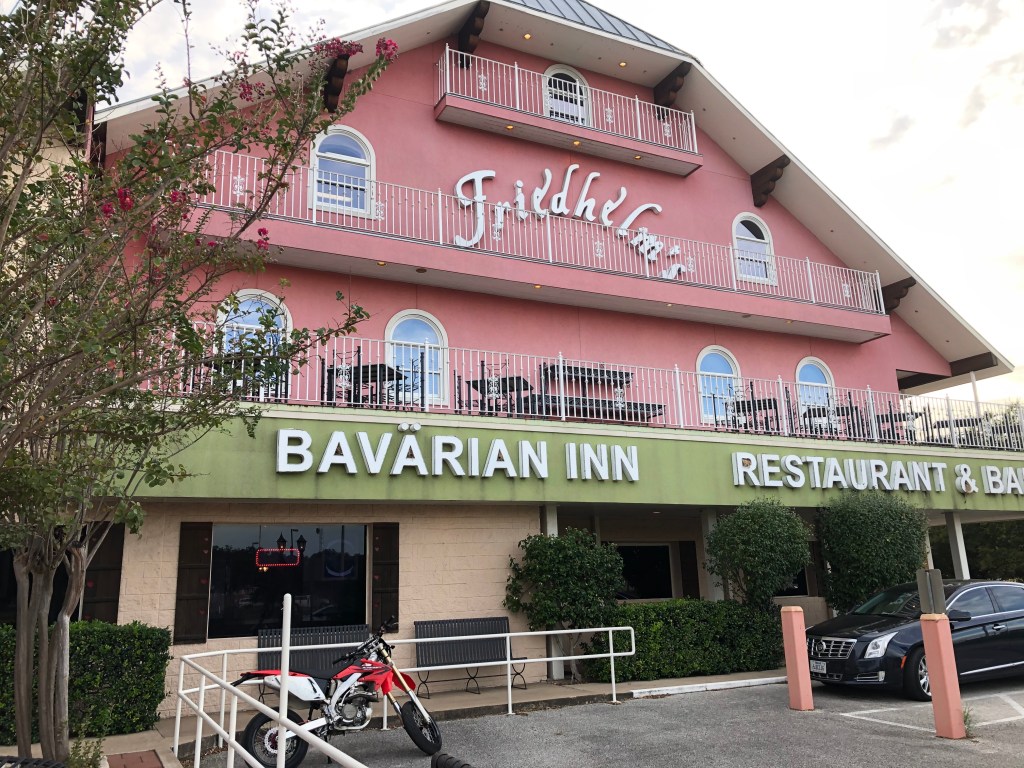
My Rind Roulade was excellent, and my Rauchbier was cold and tasty. However, I don’t think my buddies will seek out a German restaurant in the near future. I admit; we all have different tastes and that’s OK. Upon returning to the hotel I checked my bed for bedbugs, hung up my riding gear, then Googled La Loma del Chiva. “Hey Gary,” I said. “Come look at the photos of this place!” Gary’s eyes widened as much as his grin. “Marc is going to freak out when he sees this,” Gary crowed. “I am going to tell him he needs to learn how to milk a goat!” “Do you think this was a 1960’s Hippie Commune at one time?” I asked. I answered my own question: Maybe. It translated to “The hill or region of she-goats.” Although “Chiva” is also a slang term for “heroin” and “naughty girl!”

Fredericksburg is located in the Texas Hill Country on the Edwards Plateau west of Austin. As we left this quaint German community toward Leakey, TX, the hills became steeper and the canyons deeper. Leakey was the trailhead for our Twisted Sisters ride, but on the way, we stopped at Lost Maples State Natural Area, a pristine area of beautiful hills and canyons on the upper Sabinal River. The maples of Lost Maples were “lost” in much the same way as the Lost Pines southeast of Austin. When the Ice Age ended, most of the area became too hot for the maple trees to survive except for a few pockets in protected canyons. This species, Acer grandidentatum, commonly called bigtooth maple, is largely found at higher elevations in the southern and middle Rocky Mountains.

The Twisted Sisters were fun. Ranch Roads, 335, 336, and 337 are the Sisters for which riders come from near and far. The 100-mile loop follows canyons and climbs jagged, steep hills with tight, twisty curves and sheer drop-offs along the way. Signs by the road list the number of biker fatalities during a given period of time. The signs didn’t seem to slow anyone down. The Lone Star Motorcycle Museum was closed that day, but the Frio Canyon Motorcycle Stop had some great souvenirs to choose from including the obligatory tee shirt and saddlebag sticker.

The ride the next day from Leakey to Marathon via Del Rio across the southwest Texas desert was long and uneventful except for the fact that we got stopped by the Border Patrol looking for illegal immigrants. Before I pulled up to the guard, I told Marc to keep his face shield closed and his fingers crossed. The guard asked where I was from and going and if the three miscreants behind me were U.S. citizens. “Believe my words and not your eyes,” I said. “They all have US passports.” He took my word for it and waved us through.
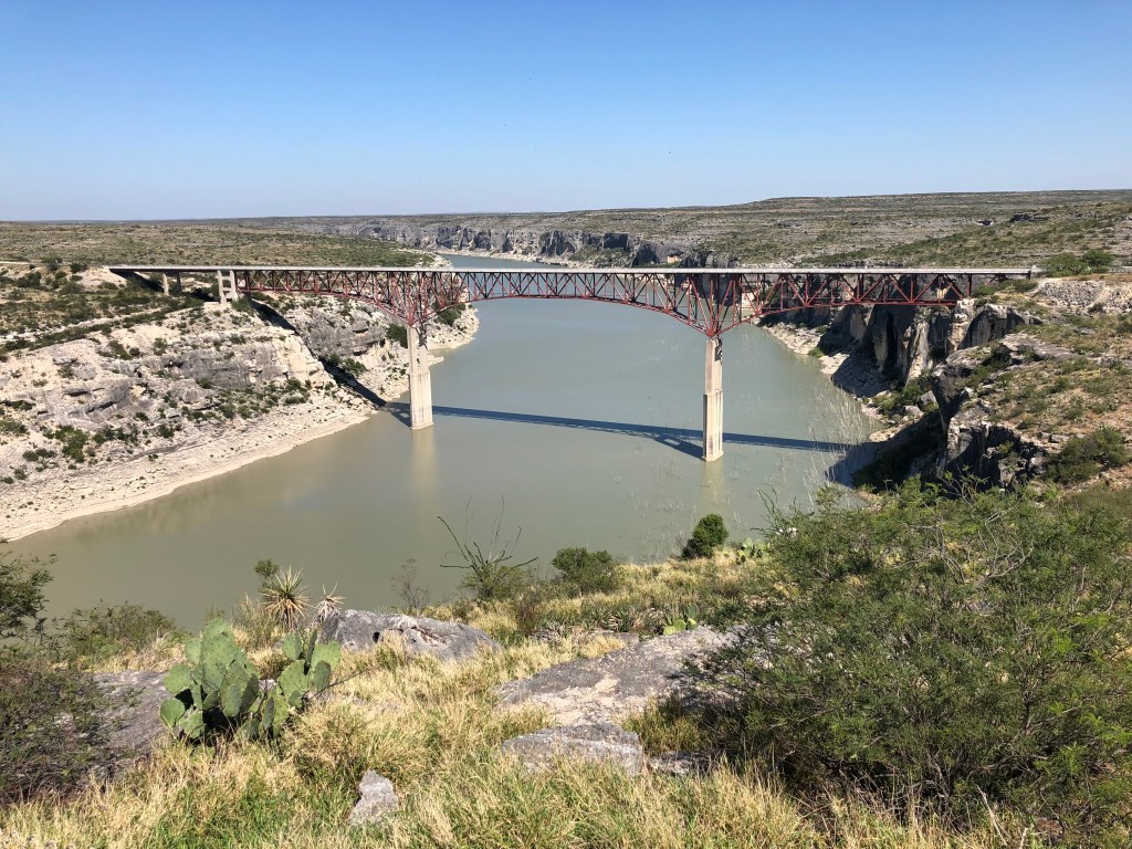

I was happy that we had a place to stay in the Goat Shed on the edge of Big Bend; this would give us the extra day to explore the Park. I was relaxed and enjoyed the ride across the desert. Don and Gary entertained themselves reliving the punch lines of old movies, Marc spent a lot of time worrying about running out of gas, and I attempted with little success to identify roadside vegetation as it blew by at 70 mph. When bored with all of the above, we collectively tried but failed to remember the lyrics to the Iron Butterfly song In a Gadda-Da-Vida. In retrospect, how could it have been so hard given there are only four lines repeated ten times? None the less, we spent so much time on it we adopted it as our trip theme song.
It was late afternoon. We rolled into Marathon, TX, at the north end of Big Bend National Park. It was time to call Ingrid for directions to La Loma del Chiva or the place of she-goats, heroin, or naughty girls. We pulled up under the shade of a cottonwood tree on Main Street. Before I removed my helmet, I heard Gary ask Marc: “Marc, do you know how to milk a goat?”
Truett, J. C. and D. W. Lay. 1984. Land of Bears and Honey: A Natural History of East Texas. University of Texas Press, Austin. 176 p.
For more motorcycle travel stories go HERE.

Really enjoyed. SteveSent from my Verizon, Samsung Galaxy smartphone
LikeLike
OK, Why In a Gadda da Vida?
LikeLike
Totally random, like most of the trip, and most of my life!
LikeLike
So which was it? She-goats or naughty girls? Or naughty she-goats? I’m assuming any heroine was long ago consumed …
LikeLike
You will be on the edge of your chair until chapter 3. Sorry.
LikeLiked by 1 person
Great job as usual, Jim. I guess Gary has moved on from Nashville Cats! 🙂
LikeLike
Great story 👏🏻👍. A nice read.
Sent from my iPhone
>
LikeLike