
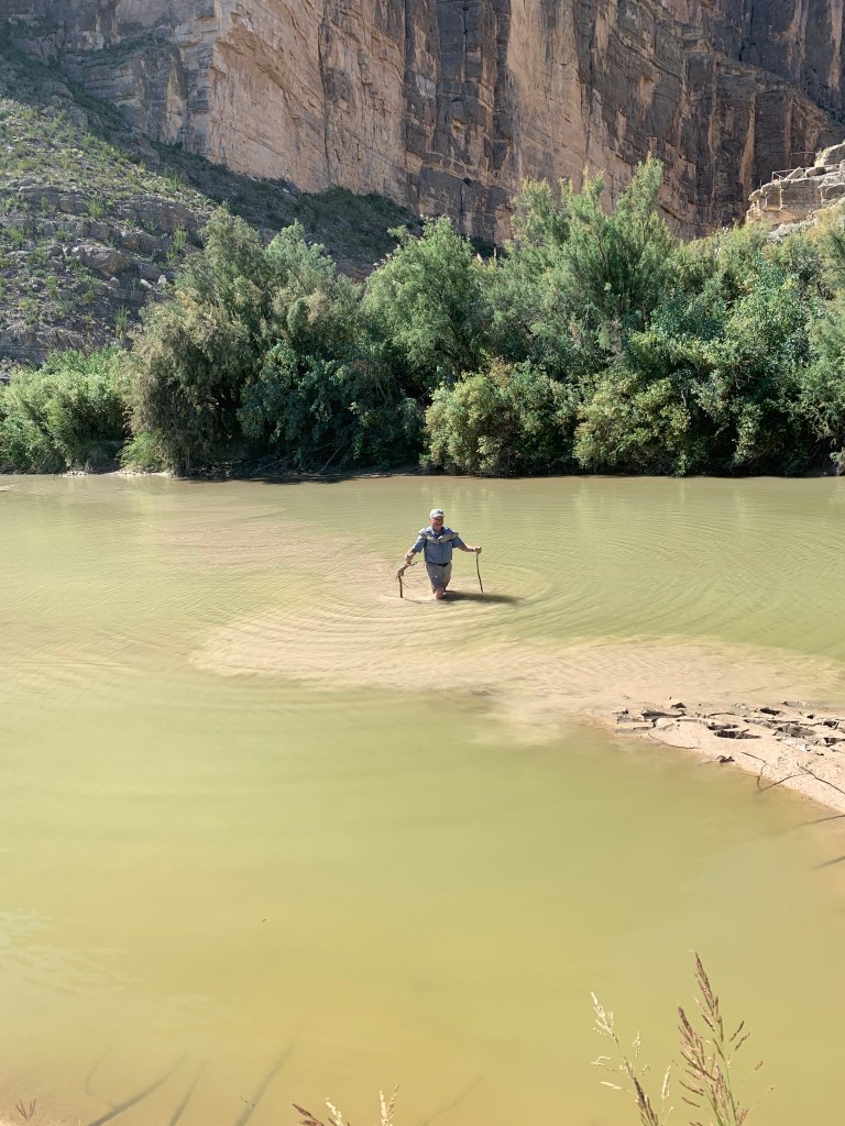
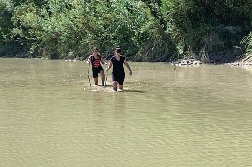
The murky water was now at mid-thigh as I took yet another careful step toward my destination on the other side of Terlingua Creek. The span was only about 150 feet, but with each step, my bare foot sunk 12 to 16 inches into the silt at the bottom of the creek. By mid-way across, I had developed a rhythm: Move the balancing stick in my left hand forward two feet and push it into the silt for good purchase; pull my left foot out of the silt, move it forward two feet and let the silt tickle between my toes as my foot penetrated again calf-deep into Terlingua Creek’s quagmire; move the balancing stick in my right hand forward and repeat.
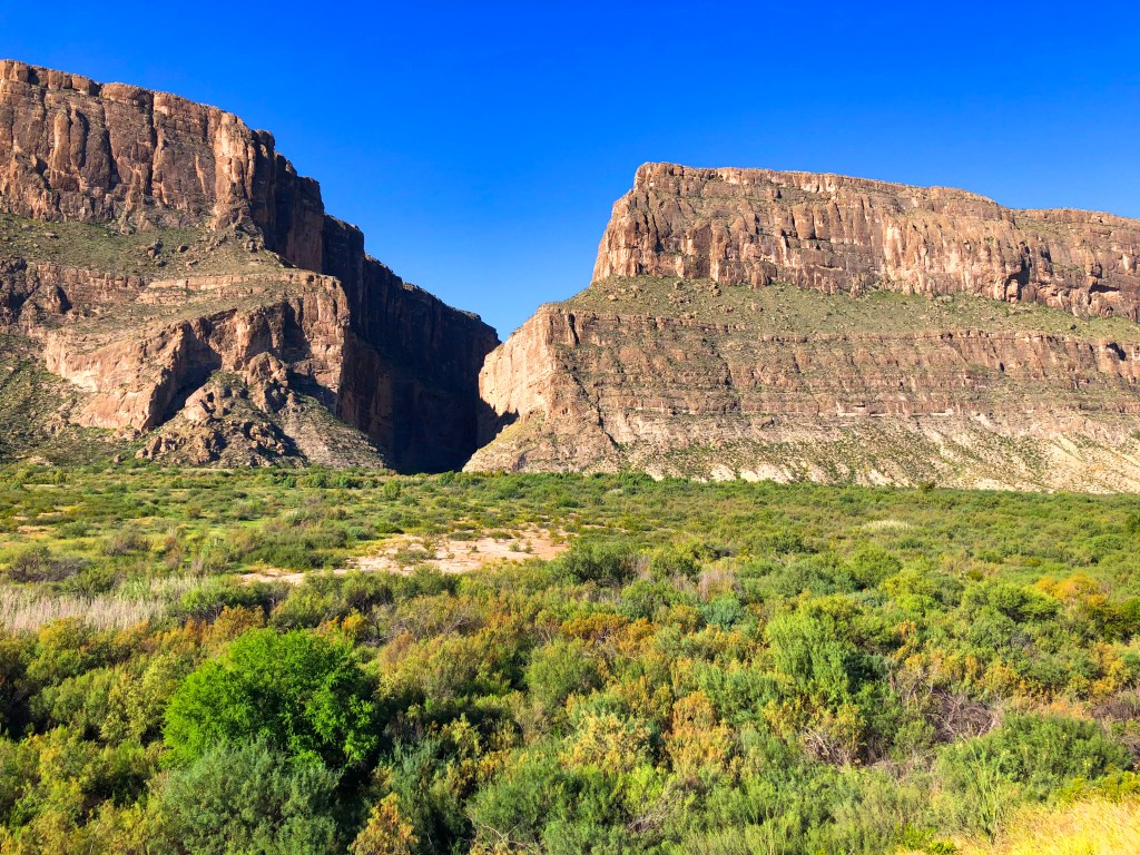
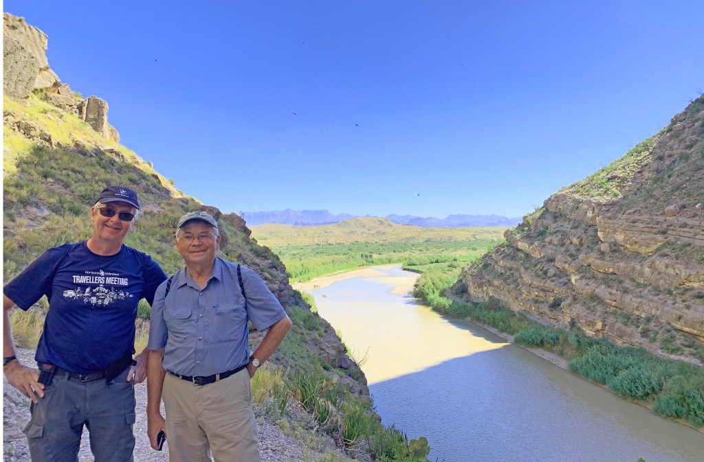
Terlingua Creek is a tributary of the Rio Grande. The creek enters the river at the point where the Rio Grande makes its “grand” exit from Santa Elena Canyon, one of the most spectacular mountain fissures on the Big Bend landscape. From the floodplain, the walls of the canyon tower 1,500 feet above you. Standing at the entrance of the canyon, you marvel at how the river could have cut through, almost tunnel-like, this imposing cliff that is three times higher than the Washington Monument and then some. An enchanting mini-ecosystem lies within the canyon walls along a one-mile hiking trail. It is one of the most sought after hiking experiences within the park. But, to get there, you first need to wade Terlingua Creek!
As Don, Gary, Marc, and I began our third and last day exploring Big Bend National Park, little did we know that we had saved the best for last? The Ross Maxwell Scenic Drive on the west side of Big Bend National Park was nothing short of spectacular with its mountain views, colorful geologic formations, diverse desert plants, and wildlife that included javelinas, jackrabbits, roadrunners and golden eagles.
The thirty-mile ride led to the Castolon Historic District and Santa Elena Canyon. Along the way, we stopped at the long-abandoned Sam Nail Ranch site, one of many homesteads once active in the area. A windmill still pumps water nourishing a small oasis of cottonwood, fig, and pecan trees that Sam and his wife Nena planted 100 years ago. Remnant walls of buildings were slowly crumbling under the shade of the cottonwoods, but the site was alive with warbles, twitters, and tweets from finches, buntings, and other little critters left unidentified.
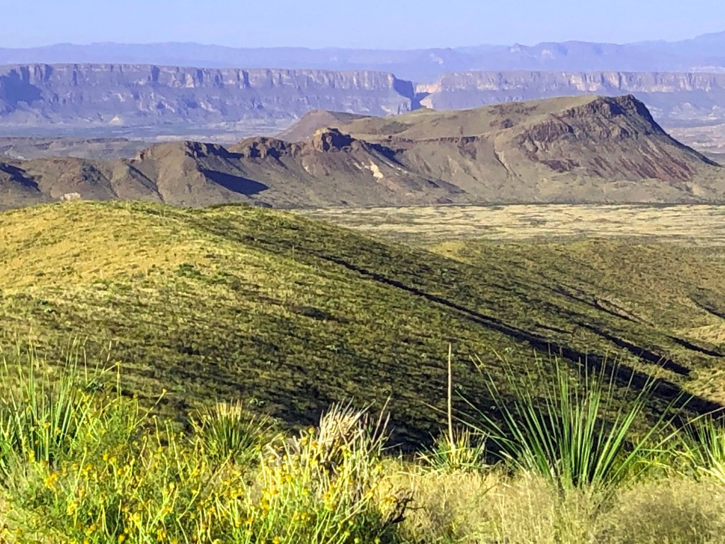
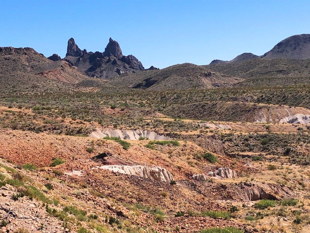
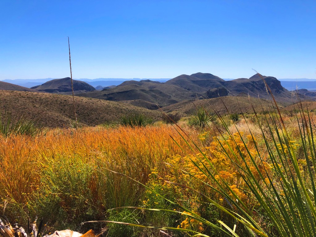
A few miles south of the Nail Ranch site, we entered the Sotol Vista Overlook. It is perched high above the desert floor, which offered a view of the entire western side of the park, including the prominent notch of Santa Elena Canyon 13-miles distant. Sotol Vista was named after the large, bright green plants with sharp “teeth” along the margins of its leaves. They encircle the Chisos Mountains a bit above and below 5,000 feet elevation. Farther on are Mule Ears Peaks, formed by dikes that erosion has sculptured into the shape of a mule’s ears. Visible for miles, they served as an important landmark for early travelers.
The paved road of the scenic drive reaches the Rio Grande at Castolon, originally a little village and now a park visitor’s center. Unfortunately, the visitor’s center is only open November through April so we were not able to enjoy its exhibits on early life in the area. Plan your visit during the winter to learn about the Hernandez, Dorgan, and Sublett families that irrigated the land and grew cotton and other crops in the rich floodplain of the Rio Grande.

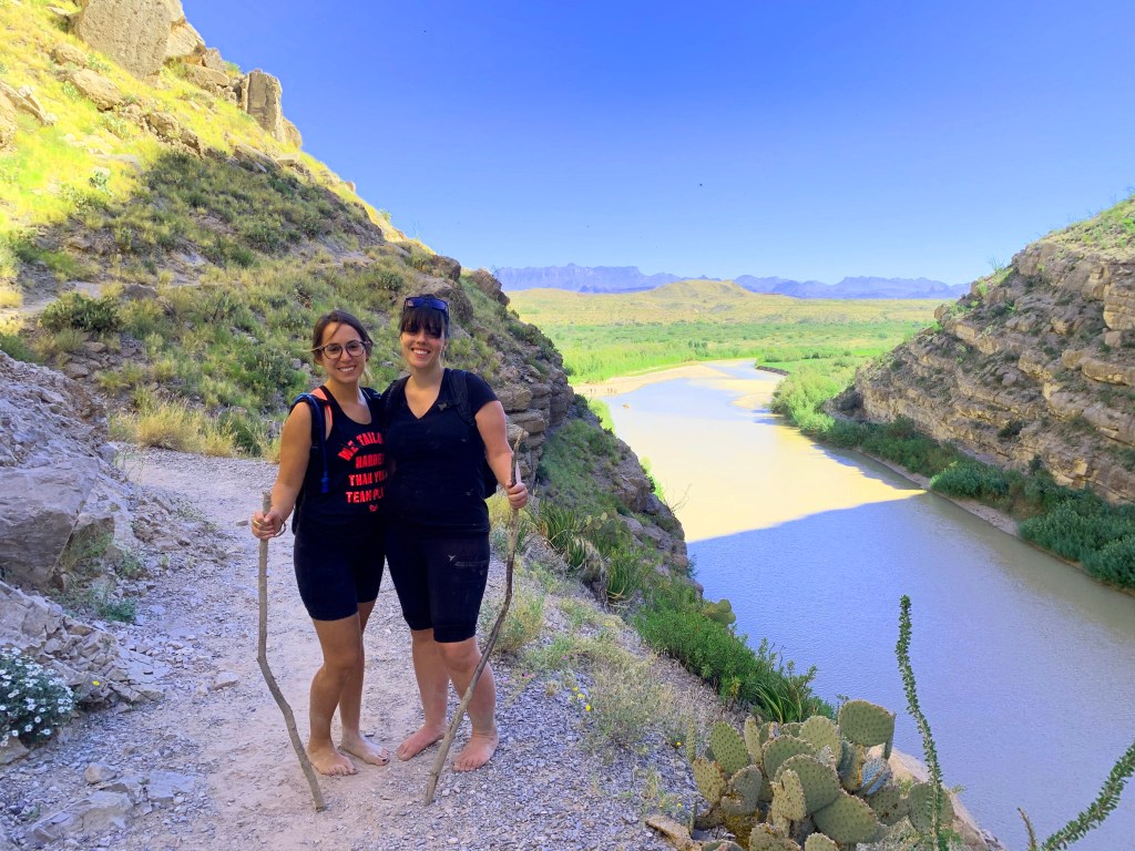
I gazed across Terlingua Creek at the trailhead at the opening of Santa Elena Canyon. Other folks with similar intentions of hiking the trail were milling around at creekside lamenting the high water. Apparently, recent rains had increased the water level to a depth unusual for this time of year. For most folks, the high water pretty much shut down plans for hiking the canyon trail. Two young women ventured out into the creek a few feet and backed out precariously with their boots full of mud.
However, neither they nor we would be deterred. Don and I removed our shoes, slung them around our neck, rolled up our pant legs, found some balancing sticks at creekside, and proceeded to test the muddy bottom of Terlingua Creek. The two women, also determined not to be put off by a little water and mud, removed their boots and followed. What about our other two riding buddies? They had their reasons for not following, none of which sounded very convincing.
Imagine an ancient, level landscape with a river running through it. At some point in time, the landscape cracked in half perpendicular to the flow of the river with part of the landscape on one side of the crack rising up 1,500 feet and the other dropping 1,500 feet. Of course, that vertical displacement, or faulting, occurred slowly over fifty million years allowing the river to cut down through the relatively soft limestone as the faulting slowly proceeded. The sediment from the river and adjacent landscape slowly filled half of the 3,000-foot displacement, which left behind a 1,500-foot high mountain escarpment and a canyon with a river running emerging from it. That is roughly how Santa Elena Canyon came about and as we see it today.
Their names were Sarah and Devora (sounds biblical), both originally from New York City and now working in Houston, TX. I was impressed by the determination and spunk of these “city girls” given that they were now barefooted and walking on sharp flints and limestone gravel of the trail. Don and I replaced our shoes and moved down the trail ahead of them.
The path began with a steep ascent to pass above a sheer cliff at the start of the canyon, followed by a more gradual descent back to the water level. A flat section of trail about 0.3 mile followed through willows and poplars to a beach, beyond which the water covered the gorge from wall to wall—the end of the trail. In addition to the grandeur of the canyon walls, the diversity of the vegetation along this short hike was amazing. It included desert scrub, grasses, mesquite, sotol and various species of cactus, and woody trees. Several species of small birds darted about and serenaded us with their songs.

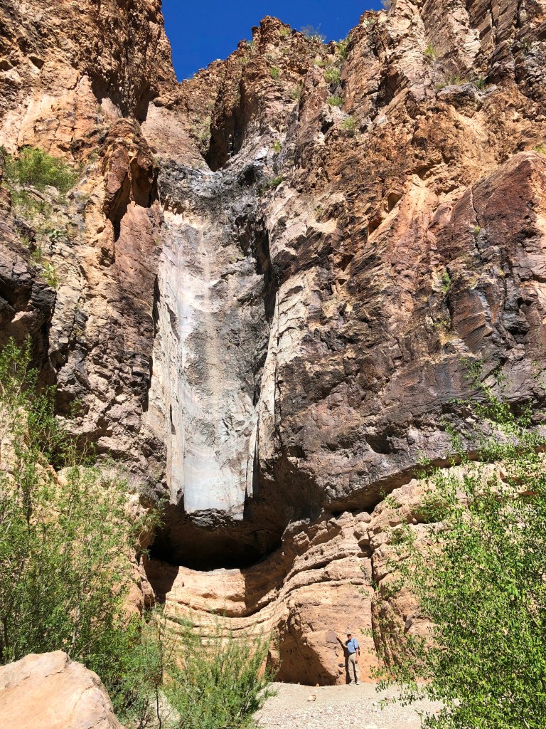
The return ride back up the Ross Maxwell Scenic Drive offered more hiking trails and geologic enigmas. Not far from Sotol Vista Overlook is Burro Mesa. A half-mile trail led us into a hidden box canyon to a high pour-off or dry waterfall. During periods of heavy rainfall, water gushes down the cliff of the canyon wall to carve a vertical depression. We saw lots of bear scat in the canyon, but no bear.
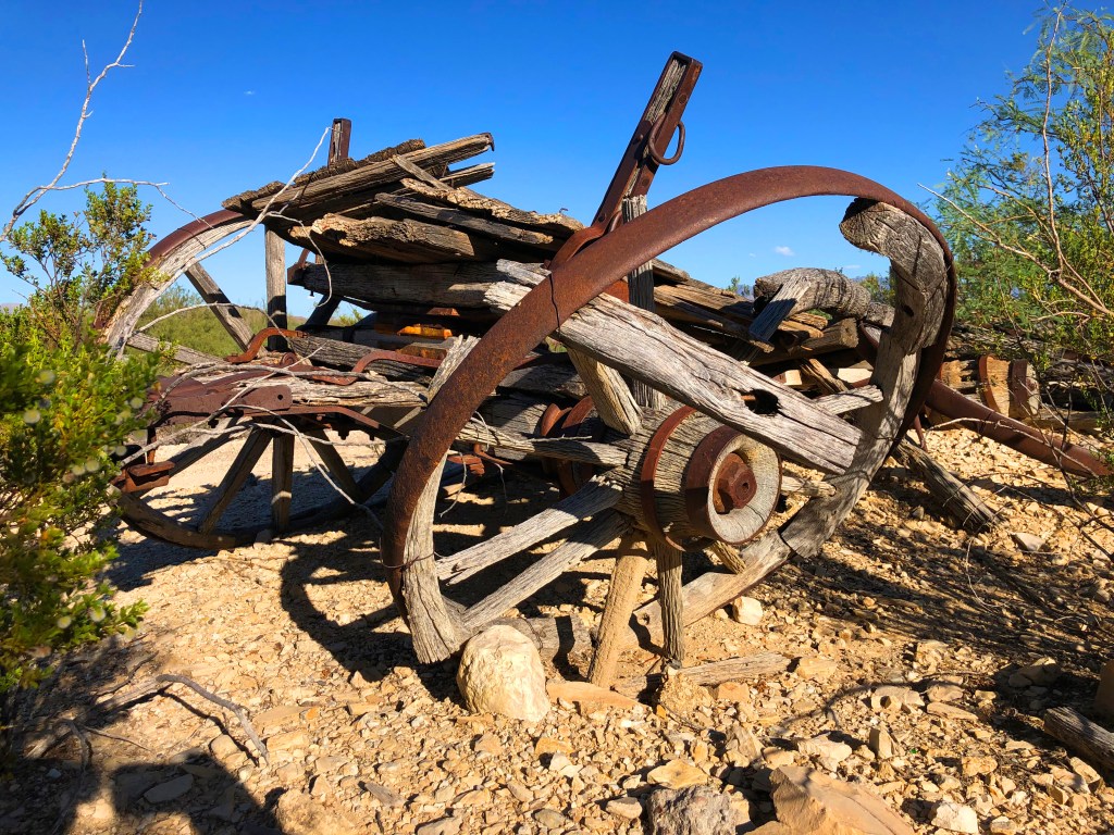
Lott Felts was a foreman for the Homer Wilson ranching operations. He built a house of native rock along with a bunkhouse, storeroom, chicken coup and corral. The house still stands down in Blue Creek Canyon. The hike down to it was worthwhile just to see the large, beautiful fireplace with its artistic stone mantle.
Did I mention that there is also a Big Bend Ranch State Park? It lies just west of Terlingua Village and is nearly two-thirds the size of the national park. It too borders the Rio Grande and shares the national park’s Chihuahuan Desert ecosystem. However, it is managed differently as the state park encompasses a network of cattle ranches operated as open range.
Regrettably, we had no time to visit the interior of the state park, but we did ride highway 171 west from Terlingua along the Rio Grande to Presidio before turning north toward Marfa, TX. This ride along the bottom end of the state park was beautiful and rivaled any within the national park for its exquisite scenery.
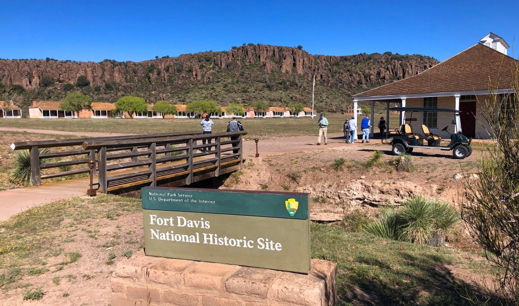
A visit to Fort Davis National Historic Site, an Indian Wars’ frontier military post, was the west-most attraction that we enjoyed before heading back east toward home. On the way, we stopped at Chickasaw National Recreation Area in Oklahoma and Hot Springs National Park in Arkansas. Each had a lovely park drive and visitor’s center.
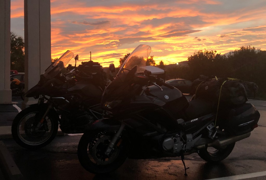
In all, we visited fourteen national parks, historic sites, or recreation areas, three state parks, rode the Natchez Trace Parkway and Twisted Sisters, and hiked and toured Big Bend National Park—not bad for a 15-day 4,200-mile ride. From time to time, we were forced out of our comfort zone: We almost ran out of gas, had a flat tire, survived the Goat Shed, waded a muddy creek, rode donkeys, were rained on multiple times, and survived Gary’s non-stop rendition of In-a-gadda-da-vida.
In the end, as is usual on most of these excursions, the best times were had via our interactions with people we met and with each other.

Yeah, long-distance motorcycle travel is a blast, and having good riding buddies to share it makes it even better.
For more motorcycling adventure stories go HERE.

Thank you! Beautiful and breathtaking.
Sent from my iPhone
>
LikeLike
Thanks, Jim. Great job as usual!
LikeLike