
Tags
“How was your ride today?” she (wife) asked.
A small miracle allowed a weak cell phone signal out of the depths of the Idaho backcountry. “It was a pretty rough day,” I answered. “By the time I got up the mountain to the base of Burnt Knob Lookout, the halfway point on the Magruder Corridor, I was exhausted.” “The steep, 8-12% grades never let up and dodging the ruts and large rocks for miles while standing on my pegs was tiring.”
With some weariness in her voice she replied: “After you get home and we are half “unbuttoned” with a bottle of wine, I want you to explain to me how what you are doing is FUN.”
“What I was doing” was riding the Idaho Backcountry Discovery Route (IDBDR) with my riding buddy Jeff. Yes, it was fun. More than fun. Exhilarating, actually. The route is a 1,250-mile dirt and gravel track from Port Hill, Idaho, on the Canadian border to Jarbidge, Nevada. The track runs roughly north to south with several east/west jogs that include some historic trails like the Lolo Motorway, the Magruder Corridor, and the Nez Perce Trail. The official website of the Backcountry Discovery Routes (BDR) Organization describes the Idaho BDR in a nutshell:

“If you’ve ever wanted to ride endless twisty mountain roads, the Idaho BDR will throw corners at you for days on end. You also won’t get many digital interruptions because your cell phone won’t have reception on most of this route. It’s a true off- the-grid ride that is long enough, at 1,250 miles, that you might just use up an entire rear knobby tire.”
Backcountry Discovery Routes (BDR) is a non-profit organization that creates off-highway routes for dual-sport and adventure motorcycle travel. Since 2010, the BDR has introduced ten routes with free GPS tracks, eight in the western states and two in the east. Their work also includes rider education, safety campaigns, and promoting responsible travel for motorcyclists traveling in the backcountry. Each route generates new tourism that delivers some economic relief to rural communities.
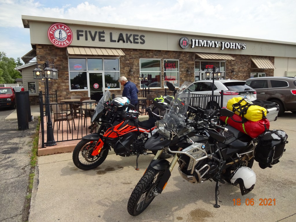
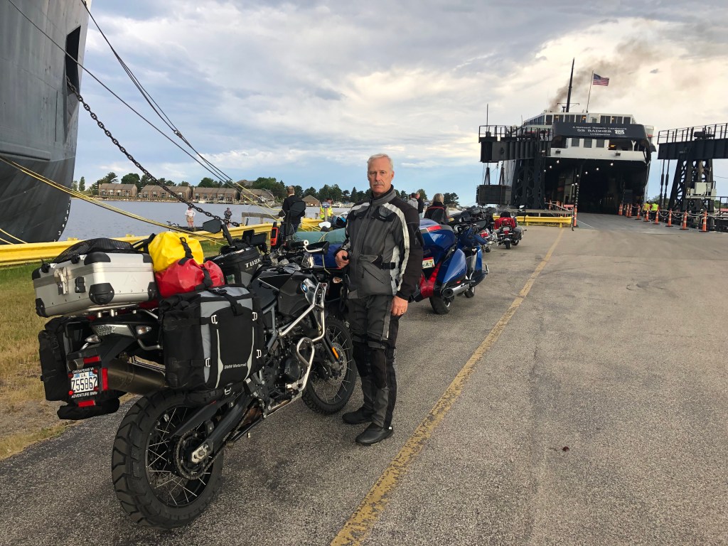
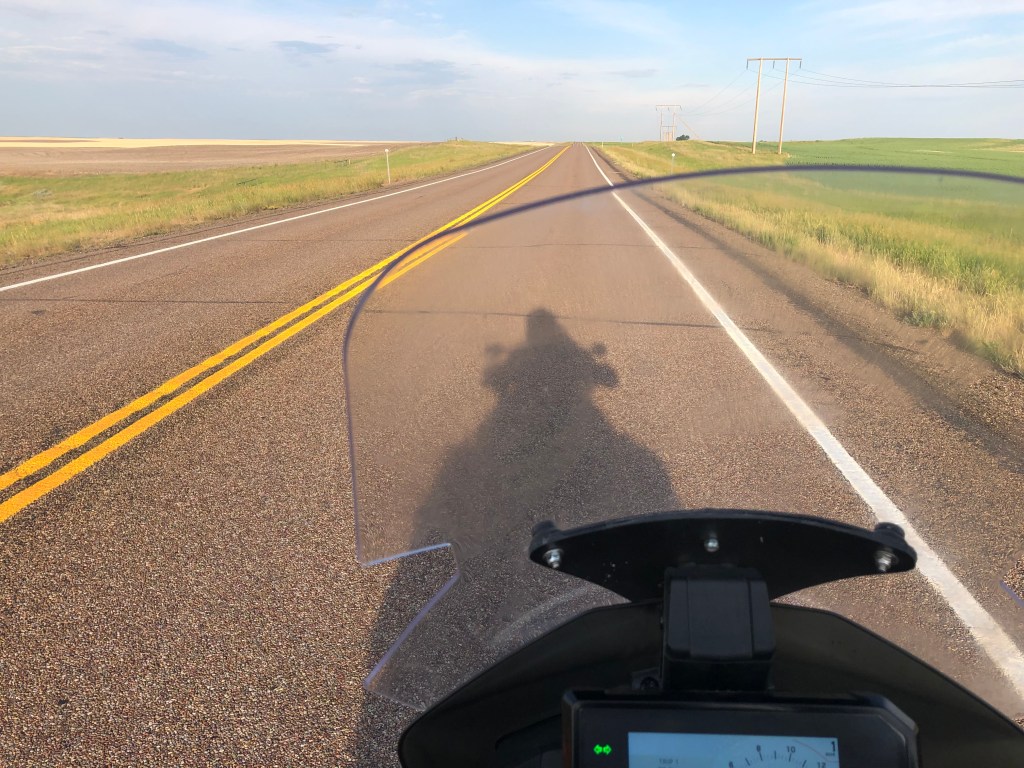
Jeff and I had ridden the Mid-Atlantic BDR last summer with our buddies Don and Marc. We enjoyed the riding challenges of off-pavement riding; the Idaho BDR presented a new challenge. After all, we would be in the “neighborhood” in Great Falls, Montana, attending the National BMW Motorcycle Rally. We would normally ride our heavy BMW R1200GS motorcycles across the country to the rally, however, our mid-sized motorcycles, Jeff’s BMW F800GS and my KTM 790 Adv were more suitable for off-road BDR travel. Therefore, we loaded our camping gear on the smaller bikes and headed west for the six-day trip to Great Falls and beyond. Following is a travel blog with photos taken by Jeff and me. Click on the photos; most of them will expand.
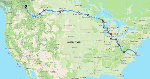
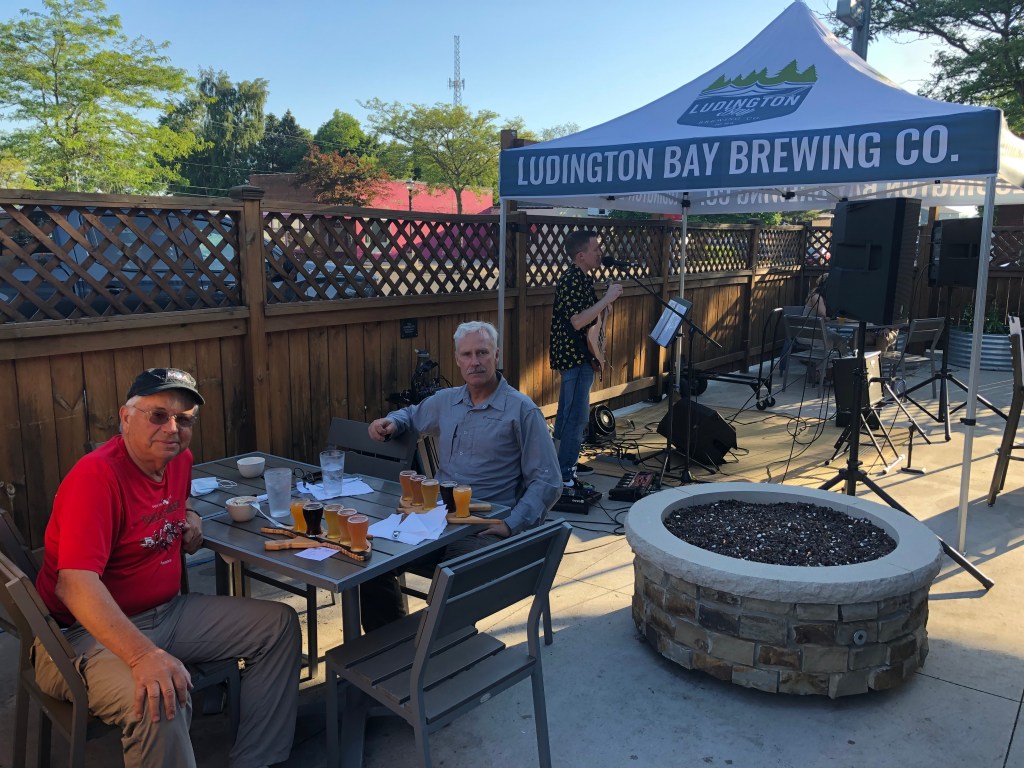
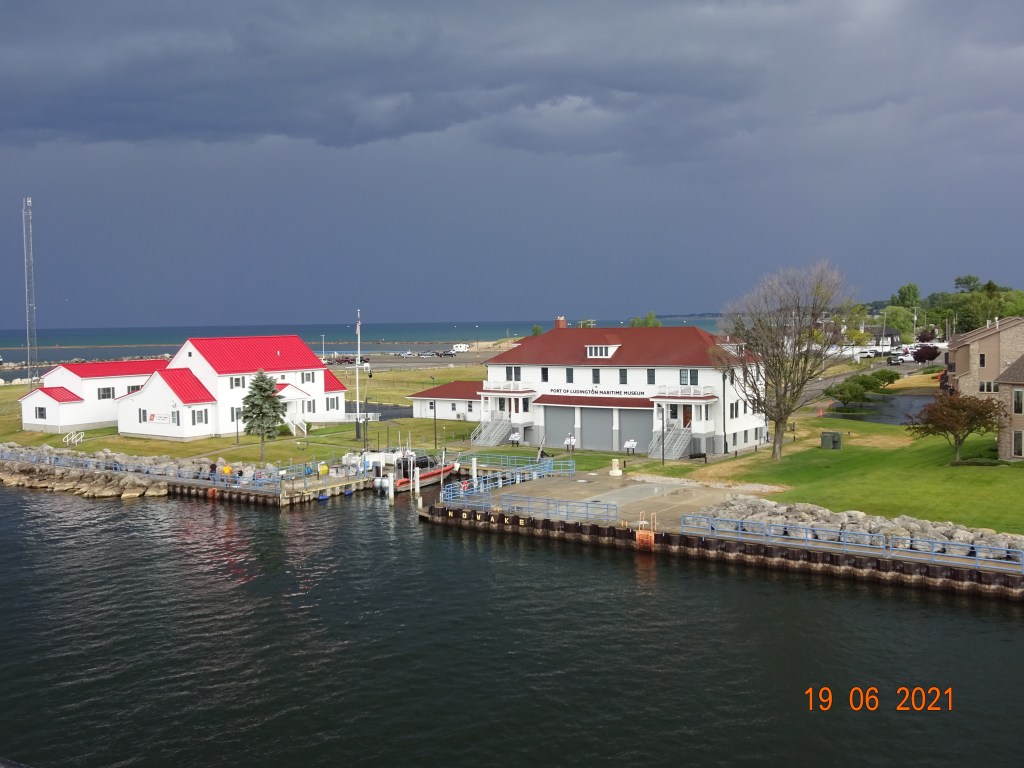
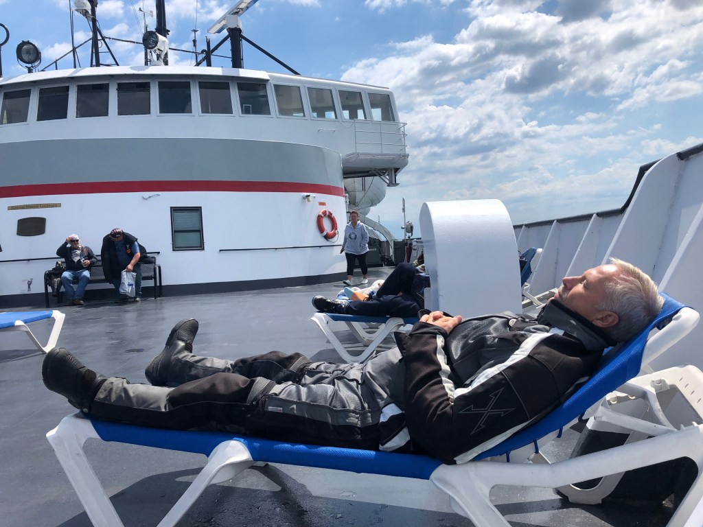
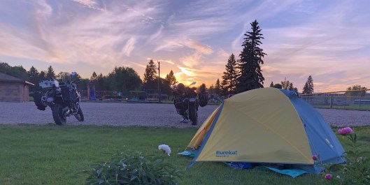
Jeff rode an extra day from his home in Virginia Beach. We met in Blacksburg and made our way to Ludington, MI, where we sailed on the SS Badger across Lake Michigan to Manitowoc, WI. We picked up Route 2 at Iron Mountain MI which took us all the way to Havre, MT, then Route 89 to Great Falls. We camped each night except after an all-day ride in the rain through Minnesota (Super 8). It was my third ride across MN and I got soaked each time! I’m sure the sun shines once in a while in northern MN, but I can’t vouch for that possibility.

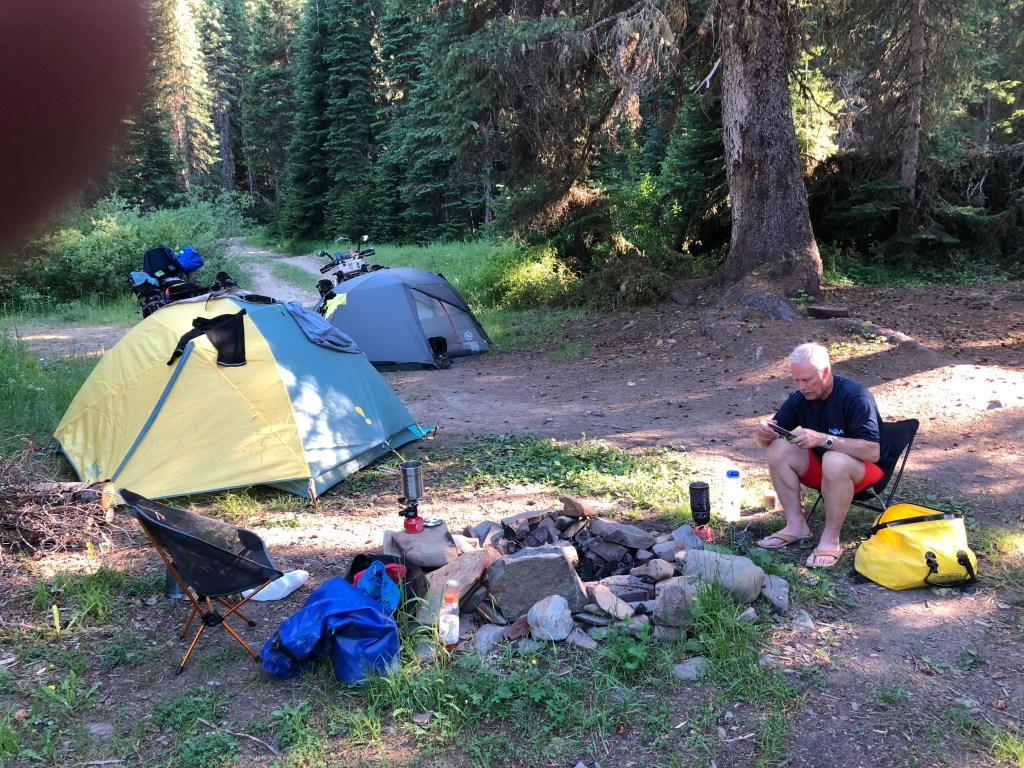
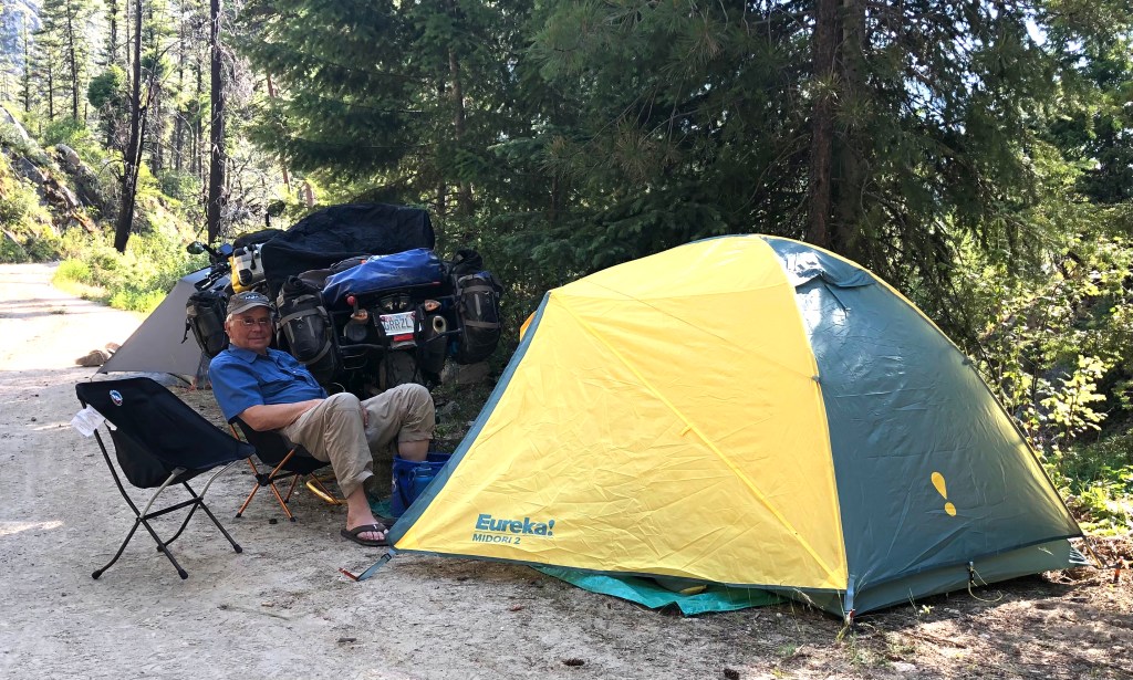
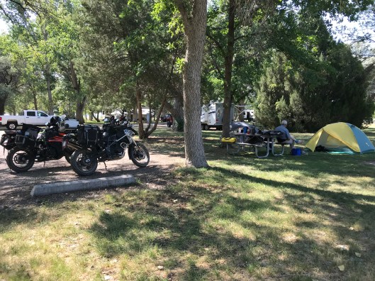
Jeff is preparing dinner at our camp in Delaware State Park north of Columbus, Ohio. We included a lot of diversity in our evening meals: Ramen noodles with tuna, ramen noodles with chicken, ramen noodles with salmon, ramen noodles with beef, etc. Breakfast was equally diverse; Quaker instant oatmeal variety pack. It’s all about items that you can pack and carry efficiently, and to which you can simply add hot water.
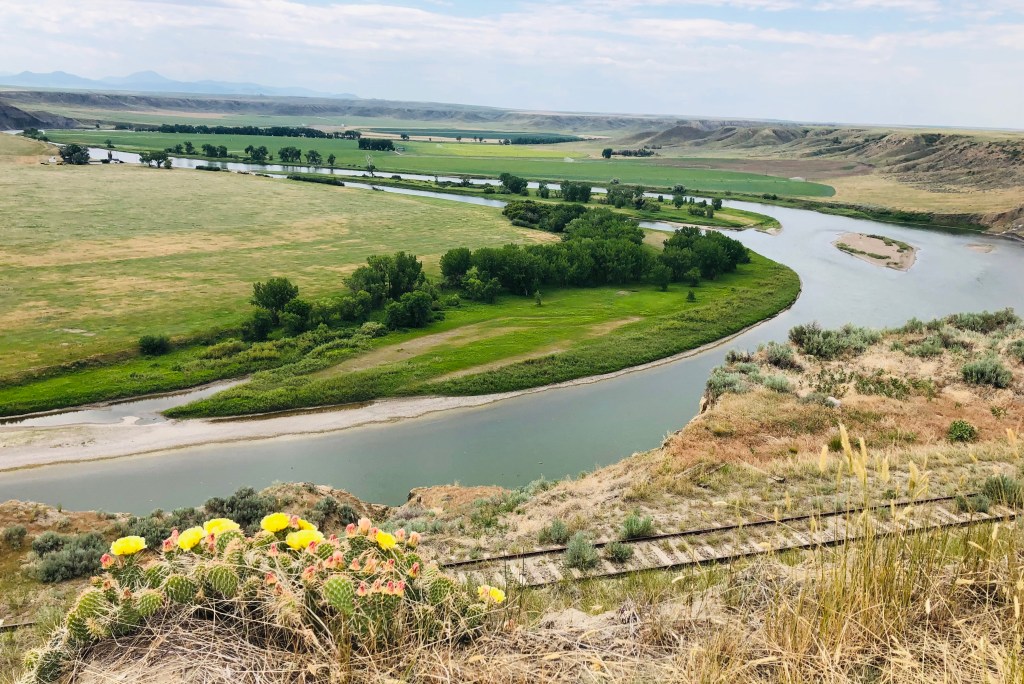
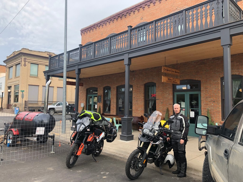
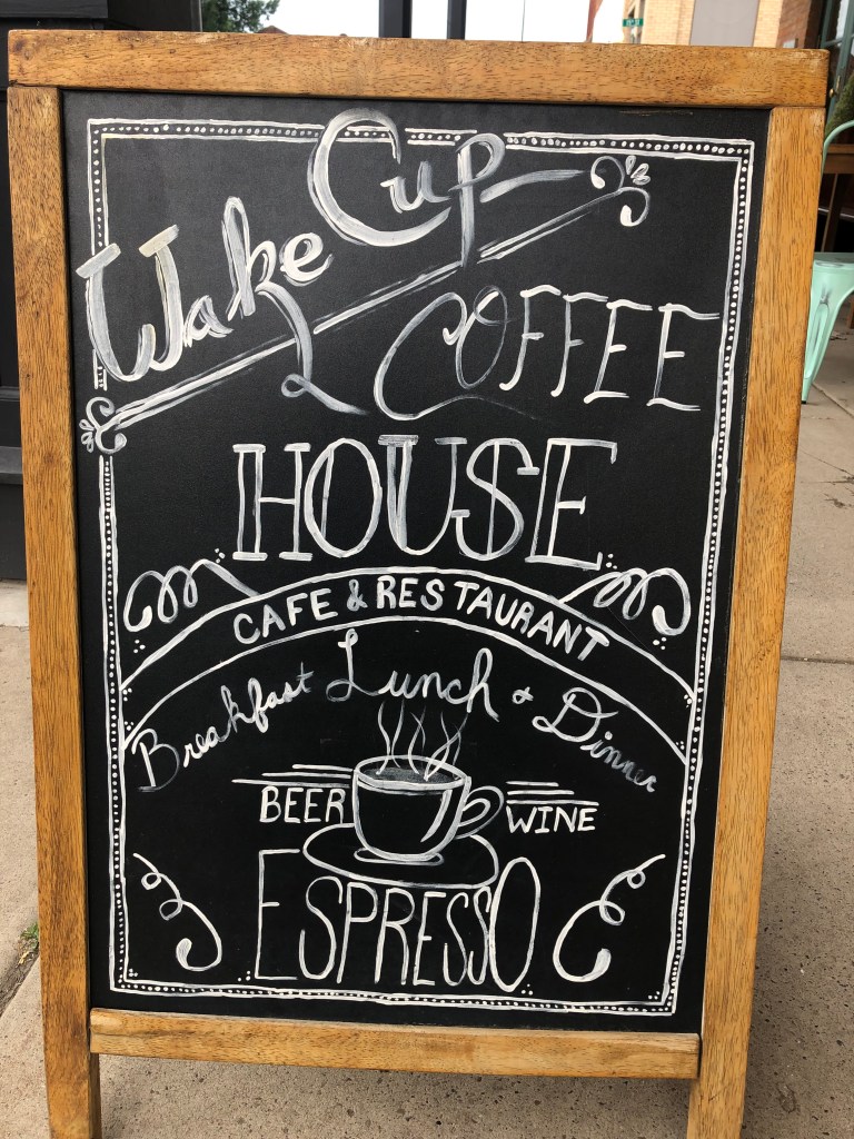
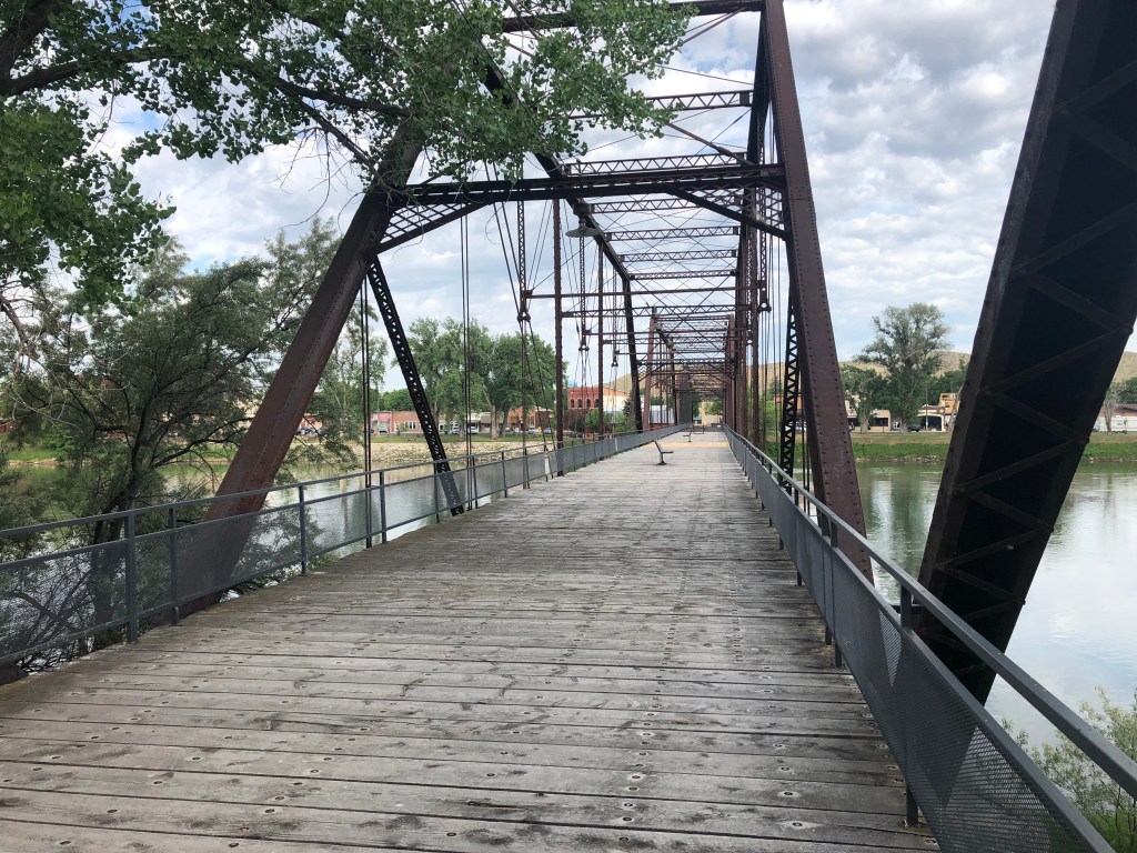
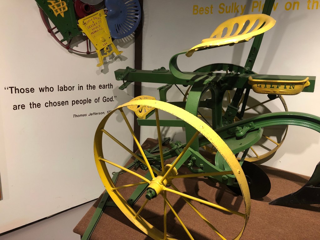
Fort Benton MT was our favorite stop prior to reaching Great Falls. Established in 1846, it is the second oldest settlement in Montana. The city’s location on the bank of the Missouri River was strategic to its growth and perseverance. The city’s waterfront was designated a National Historic Landmark in 1961. Overlooking the river was Wake Cup Coffee House that we targeted when breaking camp south of Havre. The old bridge over the Missouri River, for pedestrians only, is part of the historic waterfront. We visited the Museum of the Northern Great Plains on the other side of town. I liked the quote by Thomas Jefferson; I’m not sure I’ve “labored” enough to qualify.
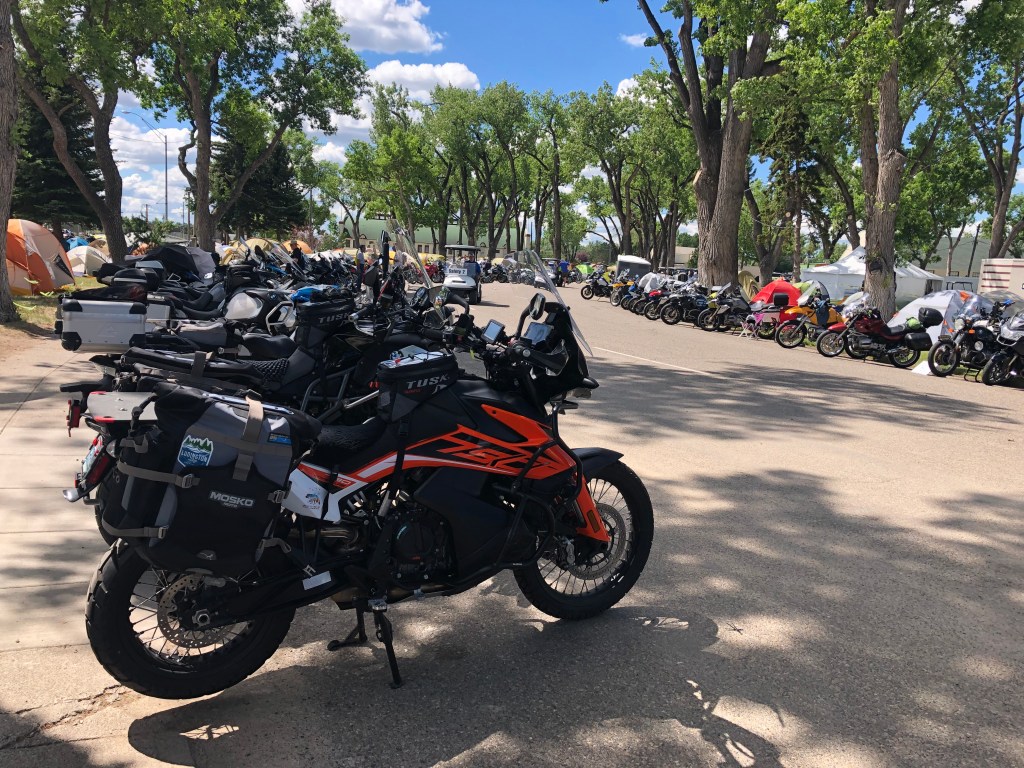
Good music, good beer, good friends, but a BMW motorcycle rally is more than that. You can sharpen your skills with on and off-road training. You can outfit your machine with new tires, new seats, dozens of things to hang on every part of the bike. There are seminars on many topics including Precision Cornering, Noise Reduction and Hearing Protection, Braking Systems, Trip-Planning, Sidecar Basics, Women Who Ride, to name a few. And it’s fun just looking at 5,000 BMW motorcycles all in one place. And one KTM.
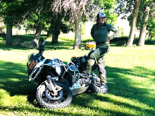
That petite, pony-tailed 20s-something young woman standing on the rear tire of her motorcycle is Cassie, our off-road training instructor. Jeff and I spent the first day of the rally as participants in an off-road riding course given by West38Moto located on the grounds of a beautiful Montana ranch west of Great Falls. Cassie, an off-road riding expert was our primary instructor. She is getting ready to demonstrate how to pick up a 550-pound motorcycle. Yes, she picked it up by herself. Why is picking up a heavy, dropped bike an essential skill for off-road riding? You guessed correctly.

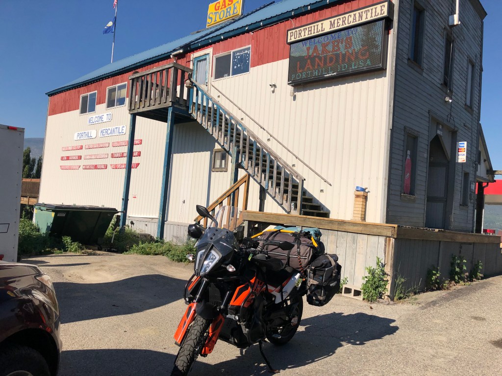
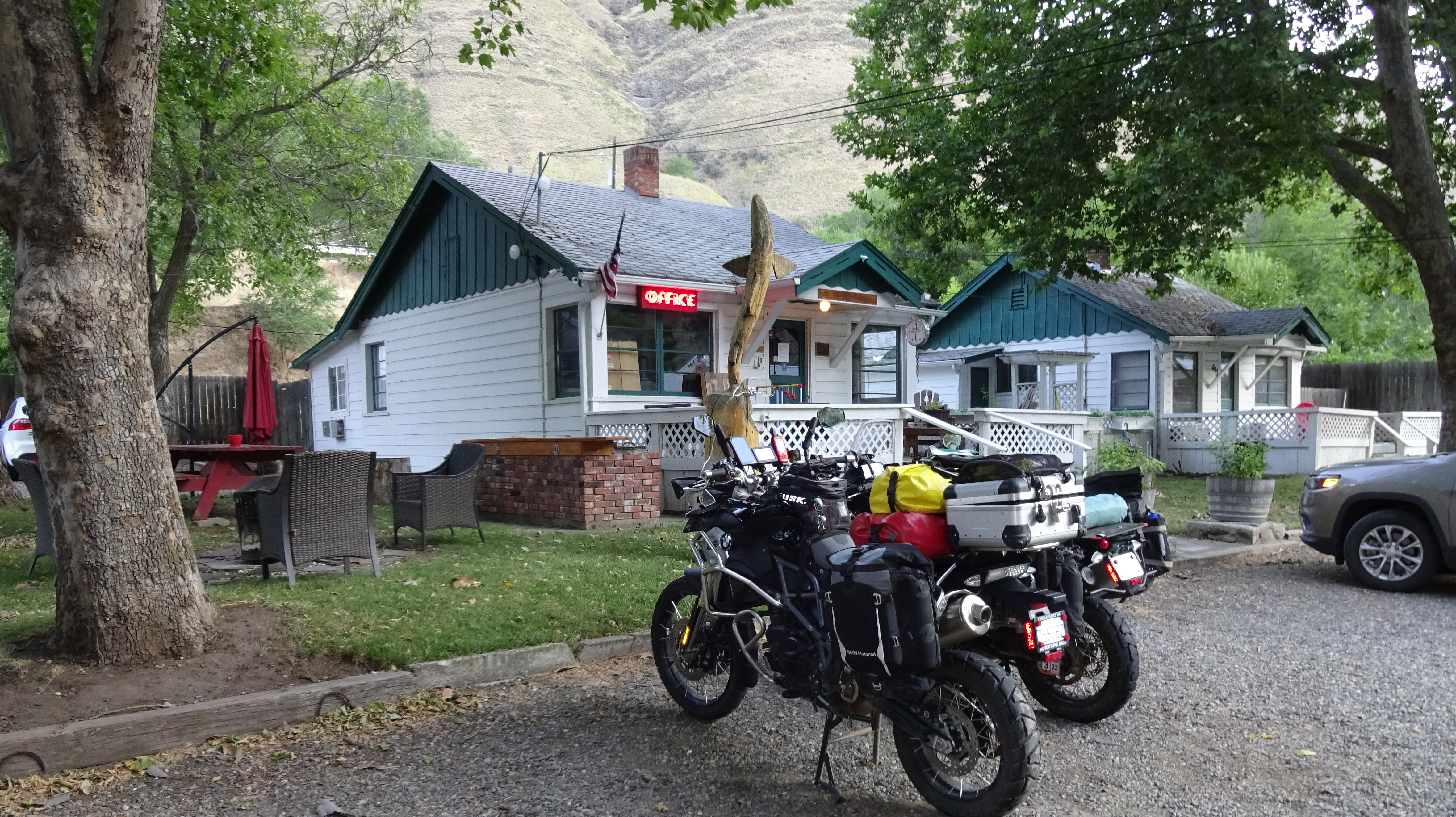
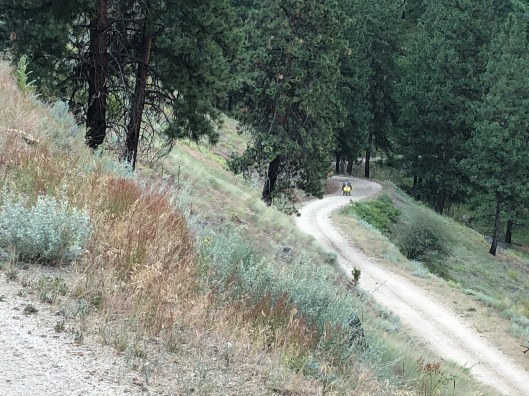
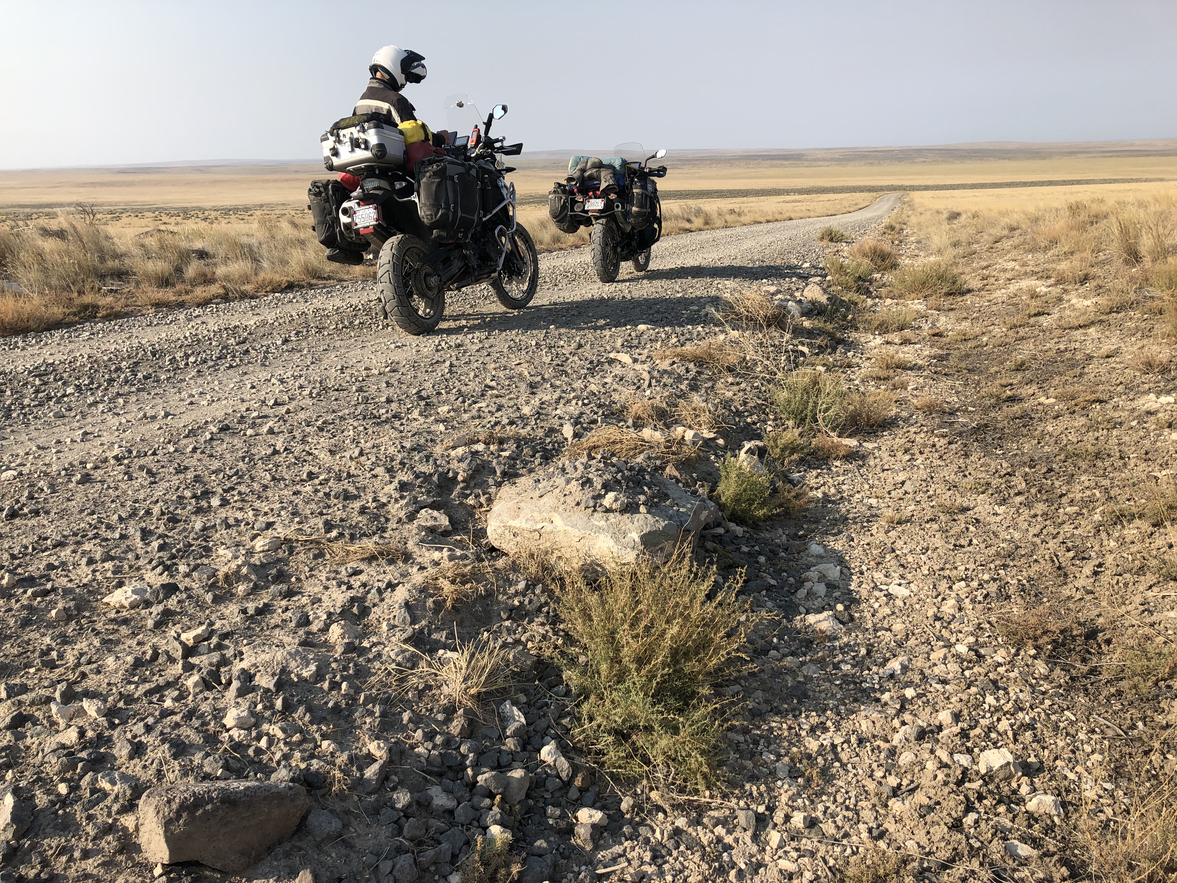
Most riders begin the Idaho BDR in Jabidge, NV, and go north to the Canadian border. Already in Great Falls MT at the BMW rally, Jeff and I were only a day’s ride from the north end of the trail at Port Hill, ID, so we chose to do the route “backward” from north to south. This coincidence turned out to be fortuitous. As we traveled south, wildfires were erupting behind us shutting down parts of the trail we had just traversed. Here we are 30 miles from the start of the trail camped at Twin Rivers Canyon Campground at the confluence of the Kootenai and Moyie Rivers, not far from Bonners Ferry, ID. A short ride in the morning would put us at the start of the Idaho BDR.

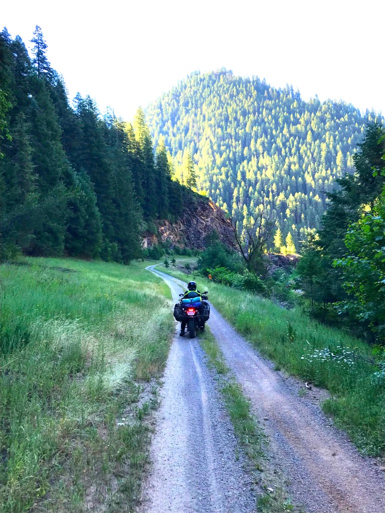
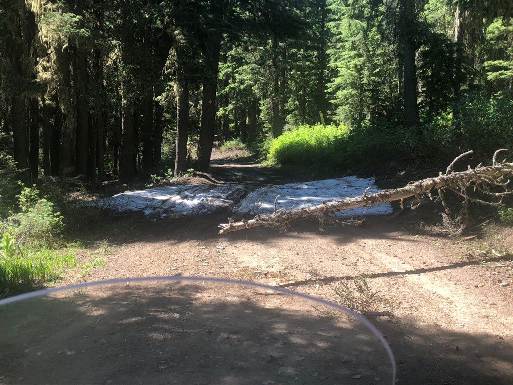
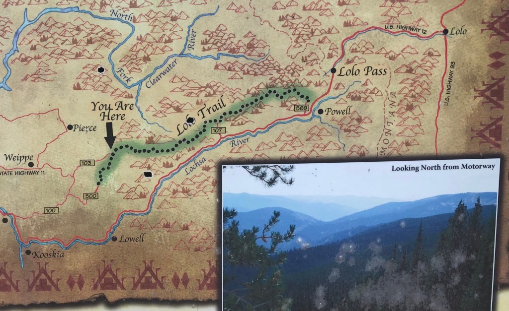
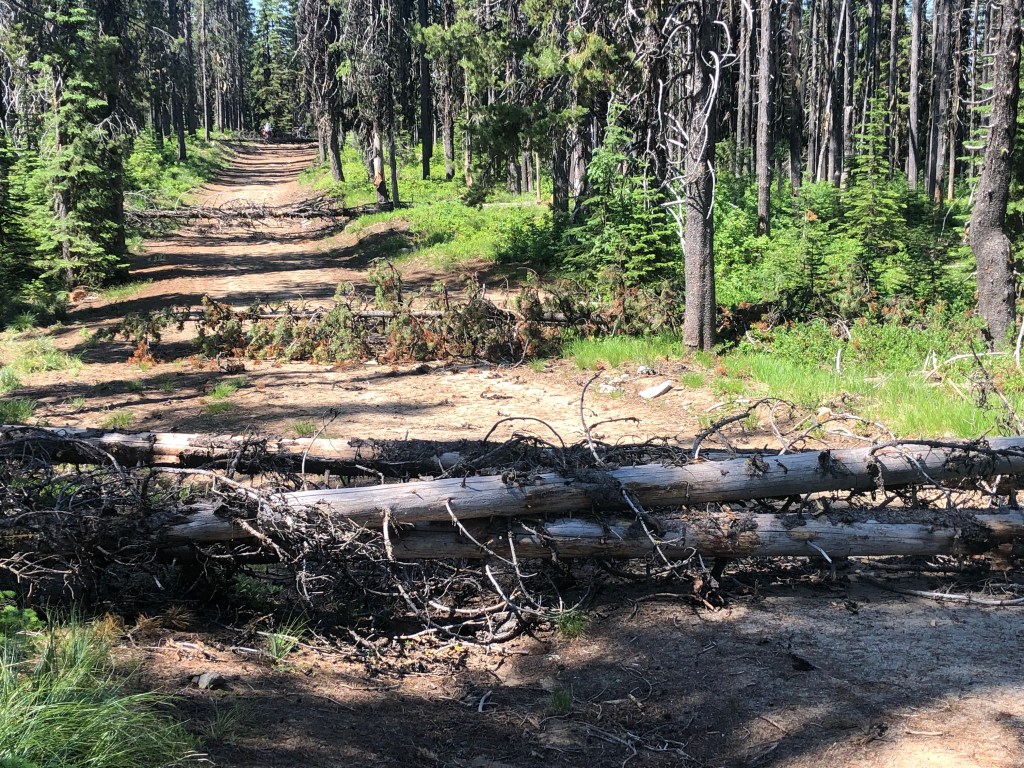
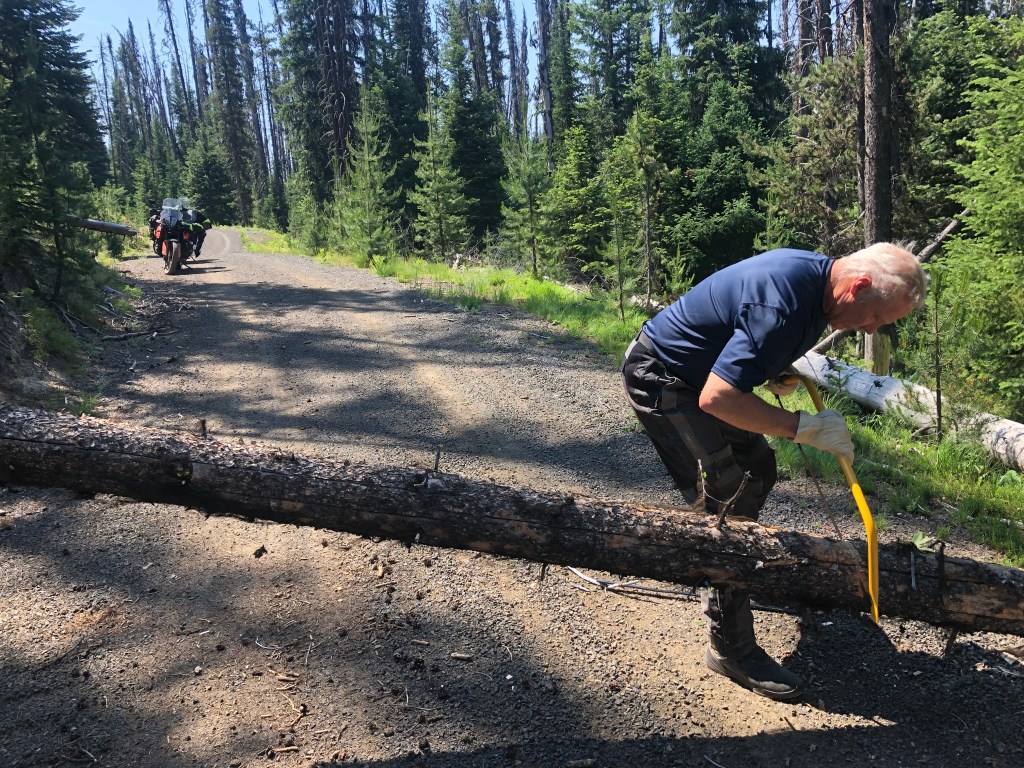
We departed the old mining town of Pierce, connected with the Lolo Trail, and traversed about 30 miles before encountering uncleared winter’s deadfall. We had gotten bad intel from two sources that the trail was open—our sources must have been lost or playing a joke. We backtracked the 30 miles, dropped down to Kooskia, spent the night at a KOA, then rode up Highway 12 along the Lochsa River to reconnect to the BDR route. No worries; it was a lovely ride along the Lochsa River through Lolo Pass and beyond.
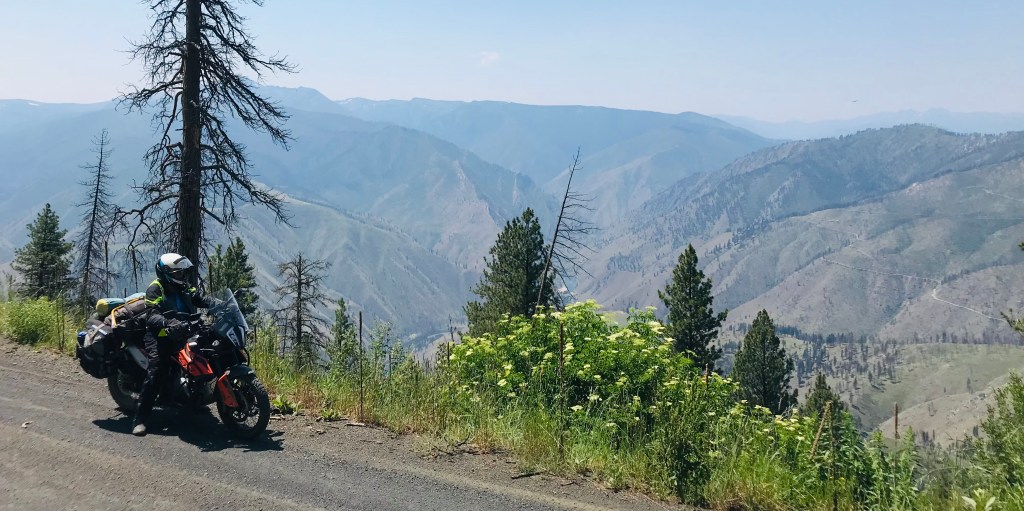
The Magruder Corridor is a primitive east to west trail bisecting the Selway Bitterroot and Frank Church-River of No Return Wilderness areas. We began the route on the east end over the Nez Perce Pass past a sign that warned: “No services for 113 miles. Axe, shovel, and bucket essential at all times.” We had no axe or shovel, just a bow saw and a collapsable, plastic bucket. I assume the shovel might be needed to dig out a stuck wheel, but the bucket requirement was a mystery—what do you think?
A second sign described the terrain of the Wilderness in front of us: “Hundreds of peaks separate more than thirty rugged drainages for nearly ninety miles along a dramatic mountain front—where rocky ridges break abruptly into the West Fork of the Bitterroot River. From the lofty vantage point of the 9,000 to 10,000-foot peaks, the impression is one of barren rock from the jagged crest of the Bitterroots to the valley floor. A closer look reveals sheer walls, cliffs, tumbling waterfalls, hanging valleys—a landscape so rough that, in comparison, most Montana mountains seem like gently rolling hills.” Welcome to the Magruder Corridor.
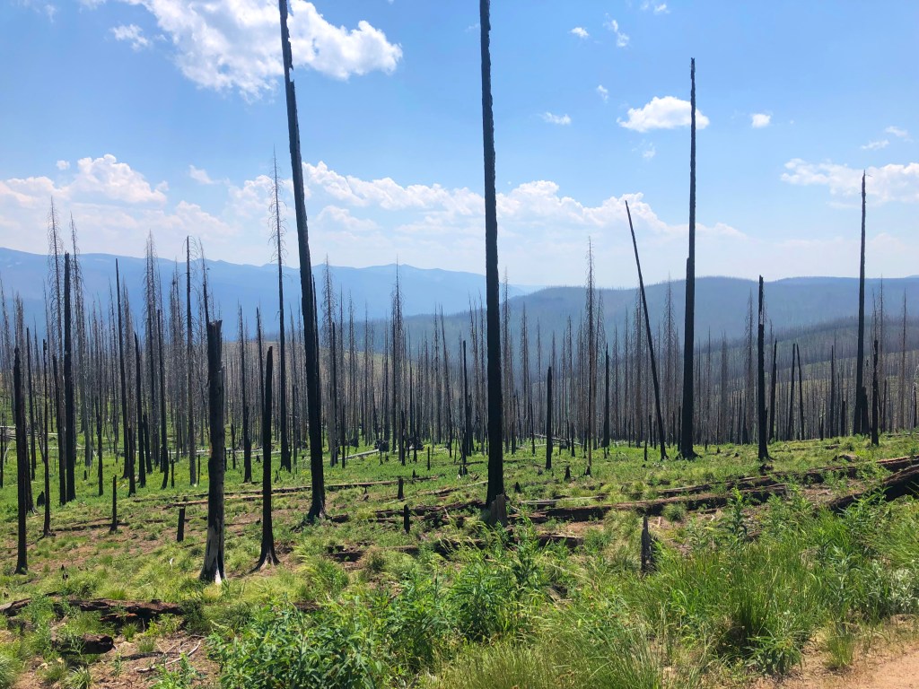
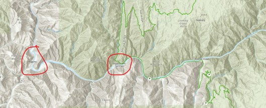

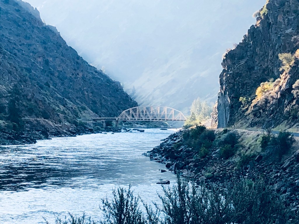
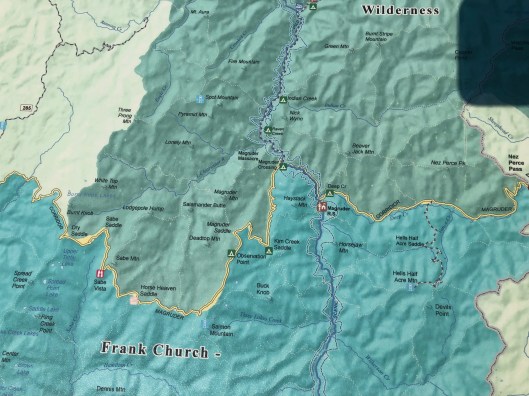
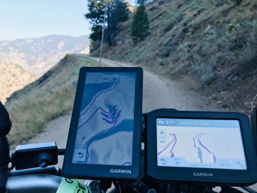
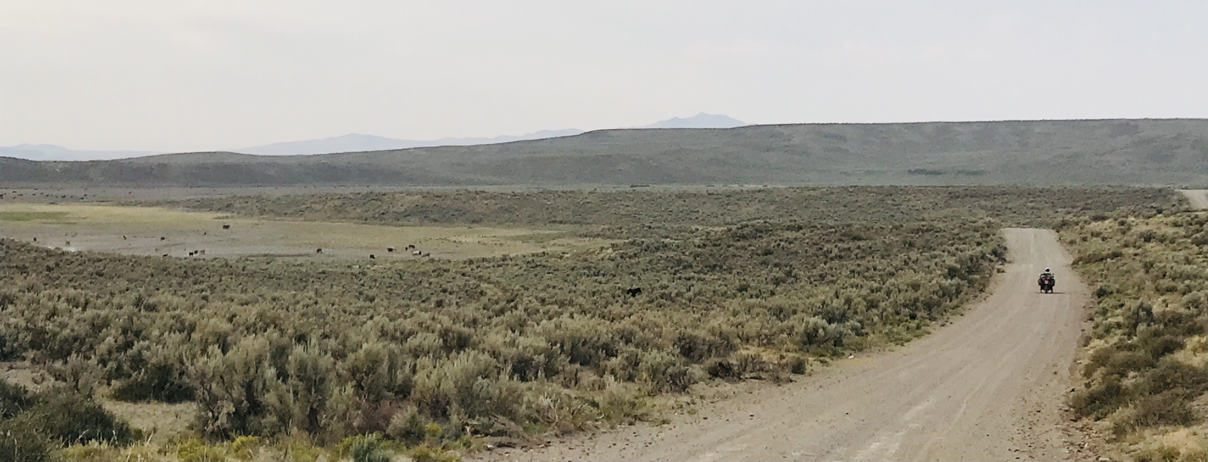
The green line on the map above is the BDR track (click on the map to expand it). Riding north to south we were nearly out of gas by the time we reached Riggins Hot Springs (red circle). One of our better decisions was to depart the track and head west along the Salmon River to the village of Riggins. It was getting late in the day anyway; we were hot and tired. The thoughts of a cold beer, a nice dinner, and a motel room flooded our meager brain cells—the ones that were still somewhat alert. But we were not too tired to suck in the beauty of the Salmon River Canyon along the 10-mile stretch of pavement to Riggins.
Riggins on the Salmon River is a rafting town. We met some folks from Bosie ID who brought their three kids for some fun on the river. After a long day, the kids were napping and Mom and Dad were in the gazebo of the Riggins Motel with a cooler of beer, which they shared along with lots of interesting stories of Idaho culture.
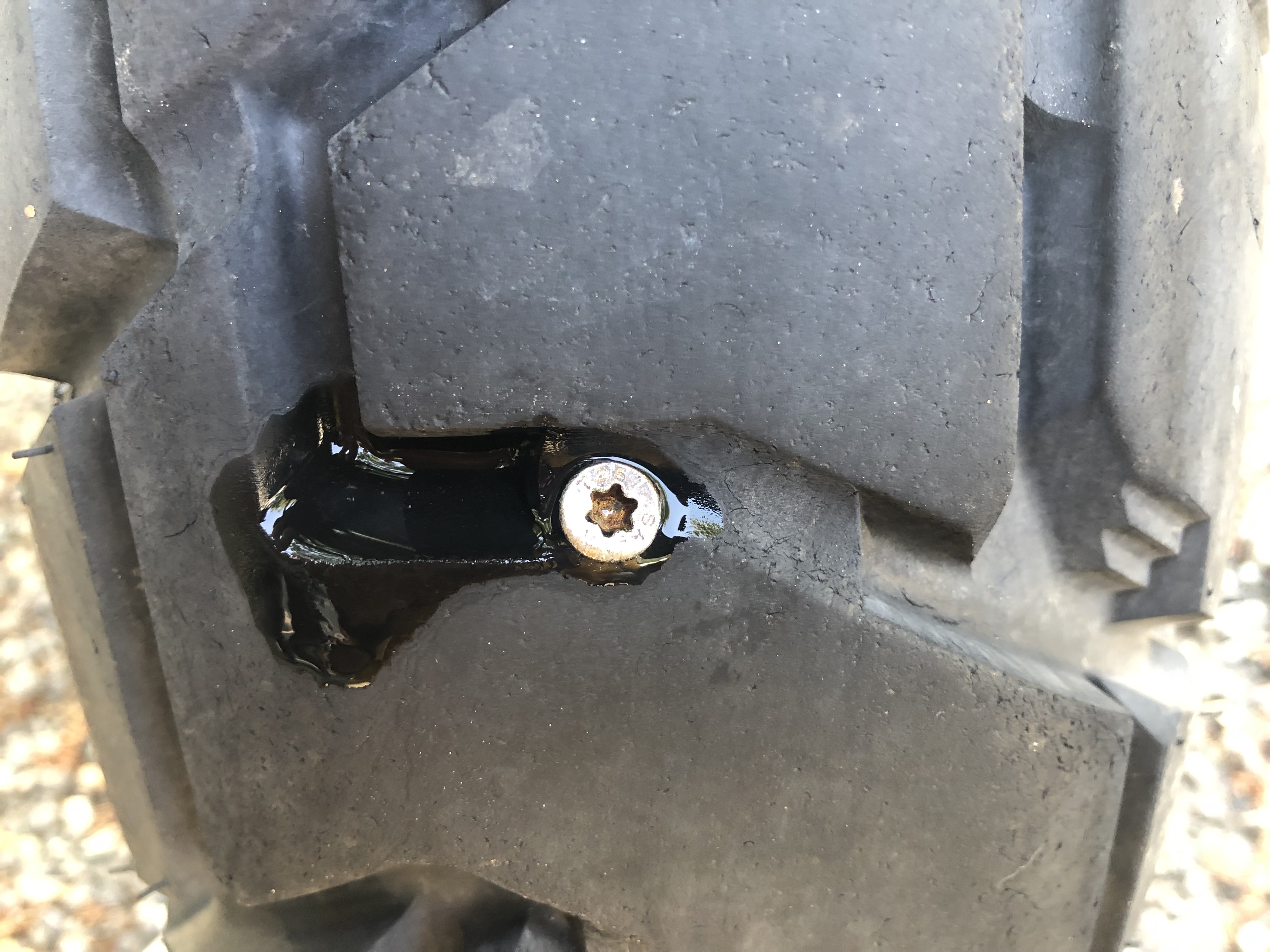
Still quite alert after a couple of beers, Jeff, while oiling the chains of both bikes, found a deck screw embedded squarely in the center of my rear tire (photo). A drop of water on the head of the screw confirmed that I had a slow leak. I’m lucky he found it, and lucky we were off the trail before I lost a lot of air. Thirty minutes later we had the screw removed, the hole plugged with the mushroom plug kit I carry, and had the tire pumped back to the required 35 psi. The patch held for another 3,000 miles. That’s the beauty of tubeless tires, they are easy to repair without removing the wheel or the tire if the hole is not too large.
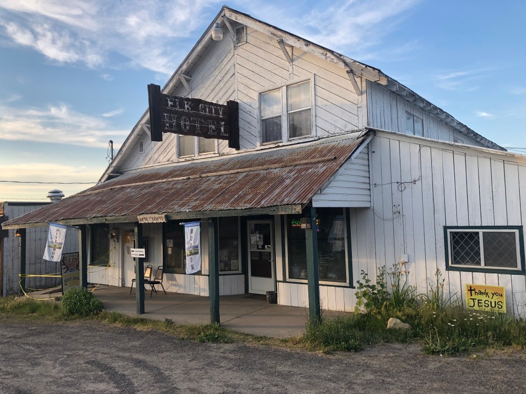
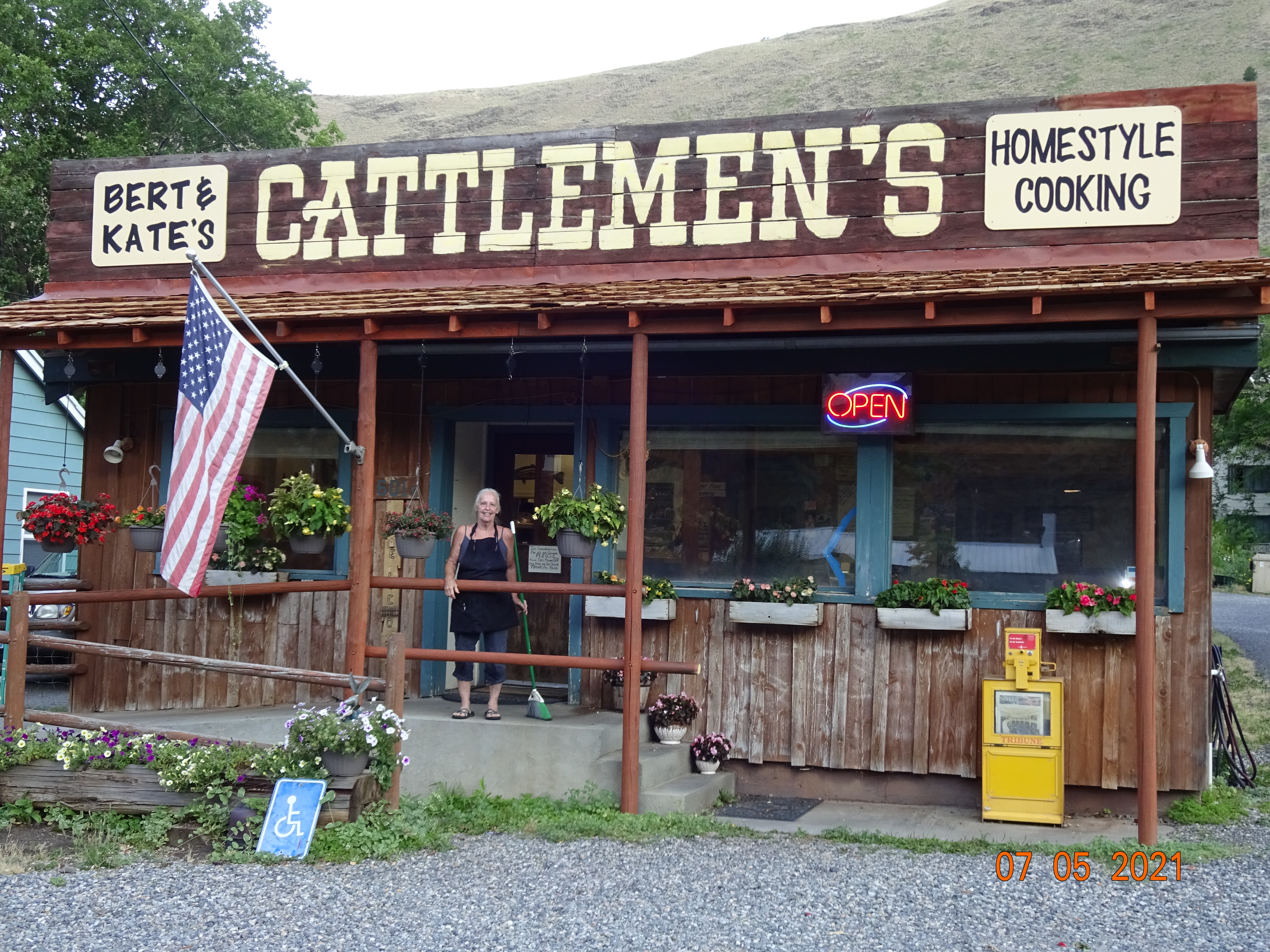
The Riggins detour was made even better with breakfast at Bert and Kate’s Cattleman’s a short walk down the street. Not only did Kate (photo), the proprietor, open at 5 AM, her stories, while she cooked and waited on us, were delightful. She was, in a good way, one of the most eccentric individuals we met along the trail. Born on a mountain above Riggins to musician parents, she is a pianist and graduate of Julliard School of Music in NYC, had a 30-year career as a flyfishing guide who worked around the globe with international clients, and was a bit of a rebel in town for continuing to serve truck drivers in her restaurant during the worst of Covid because they had nowhere else to go. Now she’s been a restaurant owner in her old hometown for the past 15 years, but still, at age 70, has big plans for more adventures. She served a great breakfast and kept us captivated with stories between the early hour of 5 to 6 AM.

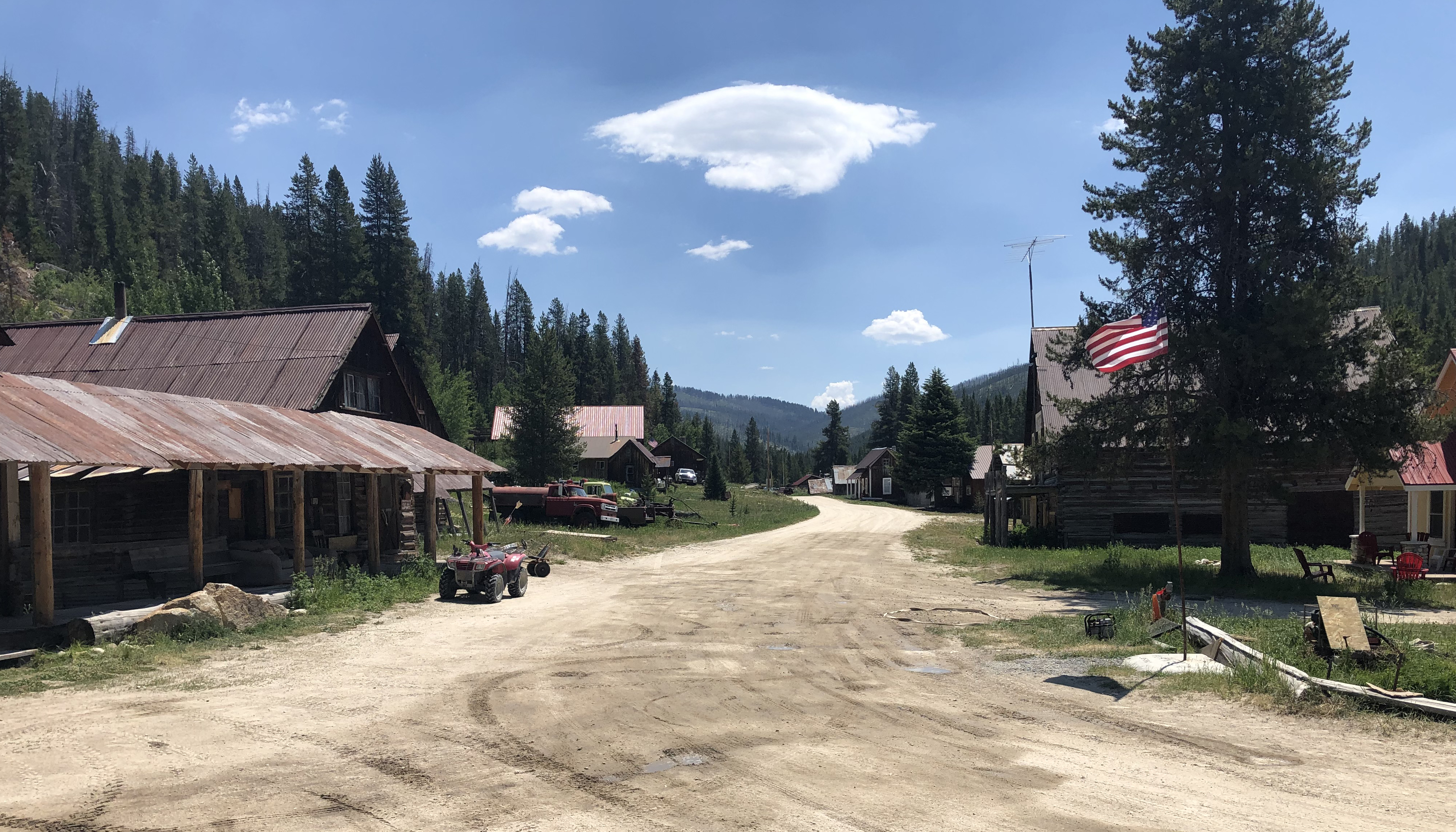
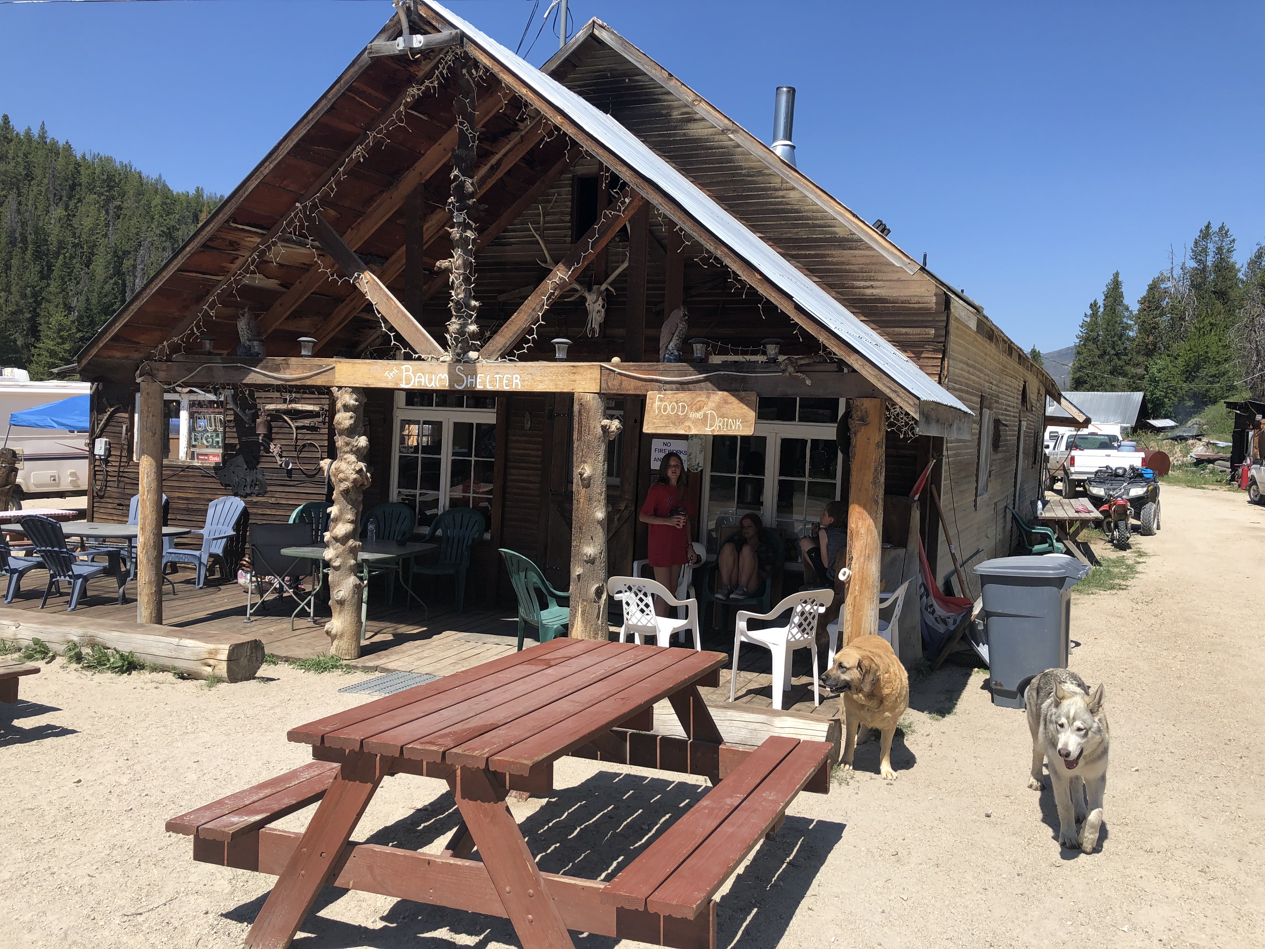
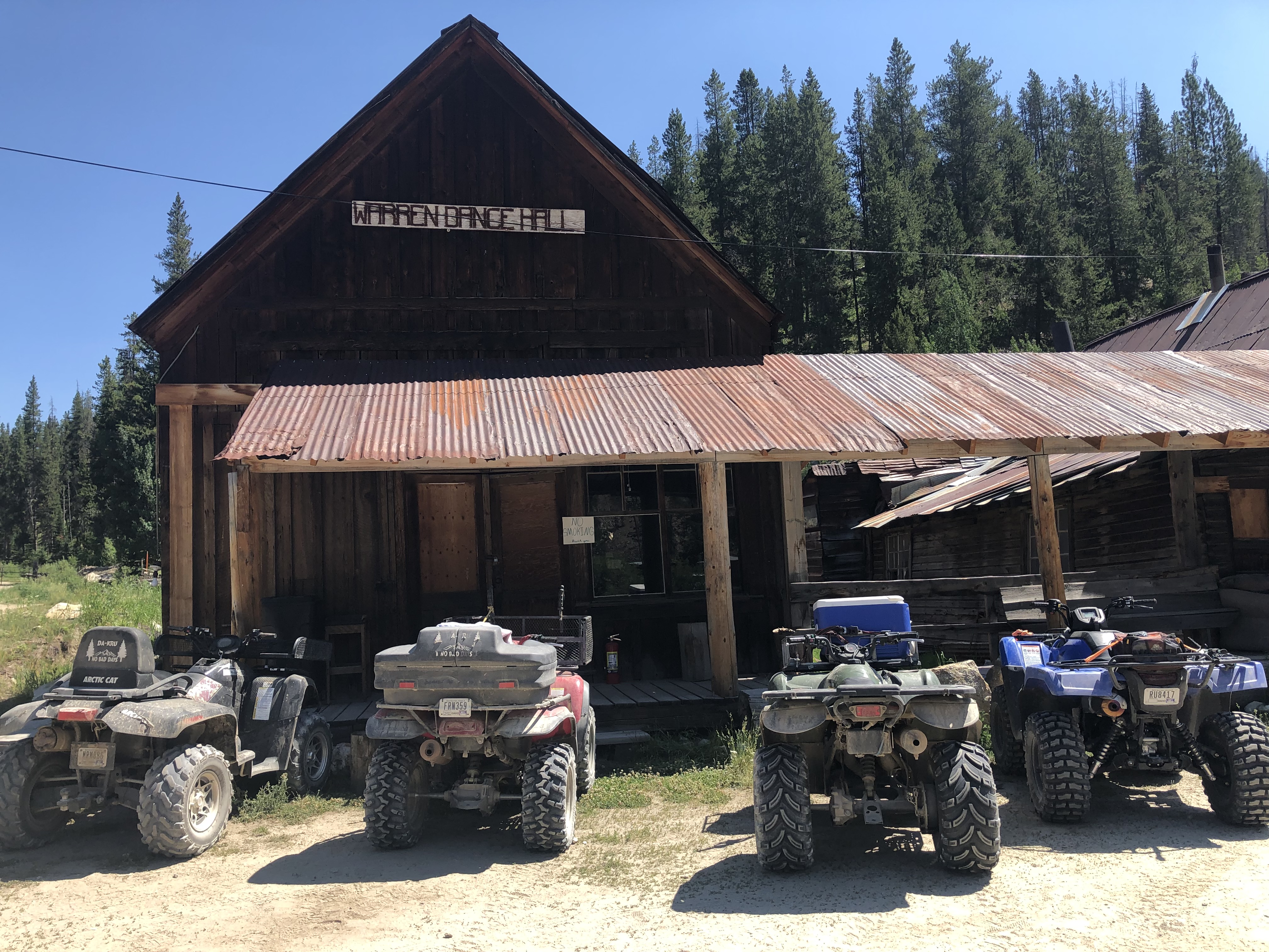
The village of Warren looked a bit like a ghost town, but there was gas available from an overhead tank if needed, dogs in the road, and a restaurant that was busy with local July 4th recreators. I had a nice Cobb Salad. The sign at the top of the building on the right (photo) says “Warren Dance Hall.” Those ATV riders were not dancing—just parked, hanging out, smokin’ an’ jokin’ in the 100-degree heat.
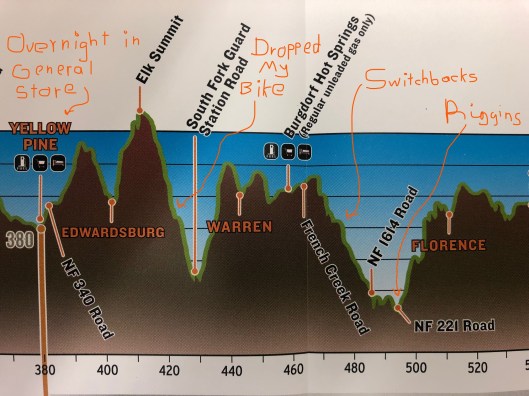
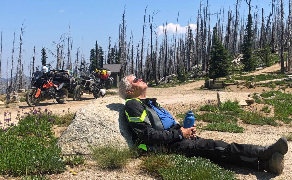
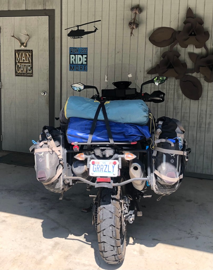
Oh Crap! I dropped my bike and caught my ankle between a rock and my 450-pound machine! Trying to motor up Elk Summit (photo) through ruts and rocks in second gear GRRZLY stalled (I should have been in first gear). One is seldom quick enough on the clutch when that happens: I was standing on my pegs, the engine stalled, the rear wheel locked up and I was flat on the ground in a fraction of a second. I’ve always gotten my leg out in the past; not this time. It was painful. Jeff lifted my bike. Was my ankle broken or just bruised?
The terrain profile map shows where I dropped it on the side of Elk Mountain, the tallest peak on the entire trail. The map showed a tributary of Elk Creek crossing the trail a half-mile uphill. I stood on my foot; not bad, maybe just bruised. We got on our bikes and motored uphill to the creek. I pulled off my boot and bathed my foot in the recent snowmelt. I think I got my boot off just in time; my foot was already badly swollen.
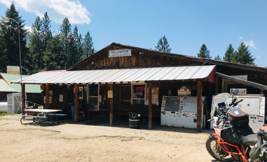
Eight hundred milligrams of ibuprofen along with my breakfast oatmeal and coffee got me on my feet and on my bike. We motored up and over Elk Summit without issue and rolled into Yellow Pine early afternoon. Josh, proprietor of Yellow Pine General Store gassed up our bikes and offered us a room in the back of the store. I iced my ankle then Jeff and I had a late lunch with David and William (photo), a father and son team heading north on the trail; we were headed south.
We swapped stories with David and William about what to expect on the trail given we were going in opposite directions. David, a young tough Marine had dropped his KTM 690 in two feet of moving water while attempting a stream crossing. But he was able to ride his father’s taller KTM 1090 through it without issue. William, the dad, said he didn’t have anything to prove. He seemed tired. They bought our lunch and motored north. Two hours later Josh told us that William had dropped his bike on a rocky switchback and broke his ankle. He was medivaced to Boise. KTMs seem to be hard on ankles.


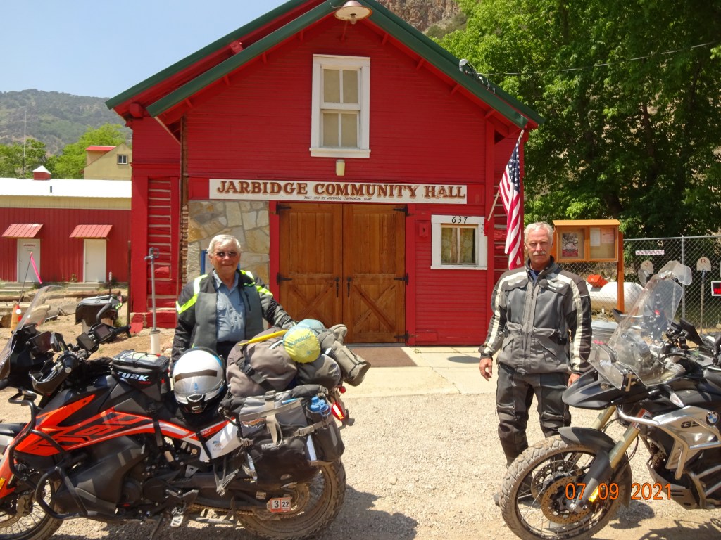
Dirty and tired at the end of day 12 we entered the old mining town of Jarbidge, Nevada, the end of the IDBDR. Except for working around some deadfall and a stream crossing with high water, we had completed the entire BDR route, an accomplishment that not many achieve.
Over a beer and dinner at the Jarbidge Outdoor Inn, we reflected on real-time messages we monitored on the IDBDR Facebook page. Most riders don’t have as much time as we had, therefore, they begin mid-trail and do only part of it. Some complete it over several attempts in multiple years. And others are simply shut out due to trail closures. The latter was the case for some who began after we did. As we rode south, wildfires erupted behind us shutting down large sections of the trail in the mountains. Some riders begin too early or too late and get shut down by snow or deadfall.
We enjoyed meeting James at the Outdoor Inn. He was an old guy (actually, at 72, several years younger than I, so not so old) riding a Suzuki DR650, a popular bike on the BDR. He had hauled his bike on his truck from Texas to the top of the BDR at the Canadian border, parked his truck, rode highways down to Jarbidge, and would meet his two sons here the next day to begin the trail north to Canada. His boys also rode DR650s. Several days later there was a post on the IDBDR Facebook page that a rider of a DR650, part of a father and son threesome, broke an ankle causing them to abort their trip. So, there’s that. Another factor limiting completion. It seems this trail is hard on ankles.
In any case, I think Jeff and I had the perfect window of opportunity. We were happy to have finished. Although at that point, we didn’t realize we had to ride another 100 miles of the Nevada BDR south of Jarbidge to get out of the canyon for our ride back east.
Jarbidge’s current claim to fame is its isolation: “The most isolated community in the lower 48 states” with 80 miles of dirt road in and 50 miles of dirt out the other end. We followed our BDR GPS track into the village. On the other hand, two groups we met that were beginning the route north both got lost trying to find their way into Jarbidge. There are no signs at critical trail junctions. The locals probably like it that way.
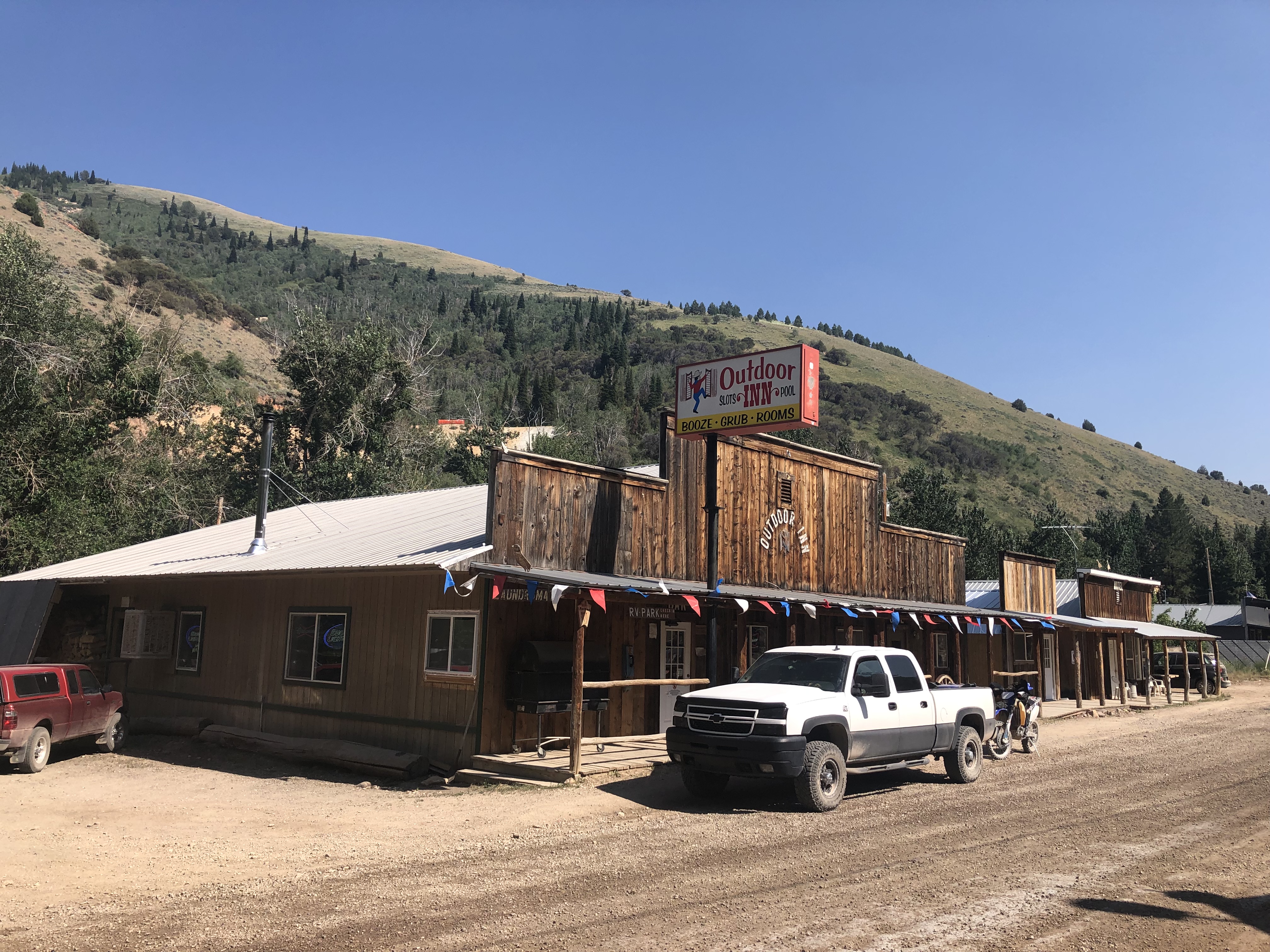
Jason is the proprietor of the Outdoor Inn (photo) where we stayed the night. He described Jarbidge and its surroundings: “It’s where the high desert meets the mountains and it’s at 6,200 feet, so we have cross-country skiing in the winter,” he said. “We had the last gold rush in the lower 48 states in 1909 and the last stagecoach robbery in 1916. About 27 people live here year-round, and we get mail delivered every Monday, Wednesday, and Friday.”

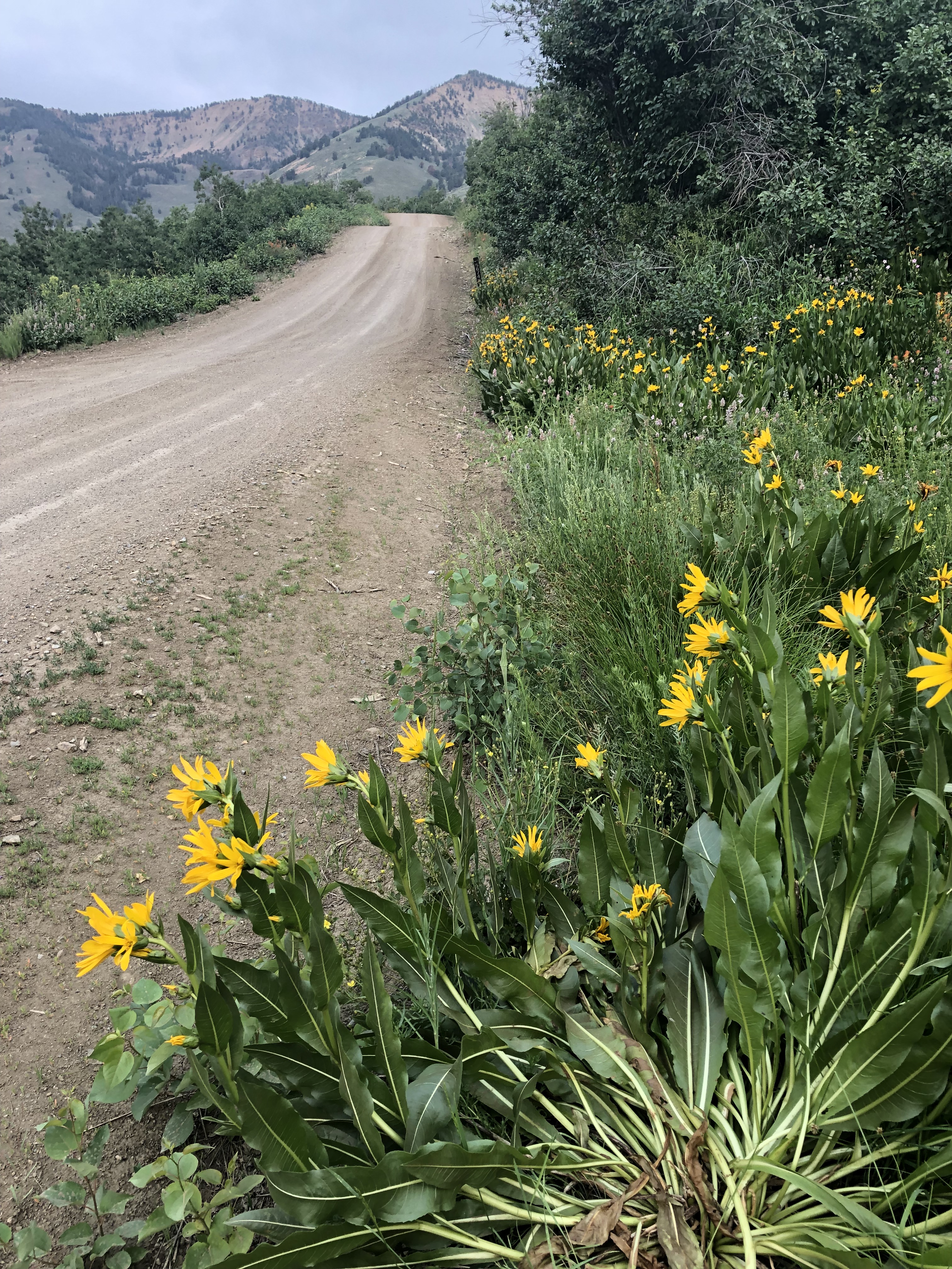
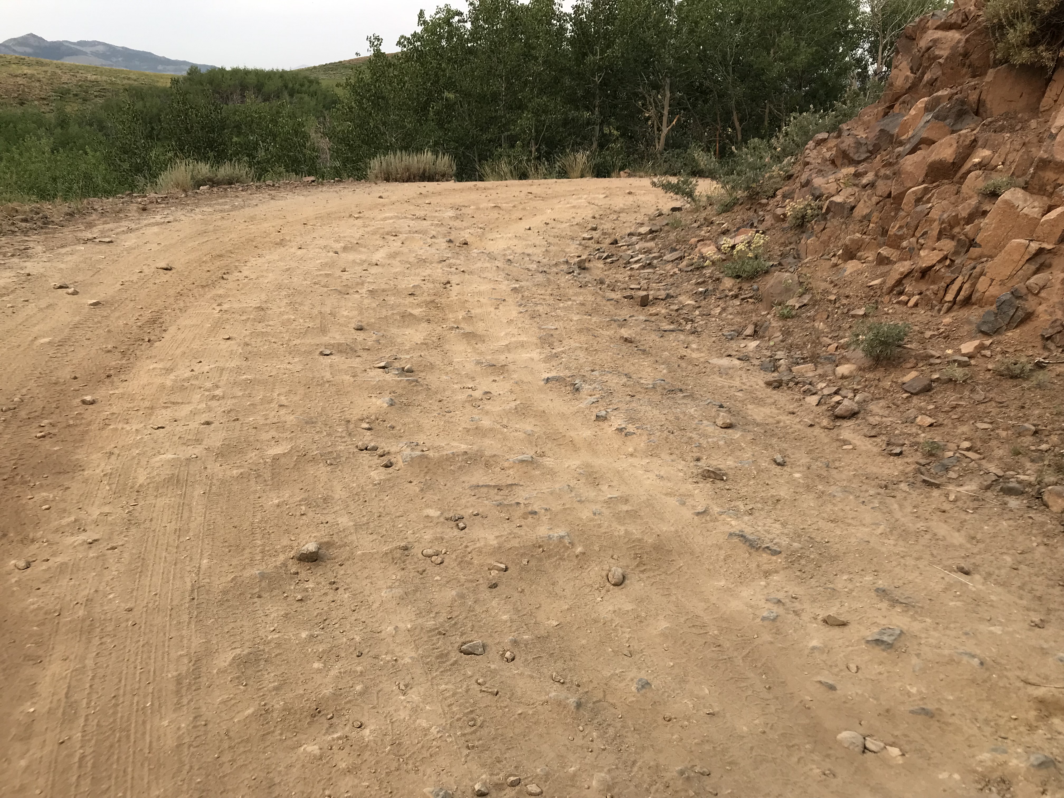
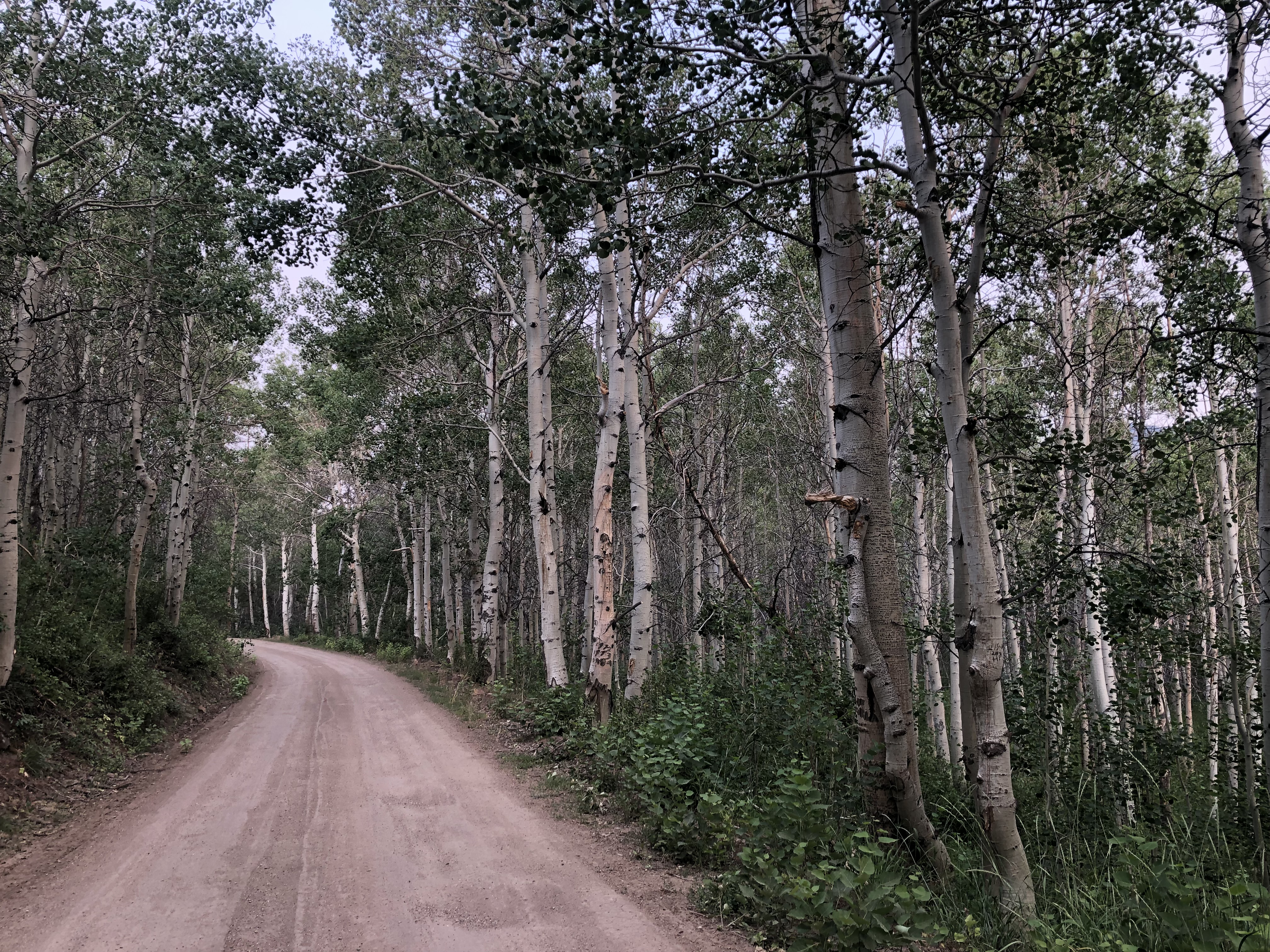
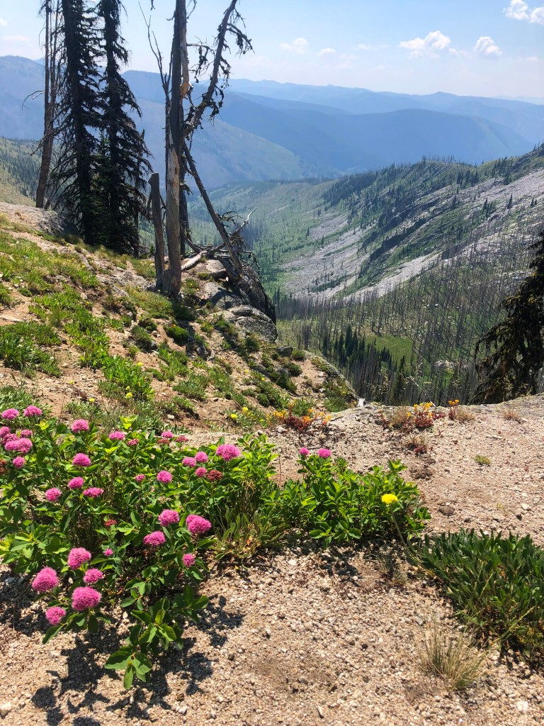
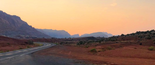
Departing south out of Jarbidge through the Humboldt-Toiyabe National Forest to Elko, Nevada, the route was actually the last 102 miles of the Nevada BDR that tracks through the state and ends in Jarbidge. The national parks have become very crowded, but there are a plethora of beautiful landscapes hidden within the borders of our seldom-visited, vast National Forests, including this one. Finding them often requires getting off paved roads. The vegetation on the Humboldt-Toiyabe National Forest varied from the wide-open desert with cactus and scrub through Ponderosa pine forests into spruce, aspen, and larch, then into lodgepole pine and krummholtz at high elevations. It’s a beautiful place.
“Traveling—it leaves you speechless, then turns you into a storyteller.”— Ibn Battuta
It was now 5 days since I dropped my bike on my ankle; the swelling never receded. We decided to forego a planned trip up Pike’s Peak and visits to some National Parks along the way back in the event my ankle issue was more than a bruise and needed medical attention. That was a good call.
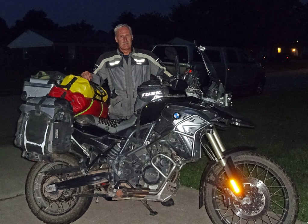
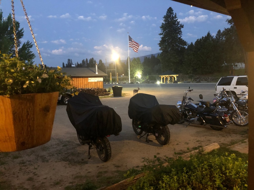
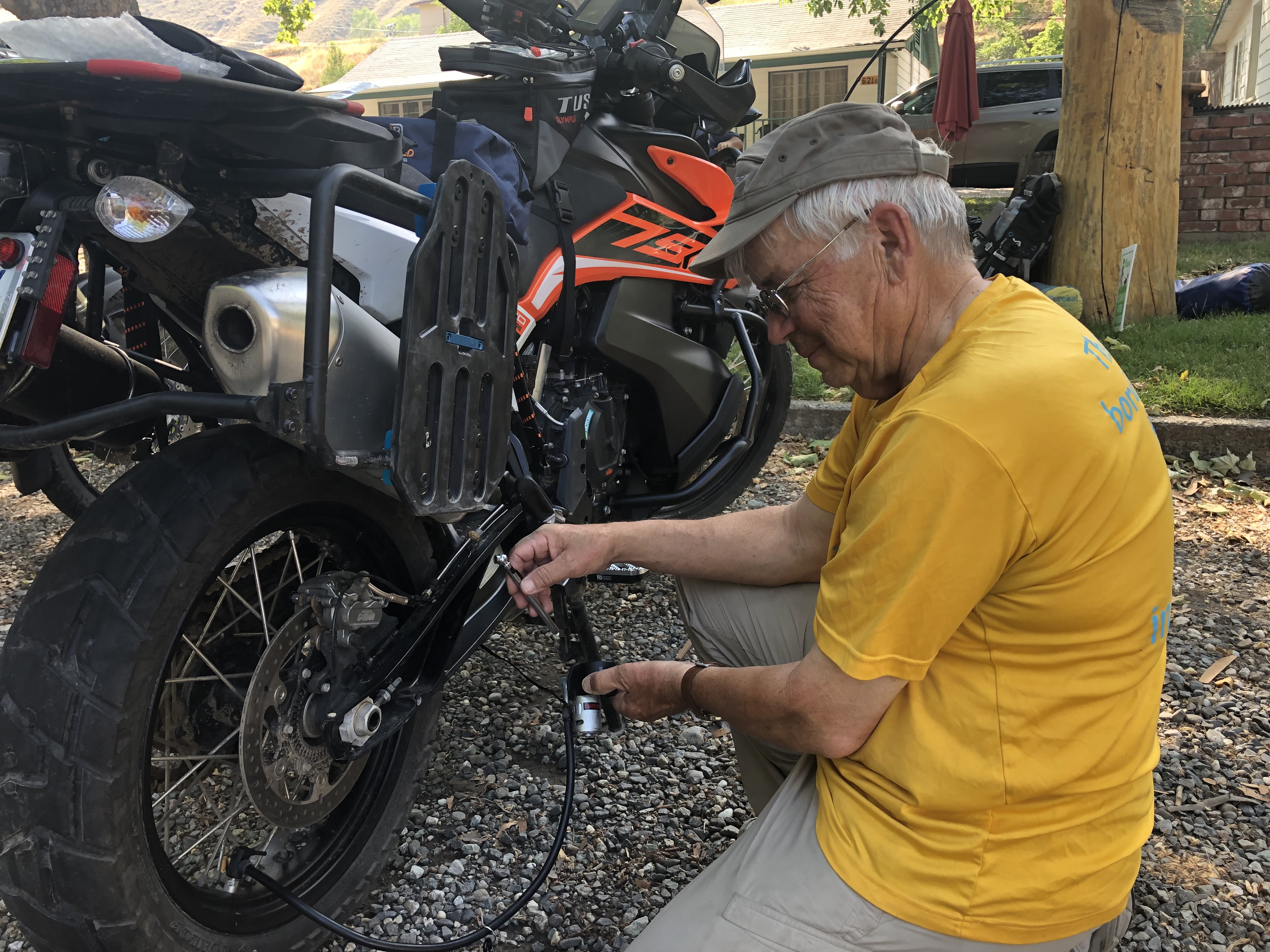
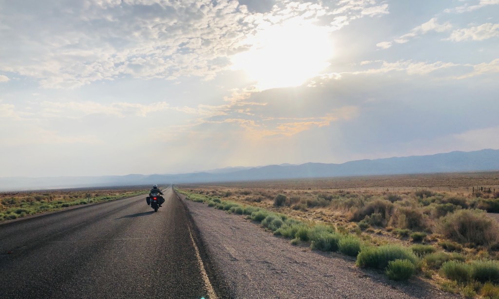
After 30 days, 1,200 miles of riding dirt and gravel, and a 7,082-mile round trip, it was time to put GRRZLY back in the barn for a while. Jeff and I went separate ways when we reached Beckley, WV. My last day’s ride was only 410 miles from southern IN to southwestern VA. Jeff rode 750 miles to his home in Virginia Beach arriving just after dark (photo).
Jeff is a Marine and a 31-year retired Navy Seal. He has multiple “Iron Butt” riding awards so this 15-hour, 750-mile jaunt home was a “walk in the park.” A long-standing long-distance riding adage is “choose your riding companions carefully.” Jeff is an excellent rider, loves long-distant riding adventures, and has a calm, mindful, and kind personality—an all-around great riding companion. And he lifted my bike off my broken ankle when I dropped it. Thanks, Jeff.
Yeah, it was broken. I rode 5 days on the BDR and 5 days back across the country on a broken ankle. It required a metal plate and nine screws. Give me five weeks; GRRZLY will be getting restless by then.
“Adventure may hurt you but monotony will kill you.”—Marcus Purvis
For other motorcycling travel adventures, go HERE.

Yet another great story about what had to be a great ride. So next time you should take a portable x-ray machine along!
LikeLike
Thanks Jim for a great story filling in your on-the-trail notes from the trip. Awesome!!! Best wishes for good healing of your ankle.
LikeLike
Thanks for your wonderful travelog! You are a gifted “story teller”. Best wishes for a quick recovery.
LikeLike
Wow jim! What an adventure, and the last bit with a broken ankle! You are one tough grizzy! Thanks for taking us along on your trip!
LikeLike
Enjoyed riding along with you guys through this story! Other than the busted ankle, sounds like it was a great time! Thanks for sharing.
LikeLike
Great narrative Jim. I get wanderlust when I read stories like yours. Enough detail for me to feel well informed and excited and not too much minor info to detract from the adventure. jca
LikeLike
Fantastic description throughout, great pictures.
I often identified with the “cold beer”.
Glad you are safely home and healing.
Looking forward to hearing more in person.
LikeLike
Great story and pictures, Jim. I am still amazed that you were able to tough out the ride home. I hope that you heal soon and are back on the road, whether paved or otherwise!
Keith
LikeLike