
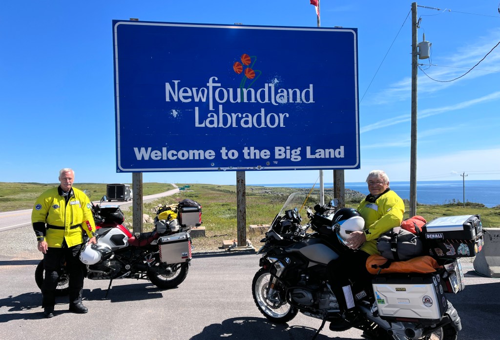
They were upon us, attacking from every direction. The critters took us by surprise. We shouldn’t have been surprised–we were warned. It wasn’t until we crossed the Bay of Belle Isle, rolled off the ferry into Labrador, and removed our helmets that we were introduced to the provincial bird of Labrador: The black fly.
Several hours prior, we were at the ferry terminal at Saint Barbe on the northwest shore of Newfoundland waiting to cross the bay to Labrador. Black flies were way down on the list of things I was thinking about because, heretofore, we had not had an issue with them or mosquitos for that matter. Instead, foremost on my mind was the journey on which we were about to embark–The Trans-Labrador Highway.

The Trans-Lab is one of Canada’s most northerly, isolated roads, which is why a specific type of traveler is attracted to it. Originally developed as a primitive road used by the iron-mining and hydroelectric industries, it began to attract tourists for the experience of driving through one of the last frontiers in North America. Because of its remoteness, the distance between habitation and the lack of emergency services, the Central Labrador Economic Development Board was compelled to publish a User Guide for traversing the Trans-Lab. In the guide are blunt warnings:
“Assume that, outside a couple of villages along the way, you have access to nothing–no fuel, no services, no communications–nothing! Have a mechanic inspect your vehicle and complete any repairs before departure. Always leave each town with a full tank of fuel, a spare can, and enough supplies to deal with a very long wait if stranded. Bring a full-sized spare tyre and tools. Parts of the road are rough gravel and dirt, notorious for routinely damaging tyres. Even when the road is paved, the nearest settlement will be hundreds of kilometers away in most cases. You are on your own; there is no cell service, no 911.”

Now, given that warning, how can one resist a go at it? The warning sounded more like an invitation. I’m surprised the Board didn’t include the quote by Bilbo Baggins warning Frodo:
“It’s a dangerous business, Frodo, going out your door. You step onto the road, and if you don’t keep your feet, there’s no knowing where you might be swept off to.”
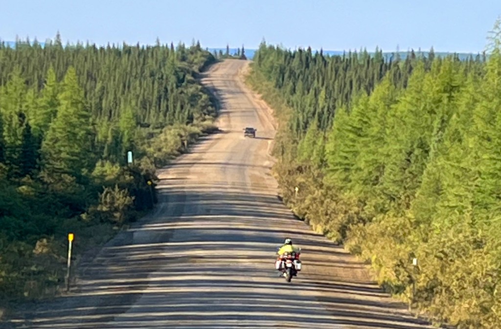
Furthermore, the User Guide was a few years old. Since it was published, most of the Trans-Lab had been paved. However, that was not the case once across the border in Quebec on Route 389, which was still a dirt road from Labrador City to Manic Five. If the road was wet, it could be treacherous. In any case, I felt ready. Jeff and I carried our tent and enough food and water for several days if we got stranded. And I had an extra gallon of gas strapped to my bike for the one long stretch that I thought was out of reach of my 5.3-gallon tank.
While waiting for the ferry, to distract me from thinking about wet, slick, dirt roads, I walked across the lot and struck up a conversation with a local gentleman, Patrick, who rode up on a barely-running ATV. I was curious why he pulled up just before the ferry would arrive; he didn’t look prepared to board it. “No, my job is to tie the ferry to the dock, he said. “I ride up here several times a day on the ferry schedule just to tie her up–only takes a few minutes, but the pay is good. Much better than trying to make a living fishing in these times,” he offered.

It seemed all the older men I met were fishermen at one time, and it was not a very good line of work lately. He went on to tell me how there was more to tying the ferry to the dock than may appear to the uninitiated. He was sharing the details when one of his old fishing buddies came up to get advice on how to repair a bent propeller shaft. I left them deep in the mechanics of pulling bearings and noticed that the ferry was approaching. Patrick would need to help remove shaft bearings another time; it was time to tie down the ferry.


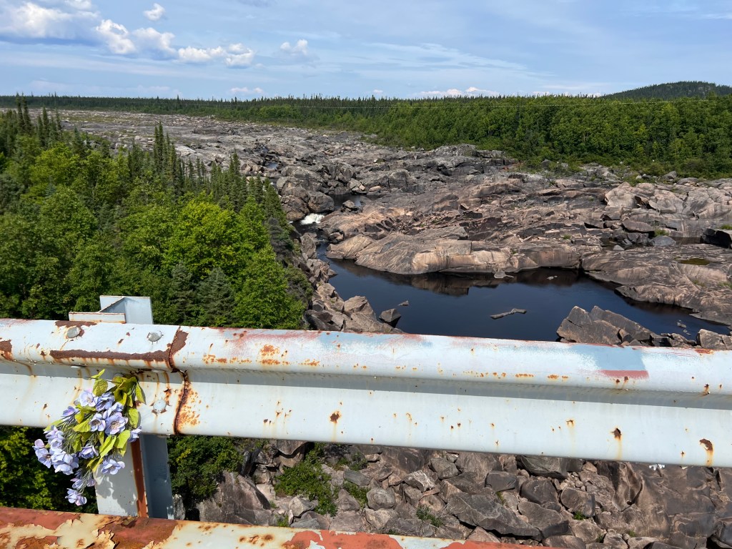
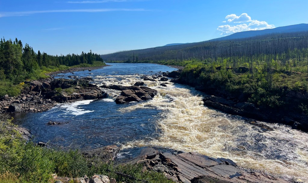
Labrador constitutes 71% of the province’s area but is home to only 6% of the province’s population, with the remaining 94% on the island of Newfoundland. Labrador is located on the Great Canadian Shield, a vast granite landscape with thin soils formed since the retreat of continental glacial ice little more than 10,000 years ago. Its southern half is classified as subarctic and is covered with boreal forest dominated by black spruce. The land is also dotted by fresh-water lakes, impoundments of water filling depressions left by the scouring of glacial ice.

Riding hour after hour was perpetual motion through forest, rocks, water, and nothing else. We saw very little wildlife, despite the roadside warnings of the danger of moose. However, anytime we stopped, we were surrounded by a swarm of black flies. Jeff stopped removing his helmet; he was sure he attracted flies more than I. By the way, Labrador’s actual provincial bird is the Atlantic puffin, not the black fly. Had the fly been a bird, it would have been granted that honor by default due to its place in the provincial conversation.


Labrador has a rich whaling history. Red Bay on the Atlantic coast was established by Basque mariners in the 16th century and became a major whaling port. The Basques rendered whale oil that lit the lamps of Europe. Archaeological research in the harbor led to the discovery of three Basque galleons and several small boats, superbly preserved examples of 16th-century shipbuilding. This history is interpreted at the Red Bay National Historic Site, also designated a UNESCO World Heritage Site due to its precious underwater archaeological discoveries. We visited the museum and enjoyed Basque whaling history on our way to Port Hope-Simpson, where we stayed the night.
Port Hope Simpson is where I filled my spare tank for the long haul to Happy Valley-Goose Bay the next day. On the way, at a roadside pull-off, we met a fellow riding a CanAm who had run out of gas on that long stretch of road. He had enough foresight to borrow a satellite phone from Labrador authorities but not enough to know the range of his machine and the distance between gas services. He was rescued by another local CanAm rider. Over time I have determined the range of my motorcycle to be 240 plus or minus 20 miles depending on speed and headwind. The ride tomorrow would be 260 miles.
After reaching the gas pumps at Port Hope-Simpson, I took extra time to squeeze in as much gas as possible into my tank. After refueling, Jeff conversed with a solo rider whose 2006 BMW was loaded on a trailer next to the gas pumps. On that long stretch of road coming east from Goose Bay, he blew out his drive train, which shut him down. Another BMW rider happened by and towed him 40 miles toward Port Hope-Simpson before a local guy in a pickup with an empty utility trailer, by chance, came upon them and offered to haul the broken bike to town. He was twice lucky to have had the help, but being from Ontario, he still had the issue of what to do next; he was still a long way from home.
“How many more miles to Goose Bay, Jeff,” I asked via my helmet intercom. I had a pretty good idea, actually a very good idea, because I was watching my GPS and my remaining miles shown on my instrument panel. “Looks like about 5 miles,” Jeff replied. I was showing I had 10 miles left; it looked like I would squeeze into Goose Bay without needing the extra gallon of gas I had strapped on the back. Except for once in Alaska, that would be the longest distance I had ever ridden on a tank of gas–260 miles. What made it possible was the less-than-60mph leisurely pace we maintained, allowing me 50 miles/gallon.

Happy Valley-Goose Bay is a town in the central part of Labrador on the shore of the Churchhill River. It is the largest population center, with an estimated 8,000 souls. Built on a large sandy plateau in 1941, the town is home to the largest military air base in northeastern North America, with one of the longest runways in the world at 11,048 feet. We rode on base and visited the Labrador Military Museum, which profiles the story of 5 Wing Goose Bay and the military history of Labrador. During the Cold War, Americans from the Strategic Air Command called Goose Bay their home.

The Churchill River itself is a sight to see. We crossed it on the way into town just upstream from where it flows into Lake Melville. The river is one of the largest in all of Canada as it meanders more than 200 miles to Churchill Falls. There, its course is broken by one of the greatest hydroelectric-power sources in Canada. Below the power station, it flows another 250 miles to its mouth on Lake Melville, draining a basin of about 28,000 square miles. The river is an attraction because the giant Churchill Falls Power Project drains the river and diverts it underground through the project’s massive turbines to generate power for the province and much of neighboring Quebec.

In lakes west of the generating station, water reservoirs have been created using a series of 88 dikes or dams. The reservoirs were named Smallwood and West and East Forebay. Water is carried through 11 intake gates and penstocks leading to underground turbines rated at 5,500 megawatts. One of the largest powerhouses in the world, the facility annually generates over 34 terawatt hours of energy, roughly one percent of the world’s hydroelectric power.


The small population of Labrador is mainly employed by the iron ore, hydroelectric, pulp and paper, and their supporting industries. Labrador City is a town near the Quebec border built around the rich iron ore deposits of the Labrador Trough by the Iron Ore Company of Canada. We gassed up and stayed overnight in one of two available hotels. There wasn’t much to do or see in this mining town; we opted out of its main attraction, an indoor mall, housing the only Walmart and McDonalds in Labrador. Nonetheless, Labrador City is important given its rich history as a significant producer of iron ore for the world.

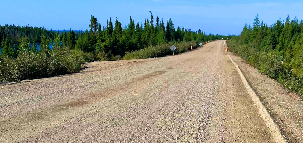
Just west of the town was the Quebec border and the point where the pavement ended, and hard-packed dirt began. Packed dirt roads with little or no gravel on the surface can be slick when wet; even knobby tires find little purchase. It had rained here a few days before, but now the road was in that magic single-day condition of dry but not dusty. Well, perhaps one day past the magic point because some dust turned our riding jackets from bright yellow to pale yellow. In any case, the ride on dirt/gravel from Labrador City to Manic-Cinq was easy and fun.
Our motorcycles, Jeff’s 2017 BMW R1200GSA and my 2018 BMW R1200GS, are perfect for this kind of trip. They are fast, stable, and comfortable on the highway, and their deep suspension, long-range, and up-right seating position are good for the long-haul under a wide range of conditions. They also allow standing on the pegs when the going gets rough. Like modern automobiles, they have a sophisticated computer managing ABS braking, fuel metering, tire pressure, traction control, and suspension requirements. It still requires some skill to manage a big bike under various conditions, but you all could do it–you might want to try it (or maybe not).

I knew about the impact crater, the “eye of Quebec,” but nothing about the Daniel Johnson Dam that, in essence, created the eye. Riding south on Route 389, the dirt road from Labrador City to Manic-Cinq, parts of the vast Manicouagan Reservoir came into view. It is an annular (ring-shaped) lake, 80 miles across, in central Quebec, covering an area of 750 square miles. With a mean depth of 280 feet, it contains the 6th greatest volume of fresh water in the world. The circular shape of the lake was created 214 million years ago by the impact of an asteroid three miles in diameter. From Route 389, I could see part of the lake to the west. I took a Google maps screenshot of my position to appreciate exactly where I was relative to its enormous size.
The Daniel Johnson Dam at Manic-Cinq is the highest multiple-arch-and-buttress dam in the world. It has a unique design and is a true monument to Quebec engineering. When completed in 1974, water backing up behind the dam merged two crescent-shaped lakes and ultimately formed a circular reservoir in the impact ring left by the asteroid. We were told that the asteroid strike was only discovered as the reservoir filled and completed the 80-mile diameter circle.


The dam comprises 14 buttresses and 13 arches, is 702 feet tall, 4,311 feet long, and contains 2,900,000 cubic yards of concrete, making it the largest dam of its type in the world. Pressure from the water behind the dam is transferred from its arches to its buttresses and lastly into the ground at its foundation. The buttress/arch design required only one-fifth the amount of concrete as a conventional dam and only one-fifteenth the amount of material as an earthen dam. We were the only two English speakers in a tour group of 25 French speakers, but with translation headphones, we learned a lot about the dam, its reservoir, construction, and dedication to the person who started the project, Daniel Johnson, the 20th Premier of Quebec.
The last leg of the Quebec side of the Trans-Lab from Manic-Cinq to Baie Comeau on the St Lawrence River was a beautiful scenic ride through mountainous, forested terrain dotted with crystal-clear lakes and streams. The road was curvy, paved, and had a smooth asphalt surface. The road along the St. Lawrence River toward Quebec City required one more ferry ride across the Rivie’re Saguenay to LaMalbaie, where we stayed the night.

Quebec City is a beautiful place; my wife and I visited it several years ago. We decided to pass it by and spend a slow day traversing upstate Vermont on the way home. Route 100, running the length of Vermont, is a scenic path through many quaint villages, including Waterbury, home of Ben and Jerry’s ice cream. We were disappointed; we stopped to take a factory tour, but it was closed on Monday (and Sunday).

The last leg of our trip was a fast ride to where we began. We arrived at Granny’s in Winchester, Virginia, at 9:00 AM, hungry for the same breakfast we had 24 days ago at the start of our trip. Our waitress remembered us. Maybe it was the motorcycles, our yellow jackets, or probably our good looks. In any case, GG (she told us she would need to kill us if we knew what the initials stood for) served us a nice breakfast to sustain us for our final miles home. From Granny’s, Jeff rode southeast toward the Virginia coast; I rode southwest toward the Virginia mountains. It was a fantastic trip.

For the first in this Eastern Canada Adventure series, Nova Scotia, go HERE.
For the second in this Eastern Canada Adventure series, Newfoundland, go HERE.
For other motorcycling travel stories, go HERE.

Thanks, Jim for sharing your experience with us!
LikeLike
What a pleasure to read of your experiences on the road in Labrador and Quebec, makes it sound so pleasant that I want to travel there. Thanks
LikeLike
Another Adventure in the books, you have a way of crafting the Adventure into a great story.
LikeLike