
“These potholes and washboards are killing me,” I said to Don via intercom with a bit of desperation in my voice. “There is no way to miss them; I can’t seem to get over 20 mph.” “I’m having the same problem,” Don replied. “Pull over when you can; let’s change our suspension settings and see if that helps.”
We had pulled into Fairbanks from Dawson City the day before under a sweltering 91 degrees F heatwave, a record for Alaska. It was hot in River’s Edge Campground in Fairbanks, but only in the mid-50s 500 miles north in Deadhorse at Prudhoe Bay. The forecast promised sunshine and more cool temperatures. We prepared our bikes, packed our tents and sleeping bags, and strapped on an extra gallon of gas.
Despite the never-ending daylight, we went to bed early for a good night’s rest before the trip. Thirty seconds after hitting their pillows, I heard heavy breathing from both Don and Richard, both already sound asleep. To fall asleep so quickly, these were men truly at peace with themselves (or maybe just dead tired). I laid awake for a long time. Was I ready for the Dalton Highway, 1,000 miles of mostly dirt/gravel road that led to the Arctic Ocean at the top of Alaska? I had watched too many videos; now they were keeping me awake. However, if those gals could do it, I figured I could as well: HERE and HERE.
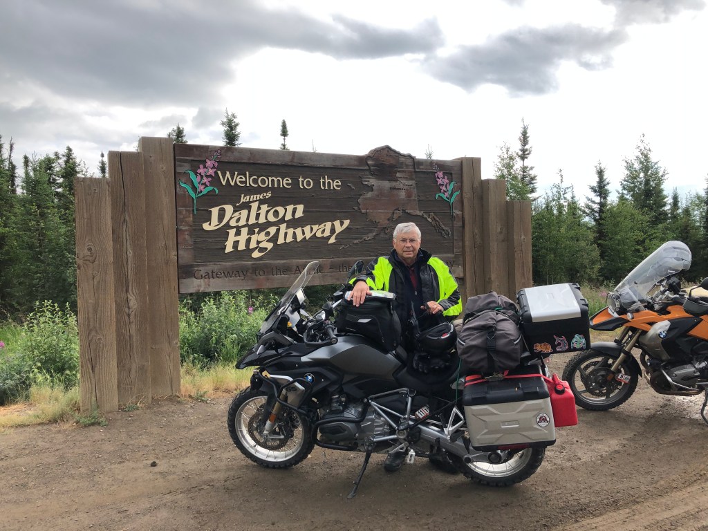
If you’ve seen the TV show Ice Road Truckers, then you’re familiar with the Dalton Highway that runs to the oil fields on Prudhoe Bay through some of Alaska’s most remote wilderness (Go HERE for a great read about the Dalton). Built in 1974 to facilitate construction of the Alaska Pipeline, it is mostly used by truckers supplying oilfield workers in Deadhorse. We were warned that the road was steep and slick in places and muddy in others, with trucks often flinging rocks and gravel on your vehicle. We had mounted shields on our lights and radiators and skidplates under our engines. We planned two trip legs: Day One, 270 miles to Coldfoot, the only service stop on the way, and Day Two, 240 miles from Coldfoot to Deadhorse, our destination.

“OK, boys, this is as far as I go,” said Richard. We had arrived at the Arctic Circle, about halfway to Coldfoot. Richard had decided to forego the trip all the way to Deadhorse; he would hold down the camp in Fairbanks and explore the city and surrounds. The Arctic Circle is the southernmost latitude in the Northern Hemisphere at which the center of the sun can remain continuously above (summer) or below (winter) the horizon for twenty-four hours. Although broken, heaved, and full of potholes, parts of the Dalton Highway to the Circle are paved. Tour companies offer day trips from Fairbanks to the Arctic Circle in vans, one of which was having its flat tire changed in the parking lot adjacent to the Circle rest stop. But that’s as far as they go. After obligatory photos by the Arctic Circle sign, the tourists load back into the vans and return to Fairbanks. After our own photo at this famous landmark, we bid Richard goodbye and Don and I motored north.

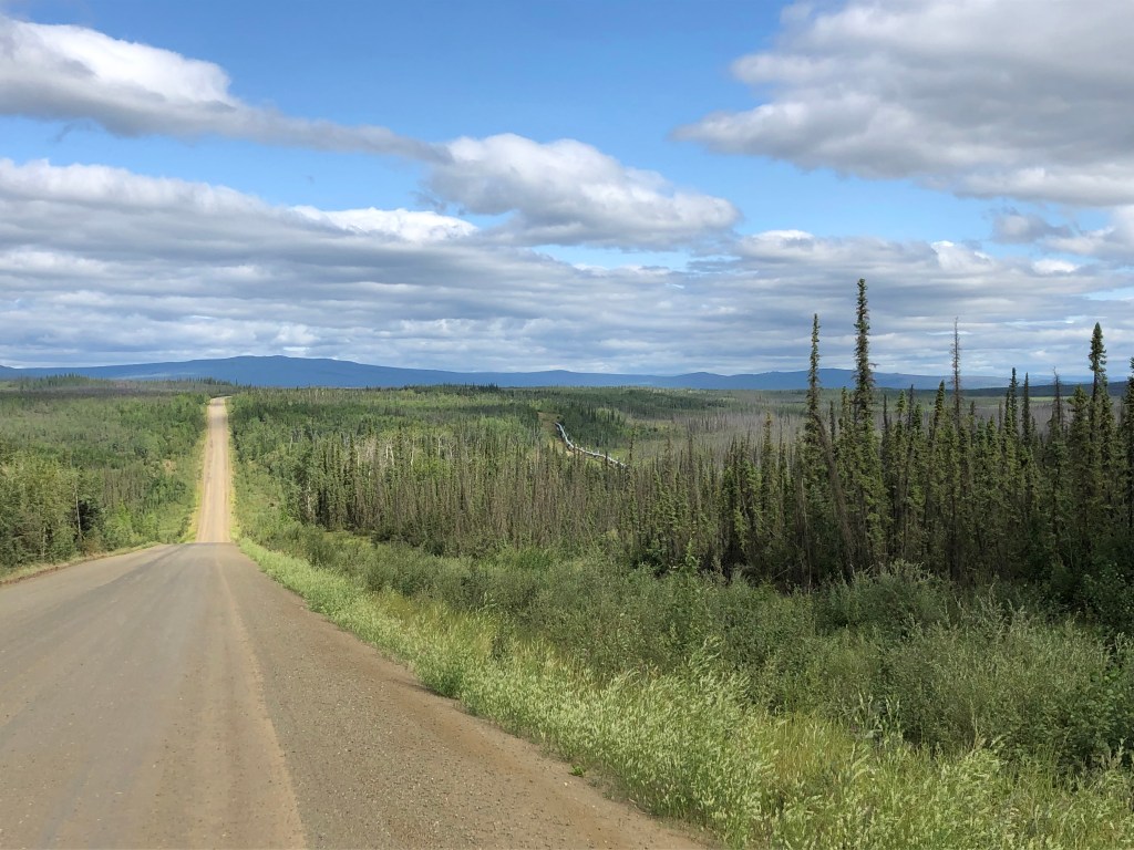
North of the Arctic Circle the road seemed almost deserted. On this first day, we saw only one or two trucks per hour going in either direction and as many private vehicles. We wouldn’t be so fortunate on the return trip, but for now, the road was dry, the dust not bad, and it was all sunshine and blue sky. It was a glorious day on the Dalton—except for the washboards, large rocks protruding from the road surface, and the potholes.


Just like your modern automobile, motorcycles have computers that control fuel injection, ABS braking, traction control, suspension settings, among other things. Neither Don nor I had really done a lot of continuous off-road riding in the past, but this road forced us to become intimately familiar with our computer-controlled suspension systems. I had four settings to choose from. I put it in Enduro Pro, for the roughest possible roads. Don chose the equivalent for his bike. It was magic! The pounding vibration in our handlebars was cut in half and we were able to double our speed. We were happy about this new-found ride but were chagrined and embarrassed that it took us so long to discover the suspension capabilities of our machines.

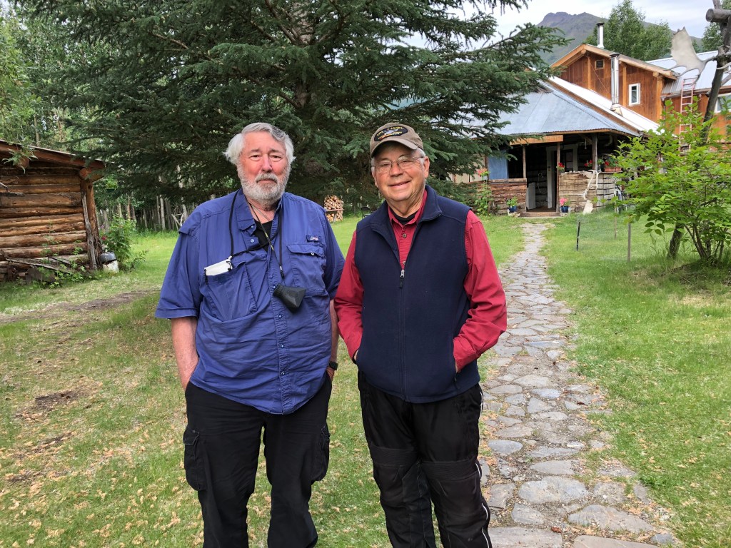
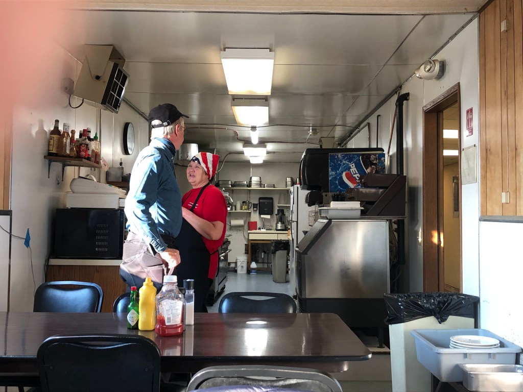
After refueling at Coldfoot, the halfway point, we decided to travel another eleven miles north to the old mining village of Wiseman to stay the night. Wiseman lies along the Middle Fork Koyukuk River in the Brooks Range. Established in 1908, it was once a bustling community after gold was discovered in the nearby creek. Today it has a population of 14, but evidence of its rich history isn’t hard to find.
Don and I were able to find a room at the Arctic Getaway, a combination hunting lodge B&B. Breakfast the next morning was good and relaxing—too relaxing, and too late, because it began at 8 am and I was anxious to get on the road to Deadhorse. With several hours to kill, we took a walk around the mostly abandoned village.

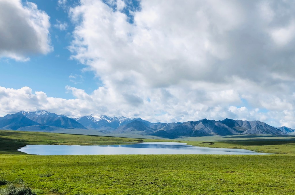
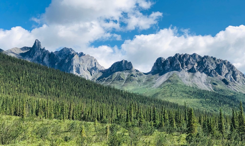
The Brooks Range is a mountain range stretching 700 miles from west to east across northern Alaska into Yukon Territory. It is the northern extent of the tree line with little woody tree vegetation to its north. It is a remote wilderness area, home to Dall sheep, grizzly bears, black bear, gray wolf, moose, caribou, and musk oxen. The Dalton Highway crosses the Brooks Range at Atigun Pass, elevation 4,739 feet, the only pass in the Range crossed by a road.


About ten miles from Deadhorse and eight, long hours into our ride, I spied the big water truck and road grader about a mile in front of us. “Hey Don, it looks like it’s going to get tricky again,” I said. “Yeah, I see those big fellas at work,” Don replied. These guys worked in teams on a continuous basis to maintain the road. The grader would chisel open the potholed, packed road, the water truck would wet it down to a sloppy, four-inch-thick loose mess, and the grader would then grade, redistribute, and repack the surface.
The right side of the road was a gooey puddle, so we followed the grader tracks on the left—until he stopped for some unknown reason. The only way forward was to plow through the 18-inch mound spilling off his blade in the middle of the road and go around him in the “slop.” Plowing through the mound was easy, but when I tried to straighten out in the slop I fishtailed badly and for a split second knew I was going down into the mud. Somehow I instinctively did the right thing and powered on the throttle and straightened up with speed. Don followed in my track with more finesse and we rolled into Deadhorse without further incident. That was one of several times we congratulated ourselves on our wise choice of knobby tires.

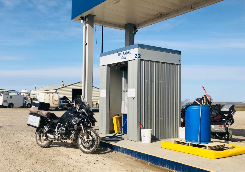
Deadhorse is a work camp established to support oil development in the surrounding Prudhoe Bay area. Buildings are pre-fab types situated on gravel pads on tundra bog. All the businesses are engaged in oil field support except for a tour enterprise called the Arctic Ocean Shuttle. There is no direct access to the Arctic Ocean which is about 5 miles further north from Deadhorse. The following rainy morning, with reservations made before we left Fairbanks, we took the shuttle with Michael, a security guard for the oil fields. This was not a tour of the oilfields per se, but on the way to the Arctic Ocean, we learned a lot from Michael as he rattled on and on based on his long experience working for various oil enterprises.

After arrival at the ocean shore, some hardy souls stripped down to their swim gear or underwear and took a traditional polar bear plunge. Wading calf-deep was good enough for me to claim I was “in” the Arctic Ocean and “felt its chill.”

The tour lasted most of the morning, and given the steady drizzle, we decided to cough up another $210 and stay another night. Even though it would remain daylight enough to ride eight hours to Coldfoot into the wee hours of the next AM, the thought of riding in the rain on a wet, muddy, slick road was not very appealing. Instead, we took a ride to the Prudhoe Bay General Store, bought some snacks, and took a nap.
It was still drizzling when I fell asleep. One of my last conscious thoughts was a blurry image of a wet and muddy road. Sometime during the night, it had stopped raining and we awakened to a dry, steady wind that pushed out the rain and humidity. The air was crisp, and the sky was blue with puffy white clouds. Yeah, the road was still wet and muddy, but at least there was a good chance that it would firm up before we got to the Brooks Range and Atigun Pass.
Departing Deadhorse we struggled with a 15 mph crosswind but were happy that it would help dry the road. The truck traffic picked up quite a bit that morning but I couldn’t determine if the traffic helped or hurt the road condition. In any case, I didn’t dwell on it long because it was an absolutely gorgeous day, and I had never seen such a mix of green vegetation, blue water and sky, and exotic wildlife on such pristine landscapes.
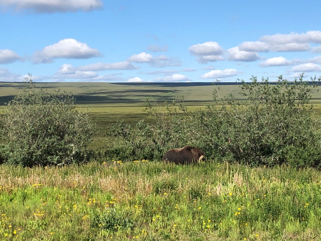
“Why is that guy sticking his arm out the window,” I asked Don as we approached a pipeline maintenance truck up ahead. “Hey Jim, he is pointing to a buffalo in the shrubs next to the road. No, wait, that’s not a buffalo!” We stopped as the truck went by and watched a musk ox tear at the alders next to the creek. We had also seen caribou, moose, black bear, coyotes, and a lynx, but still no grizzly bear.
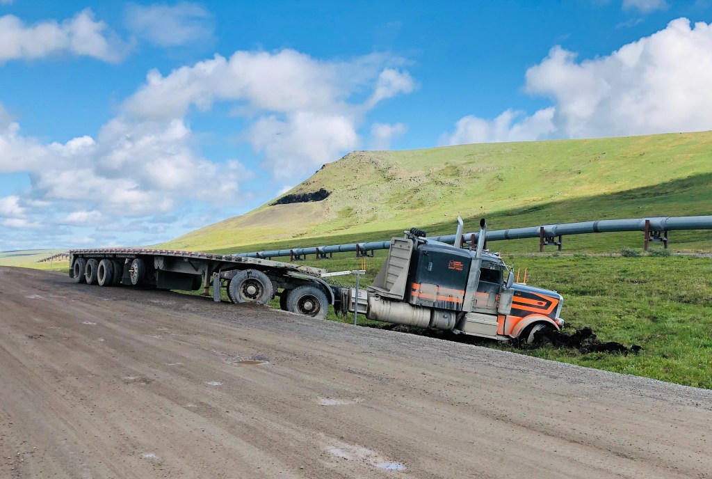
About mid-morning potholes were still filled with water, but the road was firming up. Just as I commented to Don to that effect, we topped a sharp hill and dodged the rear end of a truck that had slid off the road with the tractor straddling the ditch. That guy was running with 22 wheels and couldn’t keep it on the road. I felt good that we were doing pretty good with only two.


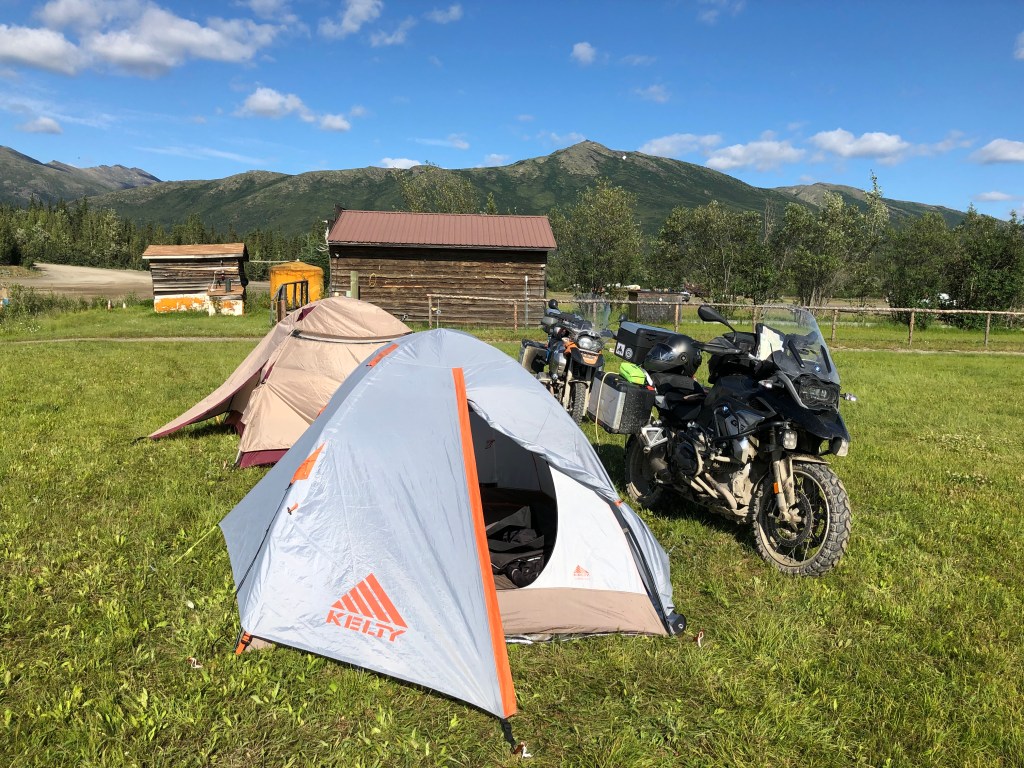
Coldfoot is the site of a former gold mining community that was built in the early 1900s. According to historical records, it got its name when one of the waves of “green stampeders” got as far up the Koyukuk River then got “cold feet” and turned around and ran. Around 1912, the miners relocated to Wiseman eleven miles north. Coldfoot today consists of a restaurant, two gas pumps, and pre-fab hotel accommodations that primarily serve pipeline maintenance crews and a few tourists. Just across the parking lot is a grassy patch where tenters can set up for free. It is what we did.

It was still a long 270 miles of rough road from Coldfoot to Fairbanks, but on a mostly dry road, we felt that the roughest part of the trip was behind us. There were still some surprises with water trucks, road graders, and wet, sticky tar on one of the paved sections, but the bikes couldn’t get much dirtier than they were.
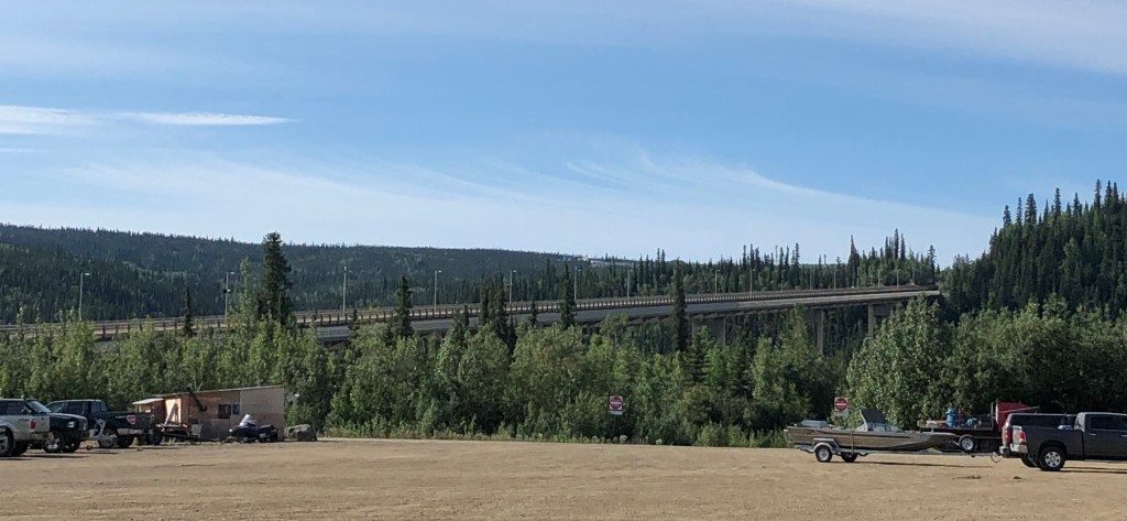
The Yukon River Bridge marked the halfway point and the Yukon River Camp at the base of the bridge served up a great “Yukon Burger” and homemade pie.


As we hit good pavement on our way into Fairbanks, I reflected back on the previous five days. I knew this 1,000-mile excursion to Prudhoe Bay would test my riding skills and physical endurance, but I was fairly confident I was up to the task. As a twenties something young man, I wouldn’t have given safety issues a second thought; I would have done the trip solo in a heartbeat. As we age, most of us become more risk-averse; we are smarter, may have more to lose, and don’t mend as quickly after a mishap. With Don, a stronger, better rider than I, covering my back, and knowing Richard would come get me if I ran off the road, I had a rare opportunity for this unique riding adventure.
“If it doesn’t challenge you, it won’t change you.” is a Gray Grizzly motto. With a sense of adventure and good buddies, challenge and change are possible even at my “older” age.
For more motorcycling adventure stories go HERE.

What neat pictures and wonderful style of sharing your adventure. Thanks my friend, Steve Sent from my Verizon, Samsung Galaxy smartphone
LikeLike
Jim that was a great story and read. I was able to see all this from the air during my career. (low leveled the haul road many times and snuck thru Atigun due to fog and weather many times. I worked out of Deadhorse for many years starting in 1977 thru 2013. Still miss it.
LikeLike
John, Thanks for following. Yes, I can imagine it is beautiful from the air. A fascinating place to work, although I imagine the winters were brutal.
LikeLike
Wow some amazing scenery there. What a great ride.
LikeLike
What a great adventure ! Brought back memories of when I took that same trip up the Dalton back in 1989. I started from Daytona, FL. solo in late July & took my time. Had a couple of baseball hats made up with customized front logos reading Prudhoe Bay or Bust ❗️What an adventure. Thanks for the pics & great story read.
LikeLike