
OK, I admit it, Richard was right. It was cold the morning we left Moose Creek Campground for Dawson City, but an extra layer kept me comfortable throughout the trip. We expected low temperatures and were prepared for them. We didn’t expect and weren’t prepared for a 91-degree F heatwave at the end of this leg of our trip.
It warmed up into the comfortable mid-50s by the time we reached Dawson City late morning. We located a nice, partially-shaded campsite on the edge of town and set up for a two-night stay. We did laundry, washed bikes, and did some grocery shopping before we embarked on a reconnaissance of this famous town.
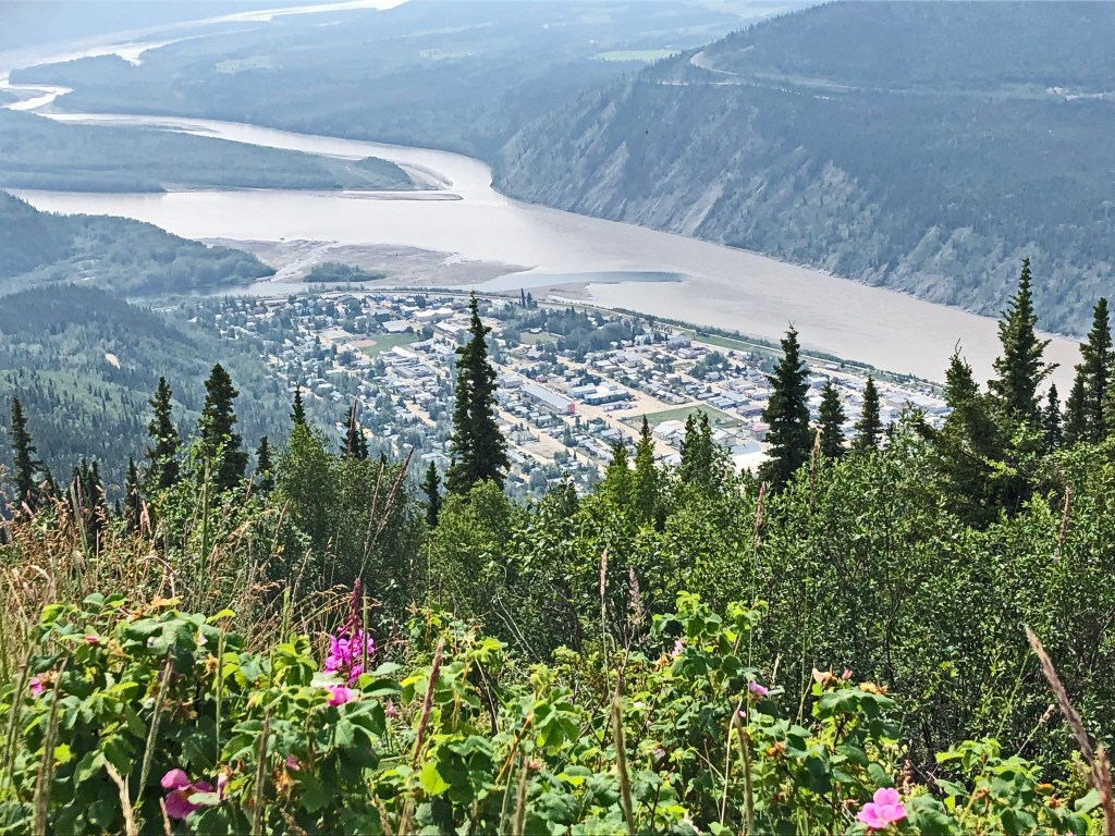
Dawson City was the base for the 19th-century Klondike gold rush. On August 16, 1896, three Yukon Sourdoughs found gold on Bonanza Creek, a tributary of the Klondike River. By 1897 there were over 1000 prospectors, miners, Mounted Police, missionaries and others who created Dawson City and called it home. By 1898, just one later, Dawson grew to 30,000 residents to include storekeepers, saloon keepers, bankers, gamblers and prostitutes. By 1899, $30 million in gold was taken from the streams and ground nearby. Dawson City became known as the “Paris of the North,” the largest city west of Winnipeg and north of Seattle. Overnight millionaires sought ways to spend their money on great food, drink, and clothing. Dance and gambling halls, bars, brothels, restaurants and supply stores all made fortunes “mining the miners” ( https://dawsoncity.ca/discover-dawson/klondike-national-historic-sites/ ). Today the dirt streets, boardwalks in front of original, historic buildings, and the saloons and shops still harken back to the boom-time gold rush days.


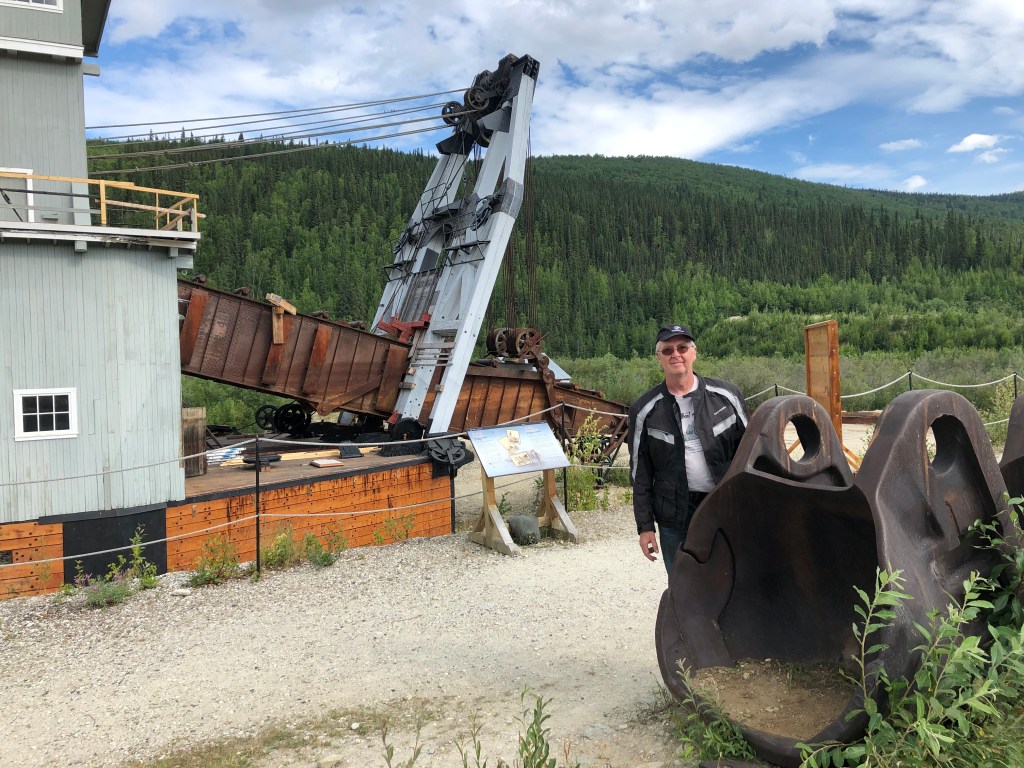
The most impressive relic of the old mining days is Dredge No. 4, now a National Historic Site of Canada. It is a bucket line sluice dredge that mined placer gold in the Yukon River and Bonanza Creek from 1913 to 1959. It is the largest gold mining dredge in North America. Don, Richard, and I motored eight miles up along Bonanza Creek where the dredge shut down in 1959, never to move again.
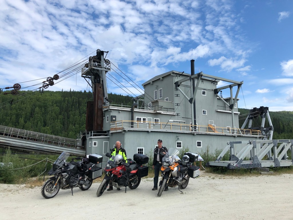
I knew placer mining (stream bed deposits) was somewhat mechanized beyond the handheld pan, but I had no concept of the scale and machinery used. Yet when I saw how visible the dredge tailings were on Google Maps along the Klondike River, it should have tipped me off that a “monster” was at work. Old #4 had 72 Buckets on a chain like a Ditch-Witch that excavated gravel at a rate of 18,000 cubic yards per day. During its operational lifetime, it captured nine tons of gold.
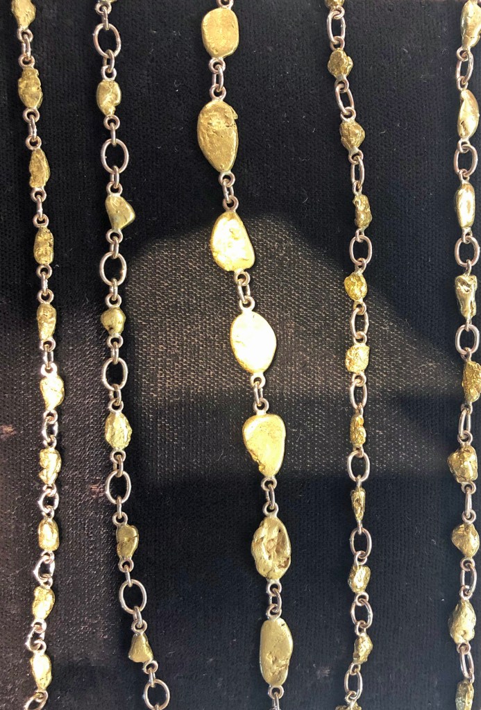
Gold is still being mined on a much smaller scale than in the old days. In the Dawson City jewelry shops, one can buy bare gold nuggets and nugget jewelry. I was tempted but convinced myself that my wife would want something “more refined” given the classy lady she is (it was all very expensive; I could have bought a new motorcycle for the price of a gold nugget necklace).
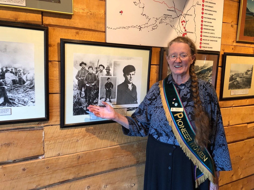
Ironically, the personalities the gold rush made famous were not the ones who struck it rich, but the ones who were able to tell about it. Jack London, the famous author of books including Call of the Wild, White Fang, and Martin Eden, headed north to the Yukon from San Francisco to seek his fortune. He found no gold but found many stories he could tell that eventually made him famous. Tucked in a quiet corner of town is a small museum dedicated to the life and writing of London. It includes the cabin Jack built and lived in while he sought but found no gold on the Klondike River.
If you make a road trip to Alaska up the Alcan, we highly recommend a detour to Dawson City. In addition to the attractions mentioned above, you can visit the Dawson City Museum, Klondike National Historic Site, Danoja Zho Cultural Centre, and pan for gold at Claim 33. However, in order to make your way to Alaska from Dawson City, be prepared to ferry across the Yukon River and ride the “Top of the World Highway”, 80 miles of dirt, dust, mud, and loose gravel, depending on the weather.

We arrived early at the shore of the Yukon River north of town in time to see the George Black Ferry depart the far shore, swoop downriver with the current, then sail slowly up against the current into the eddy behind the pier in front of us.


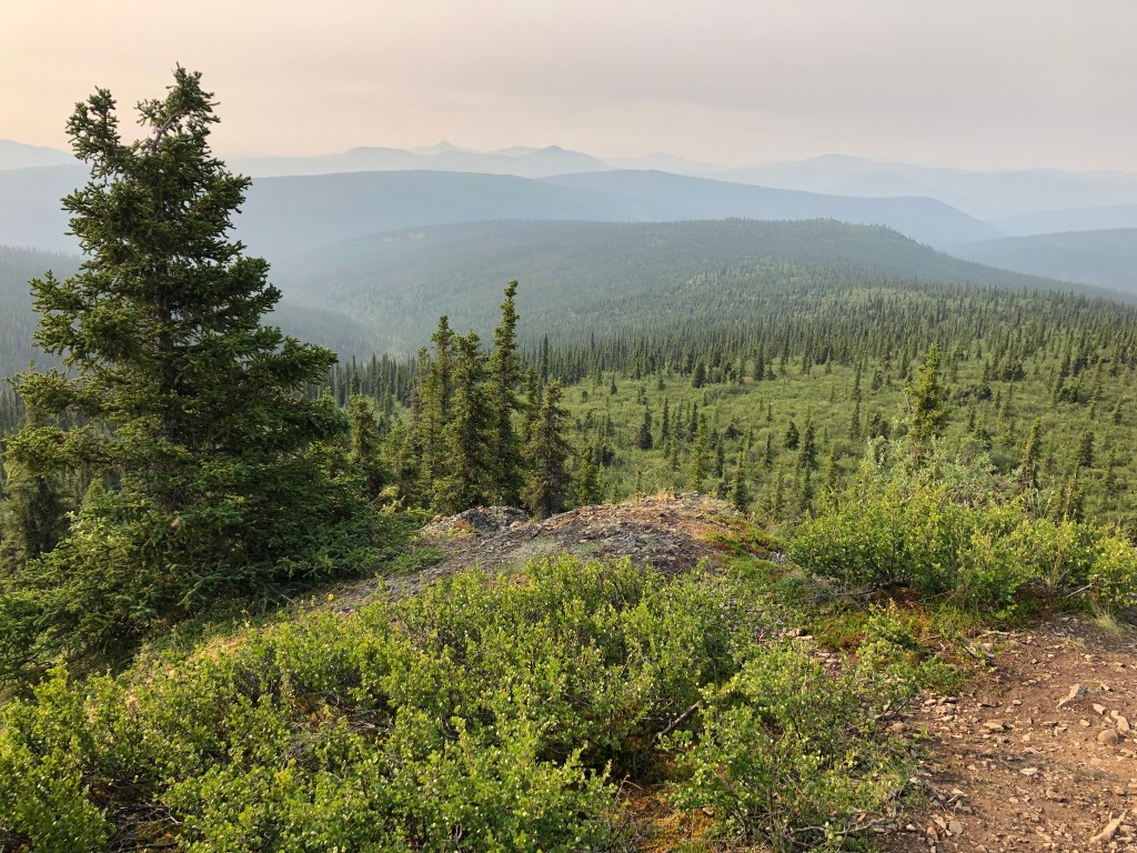
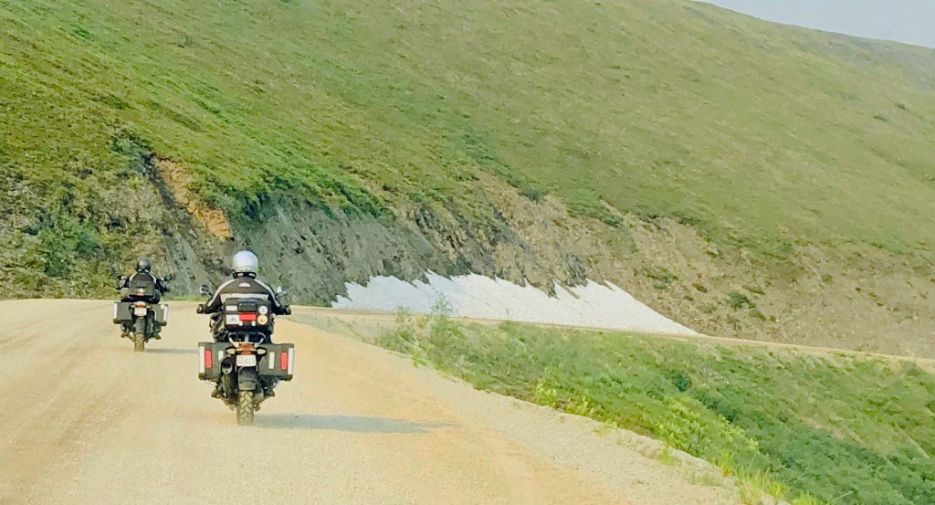
We were lined up along with several cars and RVs to enter the ferry. Motorcycles were loaded first so we would be first off. Upon reaching the far shore, a couple of miles of pavement quickly gave way to loose gravel, frequent washboard surfaces, and potholes too numerous to miss. But the scenery and views on this “Top of the World Highway” made up for the rough road. One could see for miles in all directions on this clear day, with the green boreal forest and tundra accented with white snowdrifts on shaded slopes.
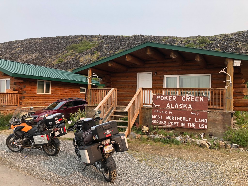
Sixty-six miles from Dawson City and 108 miles from Tok, Alaska, sits Poker Creek on the Top of the World Highway. There are no permanent residents; it is just a customs post on the Canada/U.S. Alaska border and is notable for being the northernmost international border crossing in North America.
We could hear via our helmet intercoms what the customs agent asked each of us when it was out turn to cross the border: “Do you have any fruit,” he asked Richard. “Uh, yeah, I believe I have a couple of bananas; those guys on the bikes in front of me didn’t eat their bananas for breakfast.” Don and I laughed out loud. We don’t think Richard nor the agent heard us. In any case, we all crossed without incident and the courteous agent warned us about steep curves, hills, and animals ahead.
Tok, Alaska, is located on the Alcan Highway. The only significant village between the border at Poker Creek (there was no creek) and Tok was the little community of Chicken, population about 20. Chicken was a gold mining town founded in the late 1800s. The area was abundant in Ptarmigan and often eaten by the miners when food was scarce; the bird very much reminded them of chicken. In 1902 the community was to become incorporated, the second town in Alaska to do so. The name Ptarmigan was agreed upon in honor of the bird that often sated the miners’ hunger. The only problem is that nobody could agree on how to spell it. Therefore, to avoid ridicule from misspellings, they decided on Chicken.
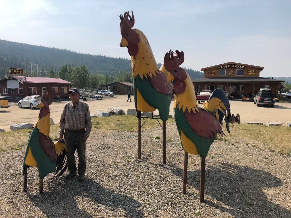
The village was a great lunch stop along the Highway. The large building in the photo above contained general merchandise. The building on the left was a cafe. It was self-serve with coffee, drinks, sandwiches, hot wraps, and other goodies. You helped yourself, sat down and enjoyed your lunch, then walked across to the main building and told the cashier what you had. This was one of several “honor system” establishments we encountered.

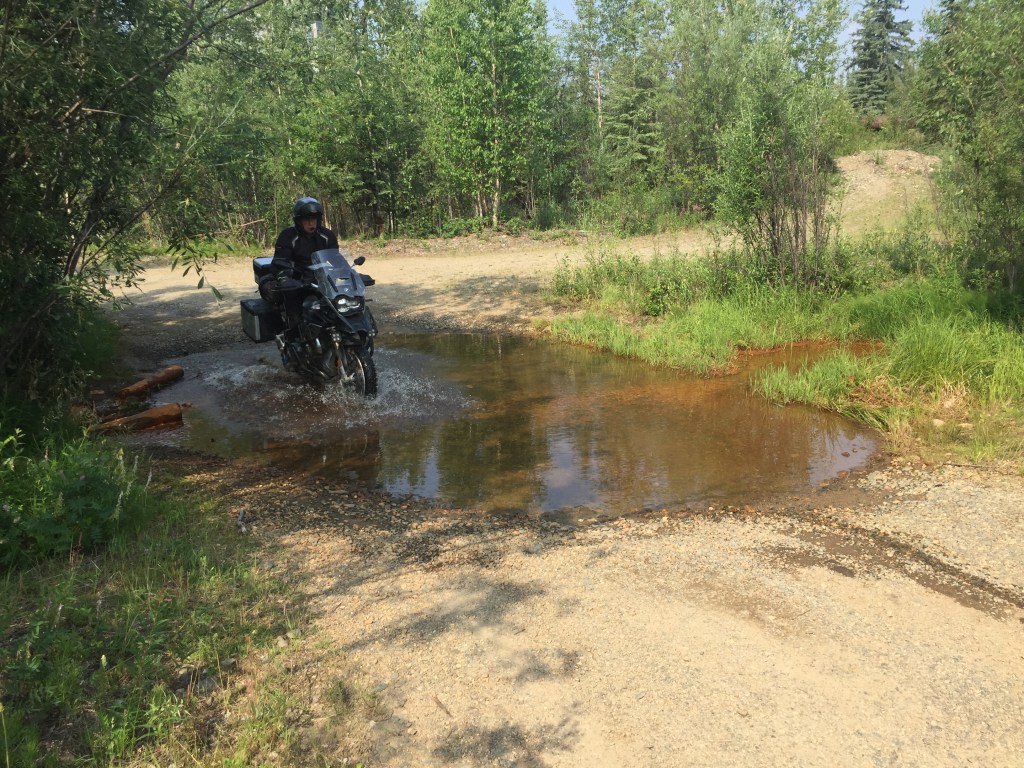
The Top of the World Highway was an 80+ mile introduction to a dirt/gravel ride. It was mostly dry and dusty the whole way. After we reached Tok and continued on to Fairbanks, we chatted about our gravel road experience so far. “Not too bad,” I said. “I actually enjoyed the ride despite the potholes.” “Maybe that is what the Dalton Highway will be like on the way to Deadhorse and Prudhoe Bay,” Don said.
Turns out that was just wishful babble.
For more motorcycling adventure stories, go HERE.

What a great story!
Sent from my iPhone
>
LikeLike
Wow, enjoyed the trip, great story telling and the photos where icing on the cake. See you Saturday. SteveSent from my Verizon, Samsung Galaxy smartphone
LikeLike