
ROAD CLOSED. BRIDGE OUT. That was the sign that greeted Jeff, Don, Marc, and me as we rode our motorcycles around a corner on a backcountry gravel road in the Appalachian mountains. Never one to take no for answer, Jeff, leader of the pack, said, “Let’s go around the sign and check it out, maybe we can get around the bridge somehow.”
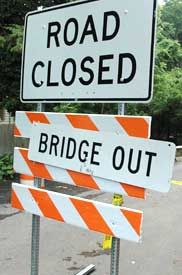
Just over the hill, Jeff asked the work crew: “Can we get across somehow?” “Sure,” said the foreman tongue in cheek, “if you can jump that ravine on your motorbike.” Having heard the foreman’s answer via his helmet intercom, Don offered: “Jim can jump it on his KTM. That bike looks like its flying when standing still.”
Later that day and farther down the trail, I hear an urgent call from Don: “Hey, Jim! “Your bike is smoking; looks like an engine fire!”
All the above is true: A bridge was out; the crew foreman did suggest jumping the ravine; Don did offer up Jim’s KTM for the first jump; the KTM almost caught fire. But Jim did not attempt to jump the ravine. Here’s a little background for this story:
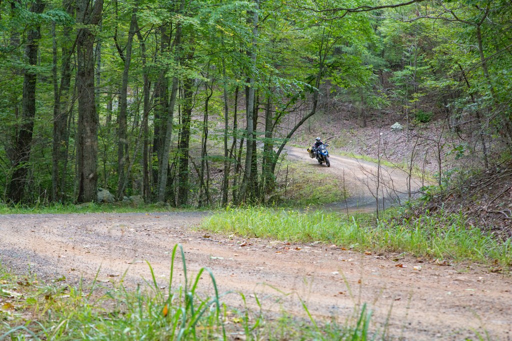
Wanting to do some off-pavement riding and avoid the public due to COVID, my buddies and I decided to ride the Mid-Atlantic Backcountry Discovery Route beginning in North Carolina and ending on the Pennsylvania/New York border. It’s just over 1000 miles of mostly dirt and gravel roads running across ridges and valleys of the Appalachian and Allegany Mountains.

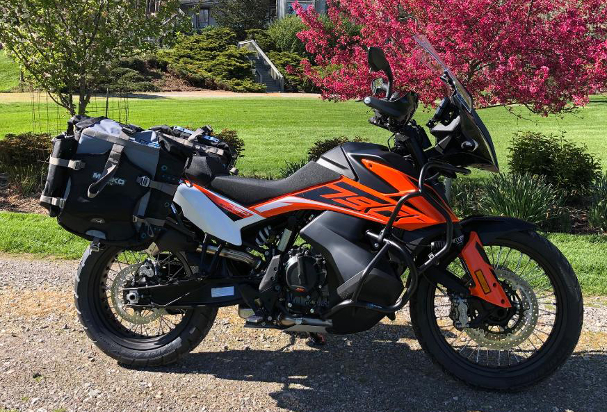
Dual sport adventure bikes in the 500 to 800 cc range are ideal for this terrain meaning that I needed a new bike; my BMW 1200 GS would be much too big and heavy (my excuse for buying another bike). After some research, I concluded that the KTM 790 Adventure would be perfect for this trail.
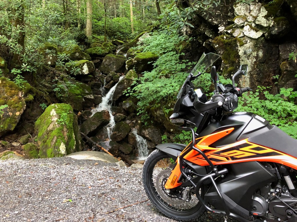
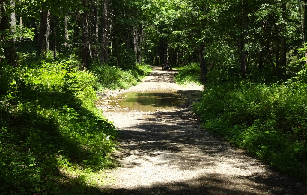
Section #1 of the trail began in Damascus Virginia, dipped across the border into Tennessee and North Carolina then wound north roughly paralleling the Appalachian foot trail along the VA/WV border. We enjoyed the steep, twisting route through the Jefferson National Forest and along the flanks of Mt. Rogers, the highest point in Virginia. The trail was dry and dusty. Parts were rocky and rutted. But the scenery was great with lush forests, small waterfalls, rock cliffs, and myriad wildlife.
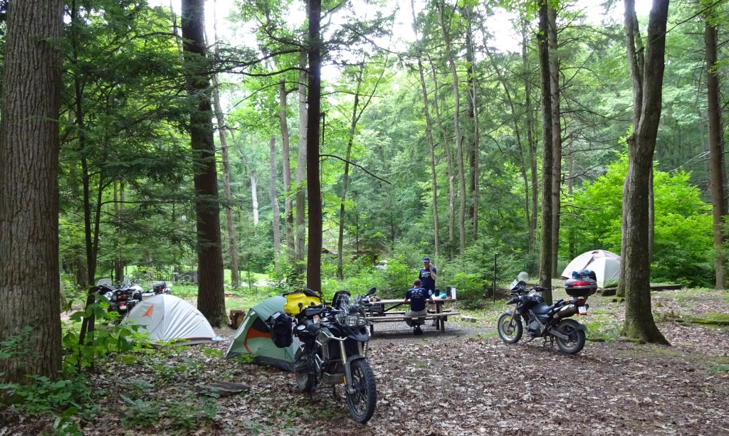
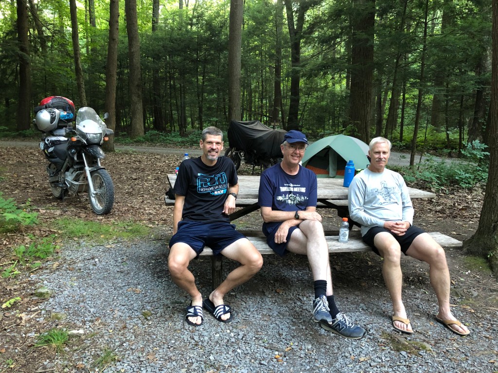
After the first 138 miles, Section #1 of the route’s 9 sections ended 8 miles from my house. In my barn refrigerator was a variety of named brand beers, good for displacing trail dust from parched throats. Ending Section #1 at the house allowed us to make adjustments to our packs, clean the bikes, oil our chains, and otherwise prepare for the next seven days of the trail. My sweet wife had a nice dinner for us. My buddies set up their tents in the yard and unrolled their sleeping bags. I slept in my real bed.

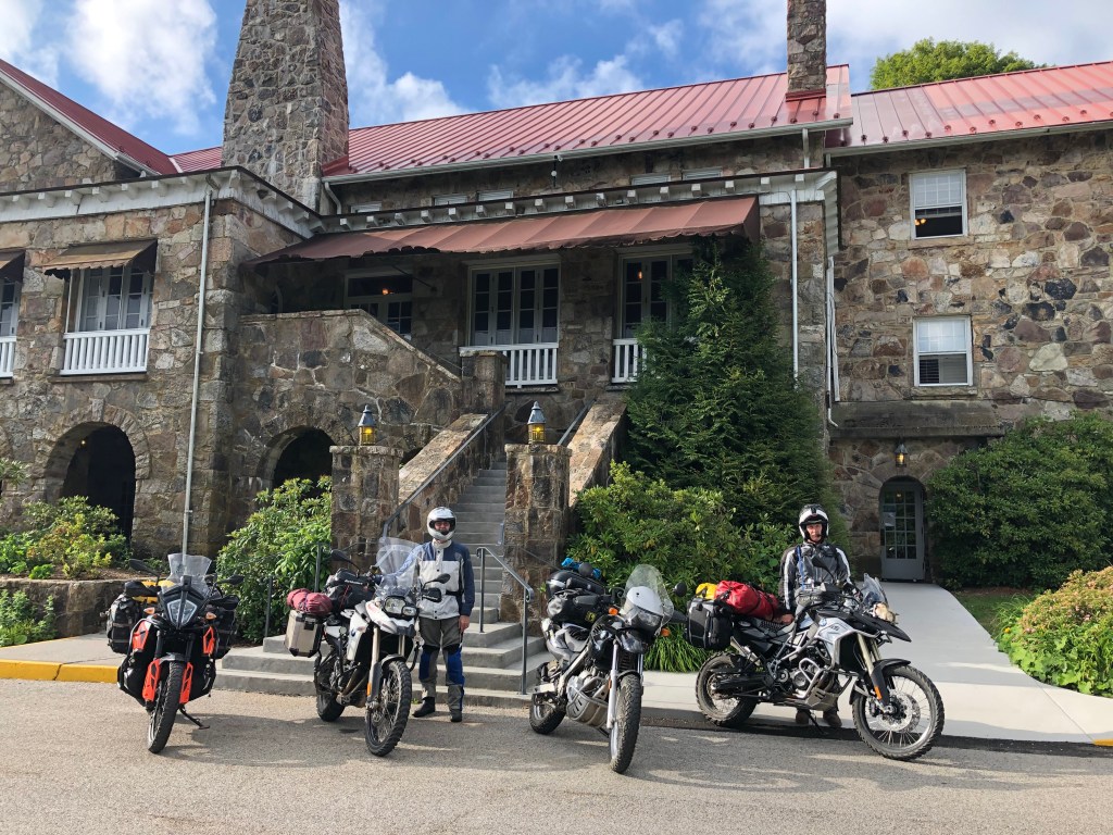
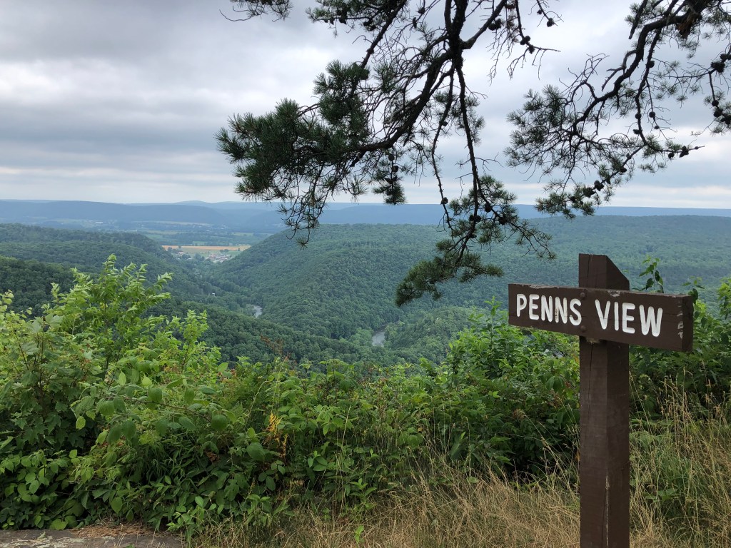
The early morning fog was lifting and the sun was speckling through the tree canopy overhanging the road as we rode up Salt Pound Mountain. Near the top is the iconic Mountain Lake Lodge where the movie Dirty Dancing, starring Patrick Swayze and Jennifer Gray, was filmed. The pavement ended at the hotel grounds. A dirt trail took us down the backside of the mountain into Potts Valley and a segment of WV where the bus ride for school children is two-hours long. This is part of the Ridge and Valley Province of the Appalachian Mountains where the Jefferson, George Washington, and Monongahela National Forests intersect.
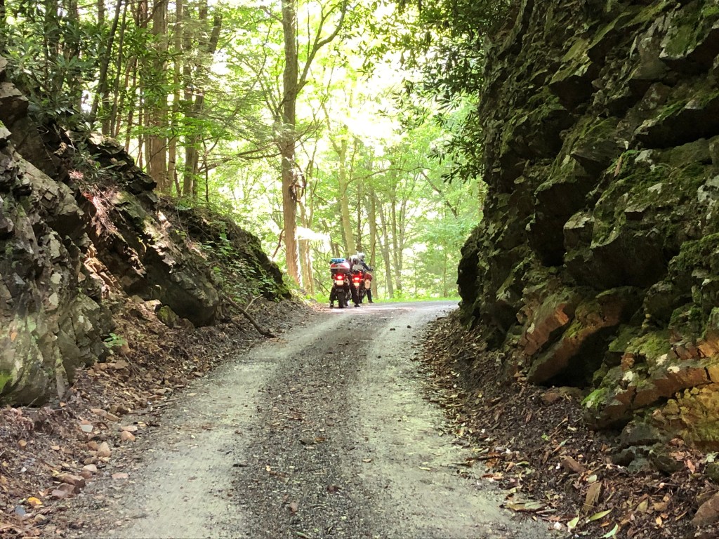
Toward the end of the second day’s ride, the trails were dry and dusty. Jeff and Marc, first and second in line, stirred up an opaque cloud to which I added with the off-road tires of my KTM. In the fourth position, Don was riding in a beige cloud a good part of the time, but, nonetheless, he knew the difference between trail dust and smoke from burning oil belching from the surface of my catalytic converter (CAT). “Hey Jim, your engine is on fire.”
It was the end of the day. We were pretty much in the middle of nowhere Virginia. My map showed a campsite called Peaceful Valley only a few miles up the road. It was a nice isolated spot on the rocky shore of the Cowpasture River, fed by clear tributaries from the surrounding national forest. The Cowpasture River lies between the Calfpasture and Bullpasture Rivers. It is said that a couple of centuries ago the Shawnee stole a herd of settlers’ cattle and were driving them westward into the mountains. With the settlers in hot pursuit, calves tired and were left behind on the stream now named Calfpasture. Over the next ridge, the cows were left behind on the Cowpasture. The male cattle were driven over the next mountain ridge to the next tributary, the Bullpasture River, where they were finally all recovered. Thus the names of these streams, which are still used today.
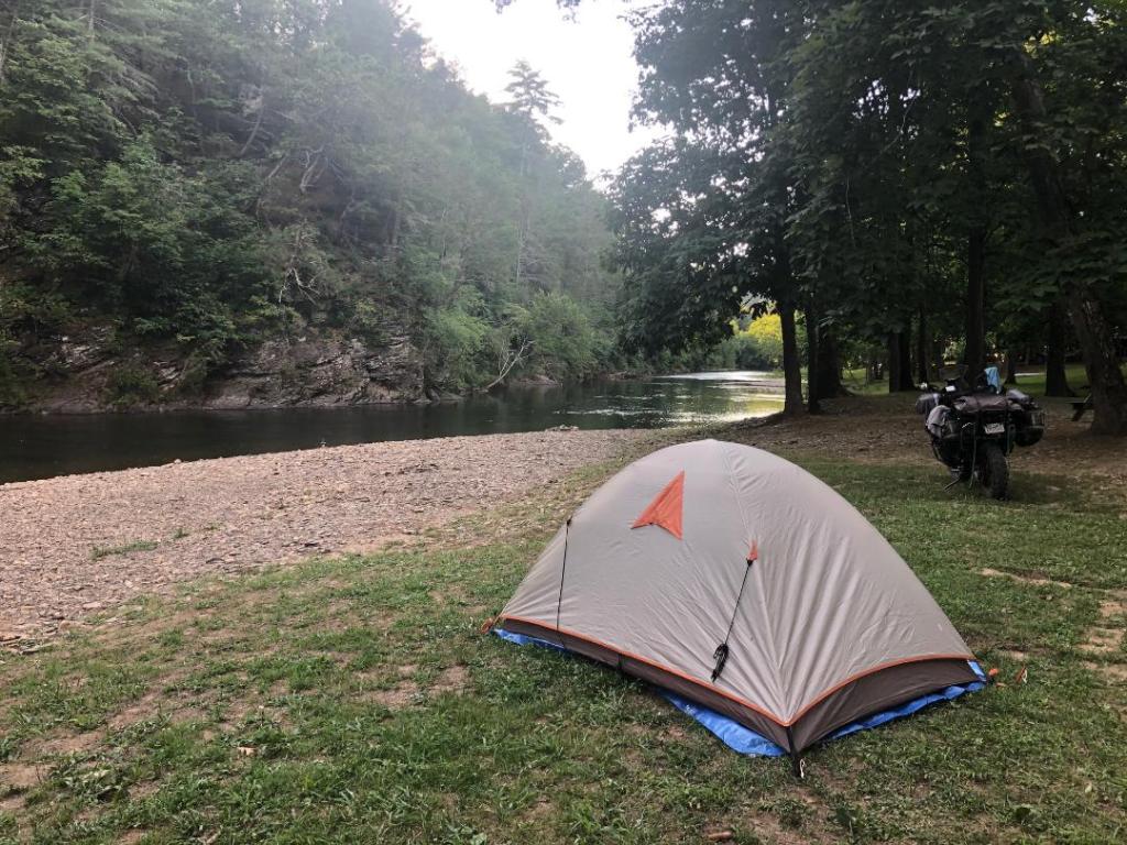
The Cowpasture River with its rocky bottom was clear and cold as we bathed and removed the trail dust from our bodies. The cold water sucked the excess heat from my core and soothed the worries about my bike. Not only did I have a ride-ending problem, but I was eating crow after talking trash about how great my new KTM looked and performed beside the three other “pedestrian” looking BMWs my buddies were riding.“Where was the oil coming from that was splashing on the exhaust?” As I emerged from my bath in the river, Marc was crouched beside my bike: “Hey Jim, its the shock seal. Look at these oil droplets in the spring coil. From the spring the oil is dripping on the exhaust.”
“OK, I will see you guys sometime after lunch,” I said, as I departed Peaceful Valley campsite the following morning. It was a two-hour, slow ride home on the highway as the remaining oil in the shock slowly dripped and the suspension became more and more like a pogo stick. I parked the KTM in my man cave, moved all my gear to my BMW 1200GS, and cruised back up the interstate at 70 mph to rendezvous with my buddies where the trail crossed route 33 near Brandywine WV. On the ride up the highway, I had a lot of time to wonder if I could successfully complete the next six days of the trail on this big, heavy bike. The route on the trail map showed a lot of dotted lines across steep mountains and deep valleys (dirt trail).

Backcountry Discovery Routes (BDR) is a non-profit organization that creates off-highway routes for adventure motorcycle travel. Most of the established routes are in the West, but there are two in the East: the North East BDR from PA to the Canadian border, and the Mid-Atlantic BDR from TN to NY, our current ride. The purpose of the BDR organization is to provide adventure riding opportunities and have a positive impact on rural economies. In the process of developing and improving off-pavement riding skills, a rider gets to enjoy some of the most beautiful parts of backcountry America.
The trail from Moorfield WV to Shepherdstown, through Harper’s Ferry and then on to Mt. Holly Springs PA qualified as one of those most beautiful parts of the country. From Brandywine WV, the trail was a mix of gravel and one-lane asphalt along the South Branch of the Potomac River. This eventually brought us into Shepherdstown, a quaint village nearly thirty years older than the United States with a unique place in American history given its role in the Revolutionary and Civil Wars.

Just downriver at the confluence of the Potomac and Shenandoah Rivers was Harper’s Ferry where the states of VA, WV, and MD meet. The BDR winds through Harper’s Ferry National Historical Park before crossing the Potomac and running up South Mountain in MD and on into PA.
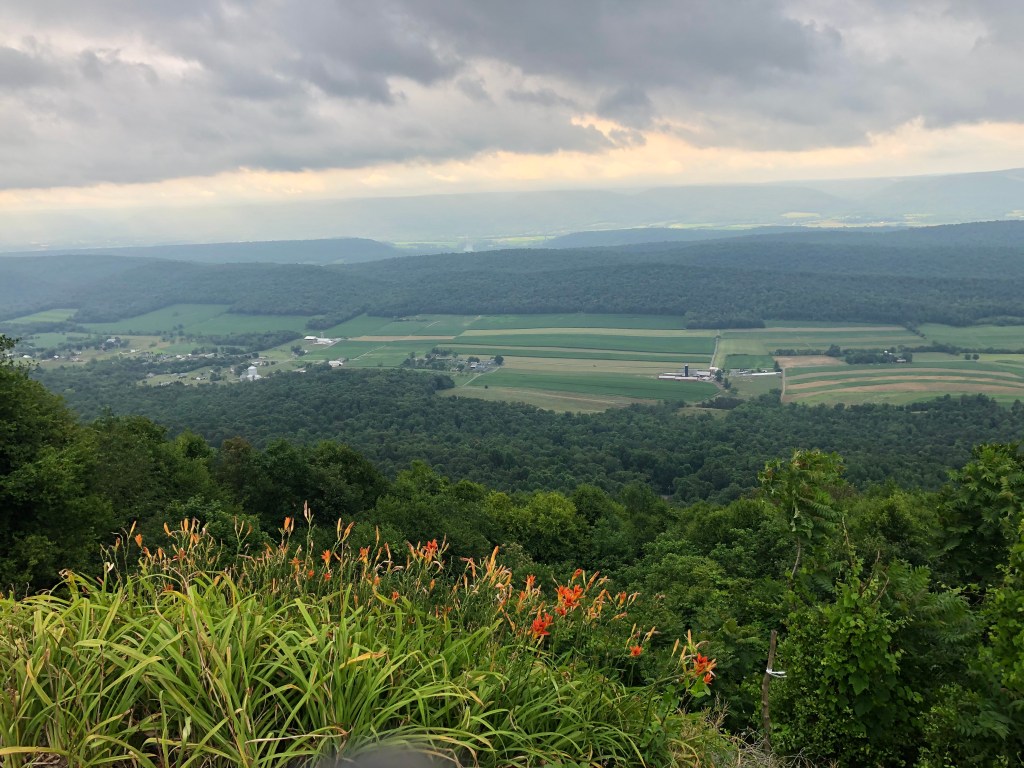
The Allegheny Mountain Range in Pennsylvania posed a significant barrier to western land travel before the railroad finally made its way across and through the many ridges and valleys in the central part of the state. The BDR punched head-on across the ridges and valleys via dirt and gravel roads that wound up and down steep forested ridges.
The higher ridges were bedecked with red spruce, sugar maple, black cherry, and American beech, typically found farther north. At one time, elk, bison, and mountain lion roamed these forests. The forests still have a primeval feel in places, but only deer, turkey, black bear, and smaller critters were encountered during our ride.
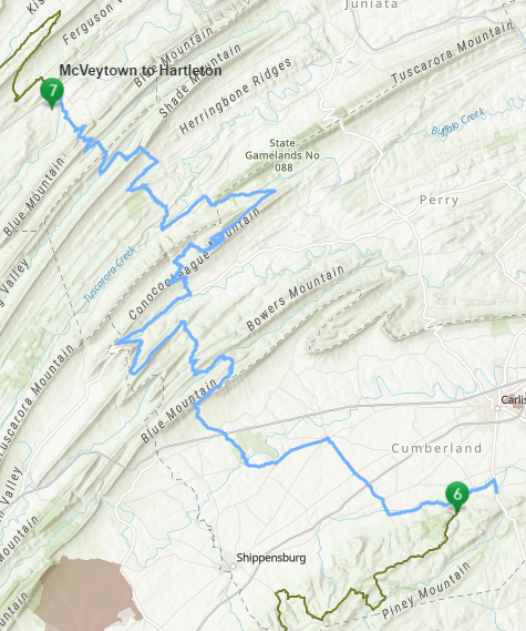
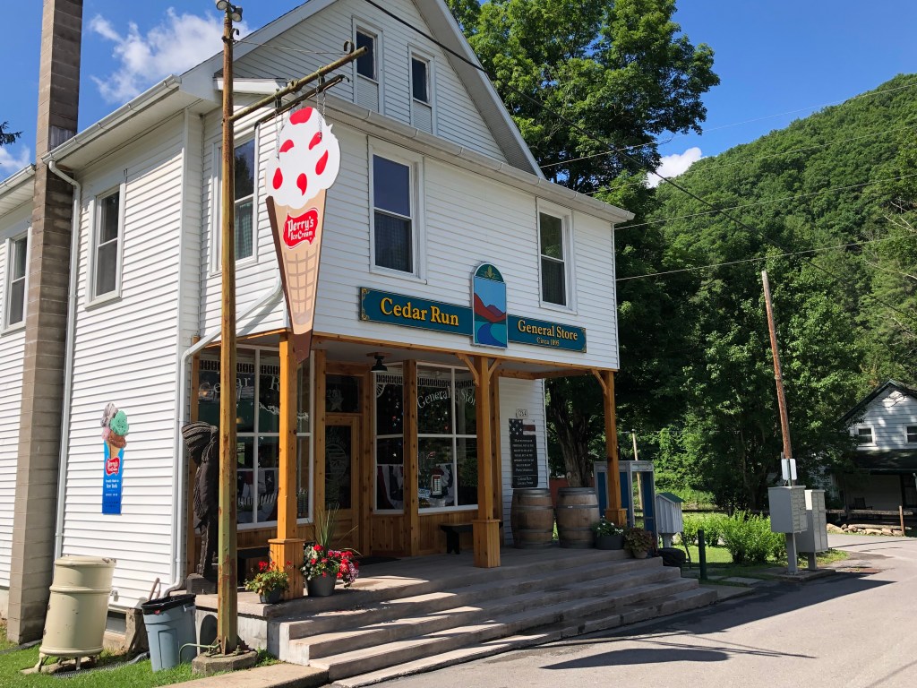
The northern end of the BDR from Hartleton to Cedar Run in north-central PA was full of surprises. Smooth gravel along a ridge-top suddenly turned into a steep, rocky, rutted descent. Standing on my pegs I let the big BMW lurch up and down and side to side beneath me while attempting to miss the loose, football-sized rocks in and among the ruts. There was little room to maneuver with a cliff on the left and a sheer drop-off on the right. Thankfully, this tribulation only lasted a mile or so. But another challenge lay across the valley.
It had rained the night before. Water in puddles and ruts were not a big deal. However, a road grader had worked up the entire surface of the dirt road and left it loose. The surface was now rain-soaked to three or four inches and slick as a whistle. A barely controlled wobble is how I would describe my ride on this muddy, slick, freshly-graded road. None the less, throughout the last six-day ride and 700 miles of trail, I kept the big beast on its wheels. And despite occasional worriment, I felt I added another layer of riding skill to the total of my experiences.
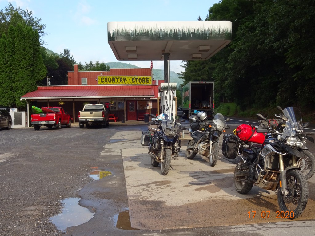
How did we deal with the public in this COVID environment? We all wore our masks, but we had little to no interaction except at gas stations where we filled our tanks and bought food items to eat back at camp. Have you been to a Sheetz gas station lately? The food items on their shelves are amazing (if you are hungry). Yeah, OK, most of it is not all that healthy, but if you pick and choose carefully you can survive nicely for a few days.
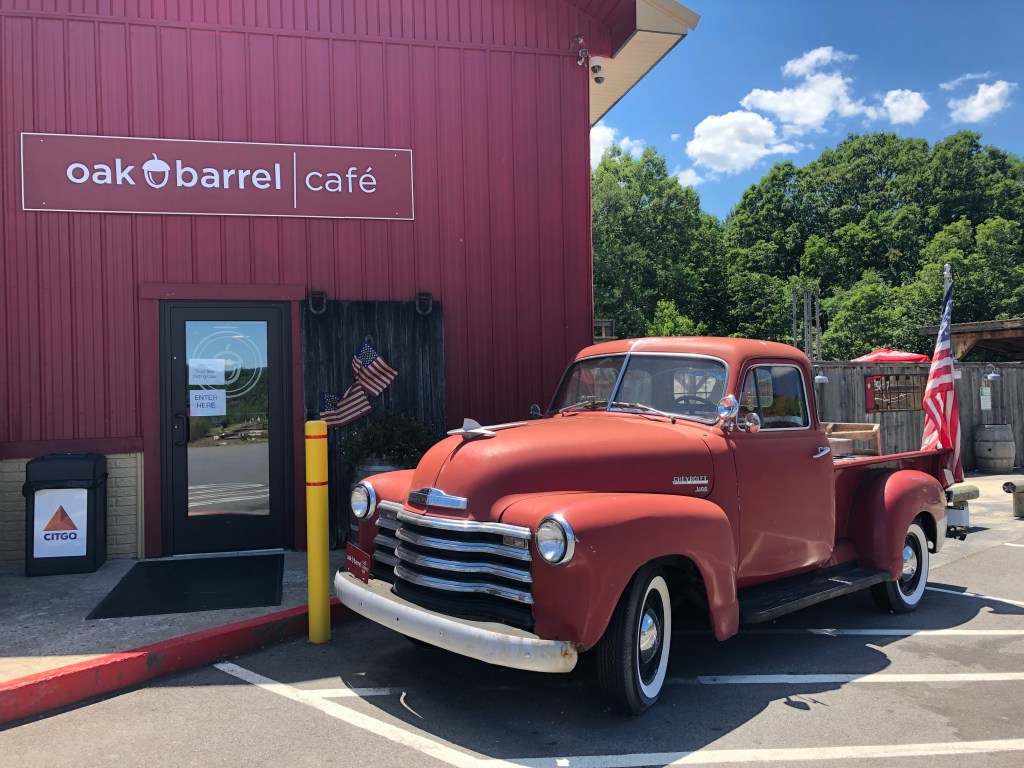
Furthermore, we found several nice lunch stops along the way so it wasn’t necessary to eat tree bark and cicadas to sate our hunger. One of our favorite places was the Oak Barrel Cafe with some great menu items including Thai Peanut Chicken with quinoa barley. Of course, they also had pulled pork sandwiches, hamburgers, and BLTs.
The end of the trail came abruptly as we rode into Lawrenceville PA on the New York/Pennsylvania border. There it was—the sign: Welcome to NEW YORK The Empire State, the official endpoint of the Mid-Atlantic Backcountry Discovery Route. We jumped the curb and aligned our bikes for the official photo.
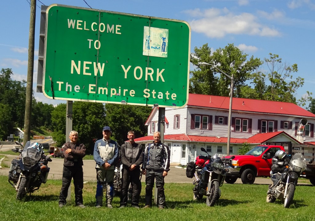
In eight days we had ridden 1,075 miles of which about 75% was on gravel or dirt roads. Except for the blown shock on my KTM, we did it without mishap. Now it was time to hit the highway and be home the next day. But, to a man, what we really wanted to do was simply turn around, reverse the route, and ride the trail again from north to south.

Jim,
Great recap of the MA BDR adventure.
LikeLike
While reading about your travels I felt like I was there also. The pictures were great especially the maps of the trails you rode. Great memories with great friends. Looking forward to reading more about your travels. This was so interesting that I thought I was reading an adventure book. Well done.
LikeLike
Jim, Congratulations on completing a fine ride. Kent 👍
LikeLike
Sounds like another great adventure ride and experience with great friends.
LikeLike
Excellent job as usual, Jim!
Keith
LikeLike